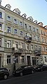
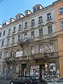
Category:Rothenburger Straße 20 (Dresden)
Jump to navigation
Jump to search
| Object location | | View all coordinates using: OpenStreetMap |
|---|
listed house in Dresden, Germany  | |||||
| Upload media | |||||
| Instance of | |||||
|---|---|---|---|---|---|
| Location | Äußere Neustadt, Dresden, Saxony, Germany | ||||
| Street address |
| ||||
| Located on street |
| ||||
| Heritage designation | |||||
 | |||||
| Address |
|
Media in category "Rothenburger Straße 20 (Dresden)"
The following 3 files are in this category, out of 3 total.
-
 Rothenburger straße dresden 2018-06-04 - 12.jpg 2,336 × 4,160; 2.39 MB
-
 Rothenburger straße dresden 2018-06-04 - 16.jpg 2,336 × 4,160; 2.58 MB
-
 Rothenburgerstr20 dresden.JPG 2,448 × 3,264; 1.76 MB

