Category:Rotuma
Jump to navigation
Jump to search
island dependency of Fiji  Rotuma – NASA NLT Landsat 7 (Visible Color) – satelitní snímek | |||||
| Upload media | |||||
| Instance of |
| ||||
|---|---|---|---|---|---|
| Location | Fiji | ||||
| Located in or next to body of water | |||||
| Inception |
| ||||
| Area |
| ||||
| Elevation above sea level |
| ||||
| Different from | |||||
| official website | |||||
 | |||||
Media in category "Rotuma"
The following 18 files are in this category, out of 18 total.
-
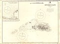 Admiralty Chart No 2992 Rotumah Island, Published 1897.jpg 11,028 × 8,069; 19.44 MB
-
 Charles Chowe Howard, of Rotuma.jpg 600 × 932; 136 KB
-
 Council of Chiefs of Rotuma, 1927.jpg 1,000 × 770; 151 KB
-
 Ethnic Map of Fiji.png 1,500 × 1,395; 290 KB
-
 Fidschi Inseln Rotuma.JPG 454 × 448; 38 KB
-
 Fiji-Rotuma.png 250 × 189; 3 KB
-
 LocationRotuma.png 250 × 158; 7 KB
-
 Mofmanu beach in Motusa, Rotuma.jpg 604 × 453; 63 KB
-
 Flag of Rotuma (1987-1988).svg 1,023 × 682; 2 KB
-
 Rotuma 1896 based map.jpg 1,000 × 609; 109 KB
-
 Rotuma etc nautical chart.jpg 12,805 × 9,403; 43.79 MB
-
 Rotuma map Gardiner 1898 - bw.jpg 2,017 × 1,215; 230 KB
-
 Rotuma map Gardiner 1898.jpg 2,065 × 1,264; 230 KB
-
 Rotuma map in Australian Science Journal 1895.jpg 2,036 × 1,564; 1.13 MB
-
 Rotuma NASA.png 591 × 321; 384 KB
-
 Rotuma nautical chart cropped.jpg 4,432 × 2,078; 4.67 MB
-
 Rotuma.png 631 × 634; 546 KB
-
 RotumaMap.png 614 × 356; 7 KB


.svg)


