Category:Rudraprayag district
Jump to navigation
Jump to search
district of Uttarakhand, India .svg) | |||||
| Upload media | |||||
| Instance of | |||||
|---|---|---|---|---|---|
| Location |
| ||||
| Capital | |||||
| Population |
| ||||
| Area |
| ||||
| official website | |||||
 | |||||
 | |||||


Subcategories
This category has the following 10 subcategories, out of 10 total.
Media in category "Rudraprayag district"
The following 16 files are in this category, out of 16 total.
-
 4. Gateway to Deoriatal.jpg 3,648 × 5,472; 5.63 MB
-
 A distant view of Damyanti Temple, Hyun Uttarakhand.jpg 4,624 × 3,468; 6.61 MB
-
 Alaknanda River.jpg 6,016 × 4,000; 2.38 MB
-
 Gairsari village,Rudraprayag district, India.jpg 1,280 × 960; 156 KB
-
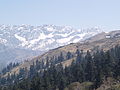 Himalayas near Ukhimath, Rudraprayag.jpg 3,264 × 2,448; 1.75 MB
-
 Himalayas, Kedarnath and Neelkanth peaks from Ukhimath, Rudraprayag.jpg 3,264 × 2,448; 1.3 MB
-
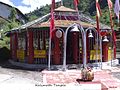 Kalimathmaa.jpg 1,600 × 1,200; 609 KB
-
 Kedar peak behind Kedarnath temple.jpg 4,208 × 2,368; 2.77 MB
-
 Kedarnath nandi.jpg 3,000 × 4,000; 3.65 MB
-
 Mini Switzerland.jpg 3,407 × 3,456; 2.19 MB
-
 River 31.jpg 4,495 × 3,456; 4.31 MB
-
 Road to Triyuginarayan.jpg 4,608 × 3,456; 7.47 MB
-
 Rudraprayag district.svg 1,250 × 1,125; 137 KB
-
 Temple Sari Village.JPG 4,288 × 2,848; 6.6 MB
-
 Triyuginarayan Temple, Rudraprayag, Uttarakhand.jpg 4,515 × 3,386; 10.44 MB
-
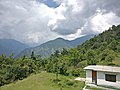 View from Devriya Tal lake.jpg 4,640 × 3,480; 4.88 MB


