Category:Rue Artaud (Lyon)
Jump to navigation
Jump to search
| Object location | | View all coordinates using: OpenStreetMap |
|---|
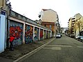
street in 4th arrondissement of Lyon, France   | |||||
| Upload media | |||||
| Instance of | |||||
|---|---|---|---|---|---|
| Part of | |||||
| Named after | |||||
| Location | 4th arrondissement of Lyon, Lyon, Metropolis of Lyon, Auvergne-Rhône-Alpes, Metropolitan France, France | ||||
 | |||||
Media in category "Rue Artaud (Lyon)"
The following 4 files are in this category, out of 4 total.
-
 Lyon 4e - Rue Artaud, depuis la rue Saint-Dié.jpg 3,096 × 4,128; 3.96 MB
-
 Lyon 4e - Rue Artaud, plaque (retouchée).jpg 1,132 × 616; 252 KB
-
 Lyon 4e - Rue Artaud, plaque.jpg 4,128 × 3,096; 2.89 MB
-
 Rue Artaud 69004 Lyon France - panoramio.jpg 4,608 × 3,456; 5.55 MB

.jpg)