Category:Rue de Vaugirard on maps
Jump to navigation
Jump to search
Subcategories
This category has only the following subcategory.
S
Media in category "Rue de Vaugirard on maps"
The following 17 files are in this category, out of 17 total.
-
 Plan Truschet & Hoyau ca 1550.png 1,600 × 869; 2.47 MB
-
 Hôtel de Condé 1652 Gomboust map of Paris - Geographicus.jpg 672 × 493; 385 KB
-
 Palais du Luxembourg on 1652 Gomboust map - Geographicus.jpg 1,102 × 1,268; 899 KB
-
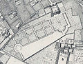 Palais du Luxembourg on 1672 Jouvin de Rochefort map of Paris - Gallica.jpg 1,581 × 1,224; 645 KB
-

-
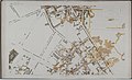
 Carmes déchaux jardins.jpg 452 × 369; 64 KB
-
 Turgot Carmes déchaussés.jpg 738 × 337; 100 KB
-
 Hotel de Condé.jpg 3,456 × 2,304; 5.13 MB
-
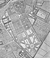
 Palais du Luxembourg with extended gardens on 1739 Turgot map - KU.jpg 3,184 × 2,006; 5.54 MB
-
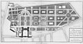 Palais du Luxembourg - Plan général des Jardins - Architecture françoise Tome2 Livre3 Ch8 Pl1.jpg 12,894 × 6,839; 25.35 MB
-
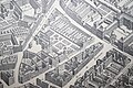
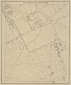
 1775 Plan de Jaillot - Extrait -1.jpg 522 × 406; 249 KB
-
 Atlas de Jacoubet - 39. Barrière du Maine et ses environs - BHVP.jpg 6,789 × 8,152; 8.69 MB
-
 Atlas de Jacoubet - 40. Barrière du Mont-Parnasse et ses environs - BHVP.jpg 6,686 × 8,086; 10.46 MB
-
 Palais du Luxembourg 1611 vs 1910 - Hustin 1910 pXXIV (adjusted1).jpg 4,880 × 6,879; 10.01 MB
-

-
-
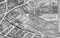
 Plan Vaugirard 1805.jpg 1,150 × 517; 203 KB


.jpg)


