Category:Ruins in County Cork
Jump to navigation
Jump to search
Subcategories
This category has the following 3 subcategories, out of 3 total.
Media in category "Ruins in County Cork"
The following 41 files are in this category, out of 41 total.
-
 3 Castles Ruin - geograph.org.uk - 506165.jpg 640 × 165; 28 KB
-
 AbbeystrowryAbbey.JPG 4,224 × 3,168; 4.85 MB
-

-
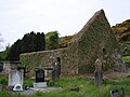
 Aglish church and cemetery (geograph 5003852).jpg 1,024 × 768; 195 KB
-
 Castle Donovan 2000.jpg 1,179 × 932; 381 KB
-
 Castles of Munster, Castle Lyons, Cork - geograph.org.uk - 1393288.jpg 640 × 421; 301 KB
-
 Castles of Munster, Dromaneen, Cork - geograph.org.uk - 1392835.jpg 1,024 × 690; 955 KB
-
 Castles of Munster, Ringrone, Cork - geograph.org.uk - 1392916.jpg 1,024 × 683; 711 KB
-
 Castles of Munster- Castle Magner, Cork (1) (geograph 3036442).jpg 683 × 1,024; 1.11 MB
-

-
 Coastal road on Bearra Peninsula - geograph.org.uk - 1403107.jpg 640 × 480; 169 KB
-
 Dromdihy House (1) (geograph 3036144).jpg 1,024 × 683; 1.13 MB
-
 Engine House Allihies Copper Mine County Cork Jun08 DSC00427.jpg 1,800 × 1,800; 2.81 MB
-
 Engine House Allihies Copper Mine County Cork Jun08 DSC00429.jpg 1,992 × 1,494; 2.56 MB
-
 Engine House, Allihies - geograph.org.uk - 889764.jpg 640 × 426; 93 KB
-
 Kilcrea Abbey1.jpg 438 × 293; 28 KB
-
 Landscape at Taoide Mhara - geograph.org.uk - 647472.jpg 640 × 429; 51 KB
-
 Mazen Head, ruins (342193427).jpg 1,200 × 798; 673 KB
-
 Mountain Mine from Allihies - geograph.org.uk - 1402803.jpg 640 × 480; 173 KB
-
 Mountain Mine, Allihies - geograph.org.uk - 889769.jpg 640 × 426; 123 KB
-

-
 No access to Old Head of Kinsale - geograph.org.uk - 1571027.jpg 640 × 480; 59 KB
-
 Old building, Mountain Mine - geograph.org.uk - 889773.jpg 640 × 426; 119 KB
-
 RedAbbeyTower Cork.JPG 3,168 × 4,224; 4.38 MB
-
 Remnants of a Church near Grange - geograph.org.uk - 14613.jpg 640 × 480; 274 KB
-
 Ruin near Eyeries - geograph.org.uk - 1167098.jpg 640 × 480; 50 KB
-
 Ruin, Ballynacallagh - geograph.org.uk - 282891.jpg 640 × 480; 96 KB
-
 Ruin, Drishane - geograph.org.uk - 244452.jpg 640 × 480; 118 KB
-
 Ruin, Tilickafinna - geograph.org.uk - 283431.jpg 480 × 640; 93 KB
-
 Ruin, Tooreen - geograph.org.uk - 272099.jpg 640 × 480; 112 KB
-
 Ruined church, Dursey Island. - geograph.org.uk - 282370.jpg 640 × 480; 69 KB
-
 Ruins of church, Ballynoe (geograph 5006269).jpg 1,024 × 768; 237 KB
-
 Ruins of former chapel attached to the Bishops Palace (geograph 5432026).jpg 1,024 × 768; 324 KB
-
 Ruins of Rostellan Castle Walled garden - geograph.org.uk - 2944116.jpg 2,616 × 3,488; 2.03 MB
-
 Ruins of Rostellan Castle Walled garden - geograph.org.uk - 2944140.jpg 3,000 × 4,000; 7.35 MB
-
 Ruins of Rostellan Castle Walled garden - geograph.org.uk - 2944147.jpg 3,000 × 4,000; 6.23 MB
-
 Shean More Castle - geograph.org.uk - 574657.jpg 640 × 310; 49 KB
-
 Shop, Eanaghouter - geograph.org.uk - 268125.jpg 640 × 480; 155 KB
-
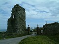
 Signal Tower, Dursey Island - geograph.org.uk - 350237.jpg 640 × 480; 100 KB
-
 Taoide Mhara - geograph.org.uk - 647465.jpg 640 × 429; 71 KB
-
 Tilickafinna - geograph.org.uk - 283430.jpg 640 × 480; 86 KB


.jpg)


_(geograph_3036442).jpg)


_(geograph_3036144).jpg)


.jpg)


,_Former_copper_mine_-_geograph.org.uk_-_263653.jpg)


.jpg)
.jpg)


