Category:Ruins in the Isle of Skye
Jump to navigation
Jump to search
Subcategories
This category has the following 9 subcategories, out of 9 total.
B
- Boreraig (32 F)
C
- Caisteal Maol (42 F)
- Cill Chriosd (22 F)
- Corriechatachan (3 F)
D
- Dun Ringill (7 F)
- Dunscaith Castle (25 F)
M
- Monkstadt House (4 F)
T
- Trumpan Church (43 F)
U
- Unish House (15 F)
Media in category "Ruins in the Isle of Skye"
The following 33 files are in this category, out of 33 total.
-
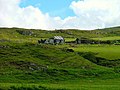
 Abandoned croft - geograph.org.uk - 782944.jpg 640 × 480; 63 KB
-
 Beyond restoration - geograph.org.uk - 994631.jpg 640 × 467; 107 KB
-
 Donald Maclean - panoramio.jpg 5,472 × 3,648; 17.76 MB
-
 Isle of Skye Trip (35440063684).jpg 5,760 × 3,840; 12.21 MB
-
 Knock Castle, Isle of Skye.jpg 5,760 × 3,840; 7.36 MB
-
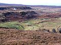
 Overgrown Ruin at The Aird - geograph.org.uk - 658494.jpg 640 × 480; 71 KB
-
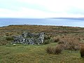
 Ramasaig - geograph.org.uk - 166230.jpg 640 × 480; 94 KB
-
 Ruin at Suisnish - geograph.org.uk - 133244.jpg 640 × 480; 74 KB
-
 Ruin by Loch Pooltiel - geograph.org.uk - 124731.jpg 640 × 480; 150 KB
-
 Ruin in Holmisdale - geograph.org.uk - 1571219.jpg 640 × 480; 152 KB
-
 Ruin in Holmisdale - geograph.org.uk - 1571278.jpg 640 × 480; 123 KB
-
 Ruin in Totaig - geograph.org.uk - 1566467.jpg 640 × 480; 172 KB
-
 Ruined Building in Glen Bracadale - geograph.org.uk - 141653.jpg 640 × 480; 90 KB
-
 Ruined Croft Building - geograph.org.uk - 141104.jpg 640 × 480; 88 KB
-
 Ruined croft building at Kilmaluag - geograph.org.uk - 1037053.jpg 640 × 480; 98 KB
-
 Ruined Croft Building at Totscore - geograph.org.uk - 351181.jpg 640 × 482; 120 KB
-
 Ruined Croft buildings - geograph.org.uk - 833877.jpg 640 × 480; 68 KB
-
 Ruined Croft House - geograph.org.uk - 123337.jpg 640 × 480; 104 KB
-
 Ruined Croft House - geograph.org.uk - 141116.jpg 640 × 480; 65 KB
-
 Ruined Croft House and Cattle - geograph.org.uk - 129949.jpg 640 × 480; 75 KB
-
 Ruined Crofthouse at Hamaraverin - geograph.org.uk - 503526.jpg 640 × 480; 86 KB
-
 Ruined House in Feriniquarrie - geograph.org.uk - 124745.jpg 640 × 480; 128 KB
-
 Ruined settlement, Galtrigill, Skye.jpg 640 × 480; 117 KB
-
 Ruins at Allt Buidhe - geograph.org.uk - 1718228.jpg 1,024 × 768; 619 KB
-
 Ruins at Greshornish - geograph.org.uk - 1560017.jpg 640 × 480; 261 KB
-
 Ruins of a crofter's house - geograph.org.uk - 783004.jpg 640 × 480; 95 KB
-
 Ruins of church in Balmacqueen in summer 2012 (1).JPG 4,752 × 3,168; 4.85 MB
-
 Ruins of church in Balmacqueen in summer 2012 (2).JPG 4,752 × 3,168; 4.33 MB
-
 Ruins of church in Balmacqueen in summer 2012 (3).JPG 4,752 × 3,168; 4.55 MB
-
 Ruins of church in Balmacqueen in summer 2012 (4).JPG 4,752 × 3,168; 5.64 MB
-
 Schotland ruïne Kilchrist in Swordale 12-05-2010 11-40-11.JPG 2,144 × 1,424; 1.57 MB
-
 Sheep Shelter - geograph.org.uk - 1472527.jpg 427 × 640; 99 KB
-
 St John's Chapel - geograph.org.uk - 1113112.jpg 640 × 480; 103 KB


.jpg)


.JPG)
.JPG)
.JPG)
.JPG)


