Category:Ruitenborgh (Dalfsen)
Jump to navigation
Jump to search
| Object location | | View all coordinates using: OpenStreetMap |
|---|
building in Dalfsen, Netherlands  | |||||
| Upload media | |||||
| Instance of | |||||
|---|---|---|---|---|---|
| Location | Ankum, Dalfsen, Overijssel, Netherlands | ||||
| Street address |
| ||||
| Located on street |
| ||||
| Heritage designation |
| ||||
 | |||||
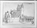
Nederlands: Huis Ruitenborgh, Ruytenburg gelegen in de dorp/buurt Ankum
|
This is a category about rijksmonument number 11669
|
| Address |
|
Media in category "Ruitenborgh (Dalfsen)"
The following 8 files are in this category, out of 8 total.
-
 Achtergevel(s) B. Volkers, Canada - Dalfsen - 20488243 - RCE.jpg 1,200 × 900; 121 KB
-
 Exterieur voorzijde - Dalfsen - 20047490 - RCE.jpg 1,200 × 960; 313 KB
-
 F.29 "Ruitenburgh", aanzicht - Ankum - 20022666 - RCE.jpg 1,200 × 796; 258 KB
-
 Ruitenberg.jpg 3,360 × 2,487; 1.87 MB
-
 Ruitenborgh.jpg 2,117 × 1,443; 567 KB
-
 Ruytenberg.jpg 3,243 × 2,469; 1.91 MB
-
 Ruytenburg.jpg 4,574 × 3,312; 5.84 MB
-
 Voor- en zijgevel B. Volkers, Canada - Dalfsen - 20488244 - RCE.jpg 1,200 × 900; 195 KB
_B._Volkers,_Canada_-_Dalfsen_-_20488243_-_RCE.jpg)


