Category:Runanga, New Zealand
Jump to navigation
Jump to search
locality in Grey District, West Coast Region, New Zealand  | |||||
| Upload media | |||||
| Instance of | |||||
|---|---|---|---|---|---|
| Location | Grey District, West Coast Region, New Zealand | ||||
| Population |
| ||||
 | |||||
English: Runanga is a small town on the West Coast of the South Island of New Zealand. It is located ten kilometres to the northwest of Greymouth, to the north of the Grey River. Barrytown is 21 kilometres further north. State Highway 6 runs through the town. (→Runanga, New Zealand)
Subcategories
This category has the following 2 subcategories, out of 2 total.
D
- Dunollie, New Zealand (1 F)
M
- Runanga Miners' Hall (2 F)
Media in category "Runanga, New Zealand"
The following 20 files are in this category, out of 20 total.
-
 2.Shearing 1980s.jpg 2,736 × 3,648; 1.85 MB
-
 Carroll Street in Runanga.jpg 3,563 × 1,424; 4 MB
-
 Coal bins by the railway line at Dunollie, Grey District (21016065243).jpg 5,153 × 3,753; 1.96 MB
-
 Coal Creek Falls 27.jpg 2,449 × 1,632; 789 KB
-
 Coal Mining, Runanga, Westland.jpg 900 × 685; 220 KB
-
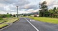
 Duncan Street in Runanga 01.jpg 3,380 × 1,908; 3.76 MB
-
 Duncan Street in Runanga 02.jpg 3,040 × 1,641; 3.7 MB
-
 General view of Runanga (21671971311).jpg 5,134 × 3,749; 2.42 MB
-
 Kilgour Street in Runanga.jpg 3,563 × 1,313; 3.7 MB
-
 Library at Runanga (21453477920).jpg 6,394 × 4,698; 3.25 MB
-
 McGowan Street in Runanga 01.jpg 3,543 × 1,819; 3.86 MB
-
 McGowan Street in Runanga 02.jpg 3,121 × 1,260; 2.8 MB
-
 McGowan Street, Runanga (21255795666).jpg 6,397 × 4,701; 4.15 MB
-
 Ranfurly Street in Runanga.jpg 3,361 × 1,798; 4.57 MB
-
 Seddon Street in Runanga.jpg 3,804 × 1,633; 4.46 MB
-

-
 Township of Runanga (20879186714).jpg 5,138 × 3,753; 2.3 MB
-
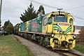 Trains in the back-yard - panoramio.jpg 2,816 × 1,880; 2.58 MB
-
 Ward Street in Runanga 01.jpg 3,356 × 2,171; 5.37 MB
-
 Ward Street in Runanga 02.jpg 3,429 × 2,310; 5.16 MB

.jpg)


.jpg)
.jpg)

.jpg)


.jpg)


