Category:Ruwiel
Jump to navigation
Jump to search
| Object location | | View all coordinates using: OpenStreetMap |
|---|
  | |||||
| Upload media | |||||
| Instance of |
| ||||
|---|---|---|---|---|---|
| Location |
| ||||
| Population |
| ||||
 | |||||
Subcategories
This category has the following 2 subcategories, out of 2 total.
K
- Kasteel Ruwiel (31 F)
Media in category "Ruwiel"
The following 9 files are in this category, out of 9 total.
-
 Coat of arms of Ruwiel.png 216 × 302; 3 KB
-
 Ruwiel heerlijkheidswapen.svg 671 × 779; 7 KB
-

-
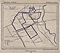 Ruwiel1865.jpg 800 × 701; 241 KB
-
 Ruwiel Ambachtsheerlijkheidswapen.svg 474 × 579; 7 KB
-
 Ruwiel wapen.svg 396 × 593; 45 KB
-
 Gemeente Ruwiel (1818-1964).png 3,668 × 3,646; 1.23 MB
-
 Overzicht - Ruwiel - 20194062 - RCE.jpg 1,200 × 794; 264 KB
-
 Voorgevel - Ruwiel - 20194063 - RCE.jpg 1,200 × 785; 246 KB


_-_Breukelerwaardsche_Polder_met_kasteelrestant_Ruwiel_en_Klein_Ruwiel.jpg)


.png)
