Category:SR 162 Bridge over the Puyallup River (Orting, Washington)
Jump to navigation
Jump to search
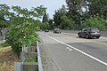
This category is intended for media related to SR 162 Bridge over the Puyallup River (2015), Orting, Washington, United States.
Please do not confuse with:
- SR 162 Bridge over the Puyallup River (Puyallup, Washington, 1973)
| Object location | | View all coordinates using: OpenStreetMap |
|---|
Media in category "SR 162 Bridge over the Puyallup River (Orting, Washington)"
The following 8 files are in this category, out of 8 total.
-
 2023-01-31, SR 162 Bridge over the Puyallup River (Orting, Washington), 01.jpg 4,032 × 3,024; 5.19 MB
-
 2023-01-31, SR 162 Bridge over the Puyallup River (Orting, Washington), 02.jpg 4,032 × 3,024; 6.13 MB
-
 2023-01-31, SR 162 Bridge over the Puyallup River (Orting, Washington), 03.jpg 4,032 × 3,024; 5.42 MB
-
 Modern 2172.jpg 4,608 × 3,072; 4.69 MB
-
 Modern 2174.jpg 4,608 × 3,072; 3.97 MB
-
 Modern 2181.jpg 4,608 × 3,072; 4.87 MB
-
 Modern 2184.jpg 3,072 × 4,608; 4.21 MB
-
 Modern deck 2169.jpg 4,608 × 3,072; 4.12 MB
,_01.jpg)
,_02.jpg)
,_03.jpg)


