Category:SVG locator maps of Ukraine (location map scheme)
Zur Navigation springen
Zur Suche springen
Staaten in Europa: Albanien · Andorra · Armenien‡ · Aserbaidschan‡ · Belarus · Belgien · Bosnien und Herzegowina · Bulgarien · Dänemark · Deutschland · Estland · Finnland · Frankreich‡ · Georgien‡ · Griechenland · Irland · Island · Italien · Kasachstan‡ · Kroatien · Lettland · Liechtenstein · Litauen · Luxemburg · Malta · Moldau · Monaco · Montenegro · Niederlande‡ · Nordmazedonien · Norwegen · Österreich · Polen · Portugal‡ · Rumänien · Russland‡ · San Marino · Schweden · Schweiz · Serbien · Slowakei · Slowenien · Spanien‡ · Tschechien · Türkei‡ · Ukraine · Ungarn · Vatikanstadt · Vereinigtes Königreich · Zypern‡
Spezifischer Status: Akrotiri und Dekelia‡ · Färöer · Gibraltar · Bailiwick of Guernsey · Jersey · Isle of Man · Spitzbergen – Begrenzte Anerkennung: Abchasien‡ · Kosovo · Südossetien‡ · Transnistrien · Türkische Republik Nordzypern‡ · UN-Pufferzone in Zypern‡
‡: teilweise in Europa
Spezifischer Status: Akrotiri und Dekelia‡ · Färöer · Gibraltar · Bailiwick of Guernsey · Jersey · Isle of Man · Spitzbergen – Begrenzte Anerkennung: Abchasien‡ · Kosovo · Südossetien‡ · Transnistrien · Türkische Republik Nordzypern‡ · UN-Pufferzone in Zypern‡
‡: teilweise in Europa

|
Die SVG-Karten in dieser Kategorie sind Teil einer Lagekartenserie, die nach dem weitverbreiteten Positionskartenschema der Kartenwerkstatt gestaltet ist. Siehe die Hauptkategorie für mehr Karten. |
.svg)
.svg)
.svg)
.svg)
.svg)
.svg)
.svg)
Gestaltungsempfehlungen ▼ | |
|---|---|
Grundlagen
Die Gestaltungsempfehlungen orienteren sich an den ▸Positionskartendesignrichtlinien der Kartenwerkstatt. Es empfiehlt sich, die Lagekarte (Locator map) möglichst von einer bestehenden Positionskarte (Location map) abzuleiten und die Abmessungen wo möglich beizubehalten. In diesem Fall kann auch die Lagekarte weiter als Positionskarte verwendet werden (▸Anleitung). Das hervorzuhebende Gebiet wird meist in einem dunkelroten Farbton gekennzeichnet. Flüsse und Seen können wo zweckmäßig leicht transparent dargestellt werden, um die Verwaltungseinteilung besser sichtbar zu machen. Achtung: Dies sind Gestaltungsempfehlungen und keine Gebote!
Hervorhebung kleiner Gebiete
„Abgesetze“ Gebiete und Minikarten
Übersichtskarten verdeutlichen die Lage der abgebildeten Region. Vgl. auch ▸verschachtelte Karten mittels Positionskarte+ & ▸Modèle:Carte en coin (französisch) für eine andere Möglichkeit, Minikarten einzufügen.
Umstrittene Gebiete
Gestaltung von „Sonderobjekten“
Hintergründe
|

-en.svg)

.svg)
.svg)
.svg)

_(US48).svg)
_(small_islands_magnified)_(-mini_map_-rivers).svg)
.svg)
_(extra_close)_(US48).svg)
.svg)
_(zoom).svg)

.svg)


_(UNMIK).svg)
.svg)
_(disputed_hatched).svg)
_(claimed_and_disputed_hatched).svg)
.svg)
.svg)
_(%2Ball_claims_hatched).svg)

.svg)
_(shade).svg)
_(shade)_(special_marker).svg)
_(-mini_map).svg)
_(-mini_map).svg)
_(-mini_map).svg)


.svg)

.svg)
Unterkategorien
Es werden 3 von insgesamt 3 Unterkategorien in dieser Kategorie angezeigt:
In Klammern die Anzahl der enthaltenen Kategorien (K), Seiten (S), Dateien (D)
Medien in der Kategorie „SVG locator maps of Ukraine (location map scheme)“
Folgende 31 Dateien sind in dieser Kategorie, von 31 insgesamt.
-
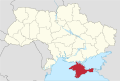 Crimea Republic in Ukraine.svg 1.547 × 1.041; 1,28 MB
-
 Donbass in Ukraine (-claims).svg 1.545 × 945; 756 KB
-
 Donetsian Region in Ukraine (claims hatched).svg 1.547 × 1.041; 717 KB
-
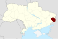
 Donetsian Region in Ukraine.svg 1.547 × 1.041; 1,29 MB
-
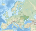
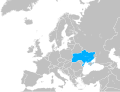 Europe ua.svg 680 × 520; 795 KB
-
 LPR in Ukraine as of 23 February 2022 (Crimea disputed).svg 1.546 × 1.038; 436 KB
-
 LPR in Ukraine.svg 1.546 × 1.038; 436 KB
-
 Lugansk People's Republic in Ukraine (de-facto) (semi-secession).svg 1.546 × 1.038; 437 KB
-
 ORDO in Ukraine.svg 1.546 × 1.039; 559 KB
-
 Ukraine (-claims) in Europe (-rivers -mini map).svg 1.401 × 1.198; 954 KB
-
 Ukraine (-claims) in Europe (relief) (-mini map).svg 1.401 × 1.198; 1,18 MB
-
 Ukraine (-claims) in Europe.svg 1.401 × 1.198; 2,61 MB
-
 Ukraine (-claims) in its region.svg 510 × 287; 4,15 MB
-
 Ukraine (-claims) on the globe (Europe centered).svg 1.032 × 1.032; 504 KB
-
 Ukraine (claims hatched) in Europe (-rivers -mini map).svg 1.401 × 1.198; 2,43 MB
-
 Ukraine (claims hatched) in Europe.svg 1.401 × 1.198; 2,43 MB
-
 Ukraine (claims hatched) in its region.svg 510 × 287; 4,15 MB
-
 Ukraine (claims hatched) on the globe (Europe centered).svg 1.032 × 1.032; 509 KB
-
 Ukraine in Europe (-rivers -mini map).svg 1.401 × 1.198; 1,38 MB
-
 Ukraine in Europe (blue marble) (-mini map).svg 1.401 × 1.198; 10,89 MB
-
 Ukraine in Europe (blue marble).svg 1.401 × 1.198; 11,42 MB
-
 Ukraine in Europe (natural) (-mini map).svg 1.401 × 1.198; 7,16 MB
-
 Ukraine in Europe (natural).svg 1.401 × 1.198; 7,69 MB
-
 Ukraine in Europe (relief) (-mini map).svg 1.401 × 1.198; 8,09 MB
-
 Ukraine in Europe (relief).svg 1.401 × 1.198; 8,62 MB
-
 Ukraine in Europe with disputed territories.svg 512 × 329; 326 KB
-
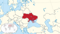
 Ukraine in Europe.svg 1.401 × 1.198; 4,04 MB
-
 Ukraine in its region.svg 510 × 287; 6,86 MB
-
 Ukraine in the world (W3).svg 3.188 × 1.948; 5,42 MB
-
 Ukraine on the globe (Europe centered).svg 1.032 × 1.032; 501 KB
-
 Ukraine Russian-cropped.svg 1.546 × 1.038; 57 KB

.svg)
.svg)


.svg)

_(semi-secession).svg)

_in_Europe_(-rivers_-mini_map).svg)
_in_Europe_(relief)_(-mini_map).svg)
_in_Europe.svg)
_in_its_region.svg)
_on_the_globe_(Europe_centered).svg)
_in_Europe_(-rivers_-mini_map).svg)
_in_Europe.svg)
_in_its_region.svg)
_on_the_globe_(Europe_centered).svg)
.svg)
_(-mini_map).svg)
.svg)
_(-mini_map).svg)
.svg)
_(-mini_map).svg)
.svg)


.svg)
.svg)
