Category:SVG locator maps of districts of Federally Administered Tribal Areas (blue and green scheme)
Jump to navigation
Jump to search
Media in category "SVG locator maps of districts of Federally Administered Tribal Areas (blue and green scheme)"
The following 7 files are in this category, out of 7 total.
-
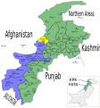
 NWPF FATA ORAKZAI.svg 1,000 × 1,075; 202 KB
-
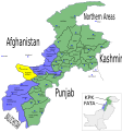
 Pakistan NWFP FATA Bajaur.svg 1,000 × 1,075; 202 KB
-
 Pakistan NWFP FATA Khyber.svg 1,000 × 1,075; 202 KB
-
 Pakistan NWFP FATA Kurram.svg 1,000 × 1,075; 202 KB
-
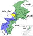 Pakistan NWFP FATA Mohmand.svg 1,000 × 1,075; 202 KB
-
 Pakistan NWFP FATA NORTH WAZIRISTAN.svg 1,000 × 1,075; 202 KB
-
 Pakistan NWFP FATA South Waziristan.svg 1,000 × 1,075; 202 KB


