Category:SVG locator maps of historic Hawaiian mokus
Jump to navigation
Jump to search
English: SVG maps of historic Hawaiian mokus
Media in category "SVG locator maps of historic Hawaiian mokus"
The following 14 files are in this category, out of 14 total.
-
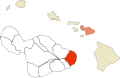
 Historic Mokus of Maui Map (Hamakualoa).svg 758 × 490; 270 KB
-
 Historic Mokus of Maui Map (Hamakuapoko).svg 758 × 490; 270 KB
-
 Historic Mokus of Maui Map (Hana).svg 758 × 490; 270 KB
-
 Historic Mokus of Maui Map (Honuaula).svg 758 × 490; 270 KB
-
 Historic Mokus of Maui Map (Kaanapali).svg 758 × 490; 270 KB
-
 Historic Mokus of Maui Map (Kahikinui).svg 758 × 490; 270 KB
-
 Historic Mokus of Maui Map (Kaupo).svg 758 × 490; 270 KB
-
 Historic Mokus of Maui Map (Kipahulu).svg 758 × 490; 270 KB
-
 Historic Mokus of Maui Map (Koolau).svg 758 × 490; 270 KB
-
 Historic Mokus of Maui Map (Kula).svg 758 × 490; 270 KB
-
 Historic Mokus of Maui Map (Lahaina).svg 758 × 490; 270 KB
-
 Historic Mokus of Maui Map (Wailuku).svg 758 × 490; 270 KB
-
 Historic Mokus of Maui Map numbered.svg 512 × 343; 49 KB
-
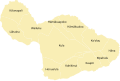 Historic Mokus of Maui Map.svg 512 × 343; 59 KB
.svg)
.svg)
.svg)
.svg)
.svg)
.svg)
.svg)
.svg)
.svg)
.svg)
.svg)
.svg)

