Category:SVG locator maps of sub-regions of Finland 2009
Jump to navigation
Jump to search
Maps of Finnish sub-regions in 2009.
Media in category "SVG locator maps of sub-regions of Finland 2009"
The following 14 files are in this category, out of 14 total.
-
 Helsingin.seutukunta.sijainti.2009.svg 1,850 × 3,220; 184 KB
-
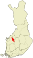 Järviseudun.seutukunta.sijainti.2009.svg 1,850 × 3,220; 184 KB
-
 Kaustisen.seutukunta.sijainti.2009.svg 1,850 × 3,220; 184 KB
-
 Kokkolan.seutukunta.sijainti.2009.svg 1,850 × 3,220; 184 KB
-
 Kuusiokuntien.seutukunta.sijainti.2009.svg 1,850 × 3,220; 184 KB
-
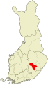
 Lappeenrannan.seutukunta.sijainti.2009.svg 1,850 × 3,220; 184 KB
-
 Mikkelin.seutukunta.sijainti.2009.svg 1,850 × 3,220; 184 KB
-
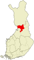
 Oulun.seutukunta.sijainti.2009.svg 1,850 × 3,220; 184 KB
-
 Oulunkaaren.seutukunta.sijainti.2009.svg 1,850 × 3,220; 184 KB
-
 Pieksämäen.seutukunta.sijainti.2009.svg 1,850 × 3,220; 184 KB
-
 Raaseporin.seutukunta.sijainti.2009.svg 1,850 × 3,220; 184 KB
-
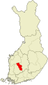
 Seinäjoen.seutukunta.sijainti.2009.svg 1,850 × 3,220; 184 KB
-
 Tampereen.seutukunta.sijainti.2009.svg 1,850 × 3,220; 184 KB
-
 Ylä-Pirkanmaan.seutukunta.sijainti.2009.svg 1,850 × 3,220; 184 KB


