Category:SVG maps of England and Wales
Jump to navigation
Jump to search
Subcategories
This category has the following 2 subcategories, out of 2 total.
Media in category "SVG maps of England and Wales"
The following 11 files are in this category, out of 11 total.
-
 England and Wales Police and Crime Commission elections 2012 map.svg 540 × 668; 110 KB
-
 England and Wales Police and Crime Commission elections 2016 map.svg 540 × 668; 108 KB
-
 England and Wales Police and Crime Commission elections 2021 map.svg 540 × 668; 108 KB
-
 England and Wales Police and Crime Commissioner elections 2024.svg 540 × 668; 108 KB
-
 England and Wales with border.svg 510 × 673; 369 KB
-
 England and Wales within the UK and Europe.svg 680 × 520; 2.57 MB
-
 England and Wales.svg 510 × 672; 1.39 MB
-
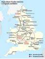 Major water transfer schemes in England and Wales map.svg 334 × 432; 655 KB
-
 Map BaronyOf MilesOfGloucester.svg 726 × 666; 110 KB
-
 PCC elections 2012 Map of Liberal Democrat candidates.svg 540 × 668; 110 KB
-
 PCC elections 2012 Map of UKIP candidates.svg 540 × 668; 110 KB


