Category:SVG maps of Rio Grande do Sul
Jump to navigation
Jump to search
Media in category "SVG maps of Rio Grande do Sul"
The following 51 files are in this category, out of 51 total.
-
 Brazil State RioGrandedoSul.svg 702 × 687; 676 KB
-
 RioGrandedoSul MesoMicroMunicip.svg 1,095 × 946; 871 KB
-
 Arquidiocese de Passo Fundo.svg 1,095 × 946; 425 KB
-
 Arquidiocese de Pelotas.svg 1,095 × 946; 425 KB
-
 Arquidiocese de Porto Alegre.svg 1,095 × 946; 425 KB
-
 Arquidiocese de Santa Maria.svg 1,095 × 946; 425 KB
-
 BABM1 Localização.svg 800 × 691; 255 KB
-
 BABM2 loc.svg 800 × 691; 262 KB
-
 BABM3 Abrangencia.svg 800 × 691; 257 KB
-
 Brazil Rio Grande do Sul location map (Catholic dioceses).svg 1,095 × 946; 425 KB
-
 Brazil Rio Grande do Sul location map.svg 1,095 × 1,088; 847 KB
-
 Clima do Rio Grande do Sul (Köppen).svg 512 × 632; 235 KB
-
 Diocese de Bagé.svg 1,095 × 946; 425 KB
-
 Diocese de Cachoeira do Sul.svg 1,095 × 946; 425 KB
-
 Diocese de Caxias do Sul.svg 1,095 × 946; 425 KB
-
 Diocese de Cruz Alta.svg 1,095 × 946; 425 KB
-
 Diocese de Erexim.svg 1,095 × 946; 425 KB
-
 Diocese de Frederico Westphalen.svg 1,095 × 946; 425 KB
-
 Diocese de Montenegro.svg 1,095 × 946; 425 KB
-
 Diocese de Novo Hamburgo.svg 1,095 × 946; 425 KB
-
 Diocese de Osório.svg 1,095 × 946; 425 KB
-
 Diocese de Rio Grande.svg 1,095 × 946; 425 KB
-
 Diocese de Santa Cruz do Sul.svg 1,095 × 946; 425 KB
-
 Diocese de Santo Ângelo.svg 1,095 × 946; 425 KB
-
 Diocese de Uruguaiana.svg 1,095 × 946; 425 KB
-
 Diocese de Vacaria.svg 1,095 × 946; 425 KB
-
 Flag map of Rio Grande do Sul.svg 671 × 647; 216 KB
-
 H1N1 Brazil RS map by confirmed cases.svg 1,095 × 946; 830 KB
-
 H1N1 Brazil RS map by confirmed deaths.svg 1,095 × 946; 830 KB
-
 H1N1 Brazil RS Map.svg 1,095 × 946; 830 KB
-
 Map olympic golf course Rio de Janeiro.svg 1,631 × 1,050; 3.98 MB
-
 Map Rio Grande do Sul municipality borders.svg 512 × 496; 385 KB
-
 Mapa de casos de COVID-19 no Rio Grande do Sul.svg 512 × 519; 1.08 MB
-
 Mapa de casos de COVID-19 por 100 mil habitantes no Rio Grande do Sul.svg 512 × 519; 1.08 MB
-
 Mapa do IDH do Rio Grande do Sul (2010).svg 512 × 518; 638 KB
-
 MisionesJesuíticasYProvinciaOriental1811-1819.svg 1,390 × 1,361; 801 KB
-
 MisionesOccidentales.svg 1,242 × 849; 779 KB
-
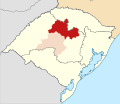
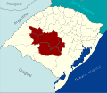
 Região Intermediária de Caxias do Sul, Rio Grande do Sul.svg 1,095 × 946; 12.19 MB
-
 Região Intermediária de Ijuí, Rio Grande do Sul.svg 1,095 × 946; 12.24 MB
-
 Região Intermediária de Passo Fundo, Rio Grande do Sul.svg 1,095 × 946; 7.52 MB
-
 Região Intermediária de Pelotas, Rio Grande do Sul.svg 1,095 × 946; 12.17 MB
-
 Região Intermediária de Porto Alegre, Rio Grande do Sul.svg 1,095 × 946; 12.2 MB
-
 Região Intermediária de Santa Cruz do Sul-Lajeado, Rio Grande do Sul.svg 1,095 × 946; 12.15 MB
-
 Região Intermediária de Santa Maria, Rio Grande do Sul.svg 1,095 × 946; 12.19 MB
-
 Região Intermediária de Uruguaiana, Rio Grande do Sul.svg 1,095 × 946; 12.15 MB
-
 Regiões Geográficas do Estado do Rio Grande do Sul.svg 512 × 442; 6.41 MB
-
 Rio Grande do Sul Köppen.svg 512 × 632; 235 KB
-
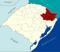
 RioGrandedoSul AglomeracaoUrbanaNordestedoRS.svg 1,095 × 946; 563 KB
-
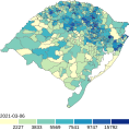
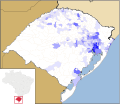
 RioGrandedoSul DensidadePopulacional.svg 1,095 × 946; 874 KB
-
 RS DensidadePopulacional 01.svg 1,095 × 946; 557 KB
-
 Serra-Gaúcha-Rio-Grande-do-Sul.-Lucas-do-Canto.svg 10,186 × 8,795; 904 KB


.svg)

.svg)


.svg)


