Category:SVG maps of Tocantins
Jump to navigation
Jump to search
Media in category "SVG maps of Tocantins"
The following 23 files are in this category, out of 23 total.
-
 Tocantins MesoMicroMunicip.svg 617 × 986; 517 KB
-
 Brazil Tocantins location map.svg 617 × 986; 650 KB
-
 Clima do Tocantins (Köppen).svg 512 × 731; 88 KB
-
 Ilha do bananal.svg 617 × 986; 525 KB
-
 Mapa de casos de COVID-19 no Tocantins.svg 512 × 932; 510 KB
-
 Mapa de casos de COVID-19 por 100 mil habitantes no Tocantins.svg 512 × 932; 510 KB
-
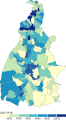
 Mapa do IDH do Tocantins (2010).svg 512 × 794; 368 KB
-
 Região Imediata de Araguatins, Tocantins.svg 641 × 1,024; 105 KB
-
 Região Imediata de Araguaína, Tocantins.svg 641 × 1,024; 105 KB
-
 Região Imediata de Colinas do Tocantins, Tocantins.svg 641 × 1,024; 105 KB
-
 Região Imediata de Dianópolis, Tocantins.svg 641 × 1,024; 105 KB
-
 Região Imediata de Guaraí, Tocantins.svg 641 × 1,024; 106 KB
-
 Região Imediata de Gurupi, Tocantins.svg 641 × 1,024; 104 KB
-
 Região Imediata de Miracema do Tocantins, Tocantins.svg 641 × 1,024; 106 KB
-
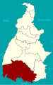
 Região Imediata de Palmas, Tocantins.svg 641 × 1,024; 105 KB
-
 Região Imediata de Paraíso do Tocantins, Tocantins.svg 641 × 1,024; 105 KB
-
 Região Imediata de Porto Nacional, Tocantins.svg 641 × 1,024; 106 KB
-
 Região Imediata de Tocantinópolis, Tocantins.svg 641 × 1,024; 105 KB
-
 Região Intermediária de Araguaína, Tocantins.svg 641 × 1,024; 291 KB
-
 Região Intermediária de Gurupi, Tocantins.svg 641 × 1,024; 530 KB
-
 Região Intermediária de Palmas,Tocantins.svg 641 × 1,024; 290 KB
-
 Regiões Geográficas do Estado do Tocantins.svg 512 × 818; 110 KB
-
 Tocantins Köppen.svg 512 × 731; 85 KB


.svg)


.svg)


