Category:SVG maps of statistical regions of North Macedonia
Jump to navigation
Jump to search
Subcategories
This category has only the following subcategory.
Media in category "SVG maps of statistical regions of North Macedonia"
The following 66 files are in this category, out of 66 total.
-
 Ethnic groups in Skopje cs.svg 580 × 600; 312 KB
-
 Ethnic groups in Skopje en.svg 580 × 600; 577 KB
-
 Ethnic groups in Skopje hu.svg 580 × 600; 577 KB
-
 Ethnic groups in Skopje mk.svg 580 × 600; 739 KB
-
 Ethnic groups in Skopje Region of North Macedonia en.svg 700 × 510; 483 KB
-
 Ethnic groups in Skopje Region of North Macedonia.svg 700 × 510; 483 KB
-
 Ethnic groups in Skopje zh.svg 580 × 600; 576 KB
-
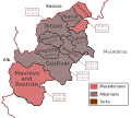
 Ethnic groups in the Eastern Region of North Macedonia en.svg 744 × 581; 238 KB
-
 Ethnic groups in the Eastern Region of North Macedonia.svg 744 × 581; 238 KB
-
 Ethnic groups in the Northeastern Region of North Macedonia en.svg 660 × 270; 165 KB
-
 Ethnic groups in the Northeastern Region of North Macedonia.svg 660 × 270; 165 KB
-
 Ethnic groups in the Pelagonia Region of North Macedonia en.svg 744 × 440; 282 KB
-
 Ethnic groups in the Pelagonia Region of North Macedonia.svg 744 × 440; 283 KB
-
 Ethnic groups in the Polog Region of North Macedonia en.svg 600 × 540; 326 KB
-
 Ethnic groups in the Polog Region of North Macedonia.svg 600 × 540; 281 KB
-
 Ethnic groups in the Southeastern Region of North Macedonia en.svg 620 × 520; 500 KB
-
 Ethnic groups in the Southeastern Region of North Macedonia.svg 620 × 520; 500 KB
-
 Ethnic groups in the Southwestern Region of North Macedonia en.svg 630 × 581; 307 KB
-
 Ethnic groups in the Southwestern Region of North Macedonia.svg 630 × 581; 307 KB
-
 Ethnic groups in the Vardar Region of North Macedonia en.svg 590 × 581; 275 KB
-
 Ethnic groups in the Vardar Region of North Macedonia.svg 590 × 581; 275 KB
-
 Hircus-Macedonia location Eastern.svg 550 × 421; 405 KB
-
 Hircus-Macedonia location Northeastern.svg 550 × 421; 405 KB
-
 Hircus-Macedonia location Pelagonia.svg 550 × 421; 405 KB
-
 Hircus-Macedonia location Polog.svg 550 × 421; 405 KB
-
 Hircus-Macedonia location Skopje.svg 550 × 421; 405 KB
-
 Hircus-Macedonia location Southeastern.svg 550 × 421; 405 KB
-
 Hircus-Macedonia location Southwestern.svg 550 × 421; 405 KB
-
 Hircus-Macedonia location Vardar.svg 550 × 421; 405 KB
-
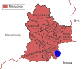
 Map of the municipalities of Eastern Statistical Region en.svg 744 × 581; 473 KB
-
 Map of the municipalities of Eastern Statistical Region.svg 744 × 581; 473 KB
-
 Map of the municipalities of Pelagonia Statistical Region en.svg 744 × 581; 477 KB
-
 Map of the municipalities of Pelagonia Statistical Region.svg 744 × 581; 467 KB
-
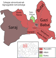
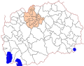 Map of the municipalities of Skopje Statistical Region en.svg 744 × 581; 457 KB
-
 Map of the municipalities of Skopje Statistical Region.svg 744 × 581; 456 KB
-
 Map of the municipalities of the Northeastern Statistical Region en.svg 744 × 581; 454 KB
-
 Map of the municipalities of the Northeastern Statistical Region.svg 744 × 581; 458 KB
-
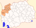
 Map of the municipalities of the Polog Statistical Region en.svg 744 × 581; 476 KB
-
 Map of the municipalities of the Polog Statistical Region.svg 744 × 581; 470 KB
-
 Map of the municipalities of the Southeastern Statistical Region en.svg 744 × 581; 462 KB
-
 Map of the municipalities of the Southeastern Statistical Region.svg 744 × 581; 372 KB
-

-
 Map of the municipalities of the Southwestern Statistical Region en.svg 744 × 581; 466 KB
-
 Map of the municipalities of the Southwestern Statistical Region.svg 744 × 581; 475 KB
-
 Map of the municipalities of the Vardar Statistical Region en.svg 744 × 581; 433 KB
-
 Map of the municipalities of the Vardar Statistical Region.svg 744 × 581; 462 KB
-
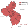
 Maqedonia, Ndarjet administrative - Rajonet af.svg 512 × 424; 1.55 MB
-
 North Macedonia, administrative divisions - ar - monochrome.svg 1,400 × 1,130; 252 KB
-
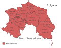
 North Macedonia, administrative divisions - bg - monochrome.svg 1,309 × 1,048; 323 KB
-
 North Macedonia, administrative divisions - de - colored.svg 1,368 × 1,133; 223 KB
-
 North Macedonia, administrative divisions - de - monochrome.svg 1,368 × 1,133; 219 KB
-
 North Macedonia, administrative divisions - en - monochrome.svg 1,400 × 1,130; 177 KB
-
 North Macedonia, administrative divisions - eo - colored.svg 1,368 × 1,133; 228 KB
-
 North Macedonia, administrative divisions - fr - monochrome.svg 1,400 × 1,130; 138 KB
-
 North Macedonia, administrative divisions - it - monochrome.svg 1,400 × 1,130; 178 KB
-
 North Macedonia, administrative divisions - lt - monochrome.svg 1,400 × 1,130; 179 KB
-
 North Macedonia, administrative divisions - mk - monochrome.svg 1,400 × 1,130; 232 KB
-
 North Macedonia, administrative divisions - Nmbrs - colored.svg 1,368 × 1,133; 220 KB
-
 North Macedonia, administrative divisions - Nmbrs - monochrome.svg 1,368 × 1,133; 158 KB
-
 North Macedonia, administrative divisions - pl - monochrome.svg 1,400 × 1,130; 140 KB
-
 North Macedonia, administrative divisions - ru - monochrome.svg 1,400 × 1,130; 356 KB
-
 North Macedonia, administrative divisions - sh - monochrome.svg 1,400 × 1,130; 180 KB
-
 North Macedonia, administrative divisions - sr - monochrome.svg 1,400 × 1,130; 177 KB
-
 North Macedonia, administrative divisions-ua.png 724 × 600; 92 KB
-
 North Maqedonia, Ndarjet administrative - Rajonet.svg 512 × 424; 1.49 MB
-
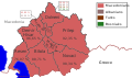
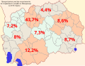 Regions' contribution to the GDP of North Macedonia for 2010.svg 744 × 581; 718 KB


.svg)


