Category:SVG maps of the history of Normandy
Jump to navigation
Jump to search
Administrative regions and territorial collectivity of Metropolitan France (‡ since start of 2016):
Normandy‡
Normandy‡

Subcategories
This category has only the following subcategory.
B
Media in category "SVG maps of the history of Normandy"
The following 13 files are in this category, out of 13 total.
-
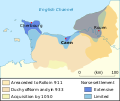
 911-1050 duche de normandie ru.svg 525 × 443; 61 KB
-
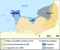
 911-1050 duche de normandie-en.svg 525 × 443; 76 KB
-
 911-1050 duche de normandie-es.svg 525 × 443; 217 KB
-
 911-1050 duche de normandie-he.svg 525 × 443; 135 KB
-
 911-1050 duche de normandie-id.svg 525 × 443; 76 KB
-
 911-1050 duche de normandie-it.svg 525 × 443; 76 KB
-
 911-1050 duche de normandie-pt.svg 525 × 443; 66 KB
-
 911-1050 duche de normandie.svg 525 × 443; 61 KB
-
 911-1050 dugelezh normandi.svg 525 × 443; 61 KB
-
 Normandie-es.svg 754 × 542; 125 KB
-
 Normandie-pt.svg 754 × 542; 25 KB
-
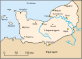 Normandie-ru.svg 754 × 542; 24 KB
-
 Normandie.svg 754 × 542; 20 KB


