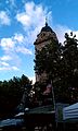
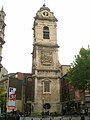
Category:Saint Catherine Tower
Jump to navigation
Jump to search
|
This is a category about a monument in Brussels, number: 2043-0001/0
|
| Object location | | View all coordinates using: OpenStreetMap |
|---|
church tower of the destroyed Saint Catherine Church in Brussels, Belgium  | |||||
| Upload media | |||||
| Instance of | |||||
|---|---|---|---|---|---|
| Named after | |||||
| Location | Quays Quarter, Pentagon, City of Brussels, Arrondissement of Brussels-Capital, Brussels-Capital Region, Brussels, Kuype of Brussels, Duchy of Brabant | ||||
| Located on street | |||||
| Architectural style | |||||
| Heritage designation | |||||
| Inception |
| ||||
| Significant event |
| ||||
 | |||||
Media in category "Saint Catherine Tower"
The following 10 files are in this category, out of 10 total.
-
 Baroktoren van de voormalige Sint-Katelijnekerk.jpg 1,952 × 3,264; 1.22 MB
-
 Bruxelles kosciol sw Katarzyny 02.jpg 1,192 × 2,816; 1.84 MB
-
 Melsens 28 - St Katelijnen 45 Ste Catherine Brussels 2012-04.JPG 3,456 × 2,304; 4.05 MB
-
 Sainte Catherine 003 (215906987).jpeg 2,048 × 1,364; 463 KB
-
 Sainte-Catherine Tower, Brussels.jpg 3,000 × 4,000; 1.95 MB
-
 St. Catherine Tower.jpg 480 × 640; 50 KB
-
 Tour baroque de l'ancienne église Sainte-Catherine.jpg 1,597 × 2,400; 580 KB
-
 Tour de l'ancienne église Sainte-Catherine de Bruxelles 01.JPG 964 × 1,512; 1.05 MB
-
 Tour Sainte-Catherine.jpg 1,656 × 2,289; 1.45 MB
-
 Église Sainte-Catherine tower (Brussels) - IMG 4050.JPG 2,448 × 3,264; 1.95 MB


.jpeg)


_-_IMG_4050.JPG)