Category:Saipan
Jump to navigation
Jump to search
State capitals of the United States: Albany [NY] · Annapolis [MD] · Atlanta [GA] · Augusta [ME] · Austin [TX] · Baton Rouge [LA] · Bismarck [ND] · Boise [ID] · Boston [MA] · Carson City [NV] · Charleston [WV] · Cheyenne [WY] · Columbia [SC] · Columbus [OH] · Concord [NH] · Denver [CO] · Des Moines [IA] · Dover [DE] · Frankfort [KY] · Harrisburg [PA] · Hartford [CT] · Helena [MT] · Honolulu [HI] · Indianapolis [IN] · Jackson [MS] · Jefferson City [MO] · Juneau [AK] · Lansing [MI] · Lincoln [NE] · Little Rock [AR] · Madison [WI] · Montgomery [AL] · Montpelier [VT] · Nashville [TN] · Oklahoma City [OK] · Olympia [WA] · Phoenix [AZ] · Pierre [SD] · Providence [RI] · Raleigh [NC] · Richmond [VA] · Sacramento [CA] · Saint Paul [MN] · Salem [OR] · Salt Lake City [UT] · Santa Fe [NM] · Springfield [IL] · Tallahassee [FL] · Topeka [KS] · Trenton [NJ] · Federal district: Washington, D.C. [DC] · Insular area of the United States · Charlotte Amalie [VI] · Hagåtña [GU] · Pago Pago [AS] · Saipan [MP] · San Juan [PR]
largest island of the Northern Mariana Islands, United States of America  | |||||
| Upload media | |||||
| Instance of | |||||
|---|---|---|---|---|---|
| Part of | |||||
| Location |
| ||||
| Located in or next to body of water | |||||
| Highest point |
| ||||
| Population |
| ||||
| Area |
| ||||
| Elevation above sea level |
| ||||
| Different from | |||||
| Said to be the same as | Saipan Municipality, Saipan | ||||
| official website | |||||
 | |||||
English: The Category:Saipan contains media related to the island of Saipan in the Northern Mariana Islands (east of China and the Philippines).
日本語: サイパン。

Subcategories
This category has the following 7 subcategories, out of 7 total.
Media in category "Saipan"
The following 81 files are in this category, out of 81 total.
-

-
(Best Saipan) COP Golf Course.webm 1 min 12 s, 1,920 × 1,080; 66.3 MB
-
 150808-N-KM939-449 (20332416880).jpg 3,560 × 2,366; 837 KB
-
 150810-N-KM939-218 (19869536553).jpg 3,696 × 2,456; 435 KB
-
 150819-N-KM939-269 (20842576796).jpg 3,696 × 2,456; 763 KB
-
 181104-M-DR983-056 (45008790484).jpg 4,608 × 3,072; 1.09 MB
-
 181123-F-QF982-0090 (46077614831).jpg 7,770 × 5,180; 10.29 MB
-
 181125-A-RT268-019 (45353404444).jpg 3,456 × 2,304; 3.85 MB
-
 American Memorial Park3.jpg 2,048 × 1,536; 507 KB
-
 Artillery in Saipan.jpg 1,024 × 576; 251 KB
-
 Battle of Saipan - US Navy docked GAG03.jpg 2,748 × 2,204; 1.11 MB
-
 Camp susupe sign.JPG 4,608 × 3,456; 6.34 MB
-
 Container Inspections (24390506459).jpg 4,912 × 7,024; 3.65 MB
-
 Emperor Akihito and empress Michiko of japan.jpg 978 × 1,760; 256 KB
-
 Feast of Fire (4577064644).jpg 2,560 × 1,872; 2.13 MB
-
 Free Our Minds (13216281895).jpg 1,024 × 767; 661 KB
-
 High shrubs saipan.JPG 4,608 × 3,456; 6.46 MB
-
 High utility mast saipan.JPG 4,608 × 3,456; 6.93 MB
-
 Isely Field with B-29s in mid 1945.jpg 947 × 687; 172 KB
-
 Japanese Merchant Vessel "Chinsen".jpg 3,264 × 2,448; 2.04 MB
-
 Japanese tourists arriving in Saipan, 1974.jpg 307 × 469; 18 KB
-
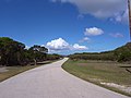
 Koblerville Road.JPG 2,048 × 1,536; 1.82 MB
-
 Last command post-Saipan.jpg 4,752 × 3,168; 5.3 MB
-
 Last Japanese Headquarters under a gray sky.jpg 1,024 × 732; 325 KB
-
 LJ & Youth.jpg 1,800 × 1,200; 441 KB
-
 Map Mariana Islands volcanoes.gif 400 × 608; 19 KB
-
 Map Saipan Tinian islands closer.jpg 290 × 410; 31 KB
-
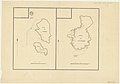
 Map SaipanTinianAquijan closer.gif 285 × 375; 5 KB
-
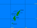
 Mariana Islands - Saipan.PNG 829 × 538; 26 KB
-
 Mariany Saipan2.jpg 3,297 × 4,281; 1.36 MB
-
 Northern Mariana Islands banner Bird Island at Saipan.jpg 2,100 × 300; 213 KB
-
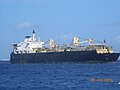
 Oil tanker off coast of Saipan (32834049595).jpg 1,024 × 768; 118 KB
-
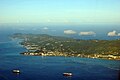
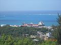
 Port of Saipan.JPG 2,048 × 1,536; 1.14 MB
-
 Rte 31 road saipan.JPG 4,608 × 3,456; 6.8 MB
-
 Saipan (7622243878).jpg 1,024 × 576; 257 KB
-
 Saipan (7622244750).jpg 1,024 × 576; 221 KB
-
 Saipan (7622245268).jpg 400 × 1,024; 163 KB
-
 Saipan - panoramio.jpg 3,504 × 2,336; 4 MB
-
 Saipan 1944 map.jpg 636 × 784; 55 KB
-
 Saipan and Tinian 2.jpg 371 × 413; 98 KB
-
 Saipan and Tinian.jpg 4,752 × 3,168; 2.34 MB
-
 Saipan As Teo Cave Inscriptions.jpg 681 × 621; 79 KB
-
 Saipan at Night.jpg 721 × 540; 92 KB
-
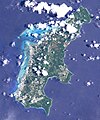
 Saipan from ISS 2.png 2,500 × 3,500; 4.27 MB
-
 Saipan from ISS.JPG 2,500 × 3,500; 396 KB
-
 Saipan Grotto Underwater.jpg 1,600 × 1,200; 300 KB
-
 Saipan Heart at Sunset..jpg 740 × 555; 93 KB
-
 Saipan Landsat.jpg 697 × 839; 230 KB
-
 Saipan superfortress 1945 runway.jpg 640 × 413; 48 KB
-
 Saipan Tinian aerial map.jpg 652 × 942; 57 KB
-
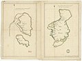
 Saipan Tinian maps 1913 combined.jpg 1,310 × 2,032; 394 KB
-
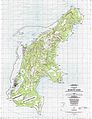
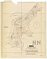
 Saipan USGS 1999 map.jpg 3,738 × 5,000; 2.46 MB
-
 Saipan, Commonwealth of the Northern Mariana Islands - panoramio (1).jpg 1,365 × 1,024; 994 KB
-
 Saipan, Commonwealth of the Northern Mariana Islands - panoramio (11).jpg 1,365 × 1,024; 941 KB
-
 Saipan, Commonwealth of the Northern Mariana Islands - panoramio (2).jpg 1,365 × 1,024; 1.17 MB
-
 Saipan, Commonwealth of the Northern Mariana Islands - panoramio (3).jpg 1,365 × 1,024; 889 KB
-
 Saipan, Commonwealth of the Northern Mariana Islands - panoramio (4).jpg 1,365 × 1,024; 929 KB
-
 Saipan, Commonwealth of the Northern Mariana Islands - panoramio (5).jpg 1,365 × 1,024; 1.36 MB
-
 Saipan, Commonwealth of the Northern Mariana Islands - panoramio (6).jpg 1,365 × 1,024; 1.11 MB
-
 Saipan, Commonwealth of the Northern Mariana Islands - panoramio (7).jpg 1,365 × 1,024; 1.01 MB
-
 Saipan-da! (24432497).jpg 2,304 × 3,072; 2.8 MB
-
 Saipan.jpg 3,008 × 2,000; 3.93 MB
-
 Saipanda.JPG 2,048 × 1,536; 955 KB
-
 SaipanTinianAquijan.png 649 × 505; 7 KB
-

-
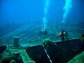
 Scuba diving in Saipan, -28 Jul. 2009 a.jpg 600 × 800; 91 KB
-
 Special Operations Map of Saipan Area - NARA - 7369166.jpg 2,483 × 3,150; 1.15 MB
-
 Stena Victory in Saipan.jpg 4,608 × 3,456; 6.68 MB
-
 Towards a stronger and more sustainable field in Asia-Oceania (52521992477).jpg 4,898 × 3,265; 547 KB
-
 Tun Herman Pan Road.JPG 2,048 × 1,536; 1.9 MB
-
 US landings saipan.jpg 928 × 1,015; 432 KB
-
 US Navy 020202-N7813S-001 Saipan - Sailor Rescuer.jpg 1,500 × 2,100; 2.2 MB
-

-
-

-
 USS La Jolla moors alongside USS Frank Cable in Saipan. (8384024050).jpg 1,500 × 2,265; 1.89 MB
-
 View of Northern Saipan.JPG 1,920 × 1,080; 932 KB
-
 White tern feather.JPG 4,608 × 3,456; 6.6 MB
-
 Wrecked small japanese artillery from ww2.JPG 4,608 × 3,456; 6.27 MB
-
 Îles de Saipan, Tinian et Guam - btv1b531219231.jpg 6,448 × 4,820; 2.53 MB
-
 Îles de Saipan, Tinian et Guam - btv1b531234193.jpg 8,814 × 6,196; 2.88 MB
.jpg)
.jpg)
.jpg)
.jpg)
.jpg)
.jpg)
.jpg)


.jpg)

.jpg)
.jpg)


.jpg)


.jpg)
.jpg)


.jpg)
.jpg)
.jpg)
.jpg)
.jpg)
.jpg)
.jpg)
.jpg)
.jpg)


.jpg)


.jpg)


_to_the_tropical_island_of_Saipan.jpg)
_off_the_coast_of_Saipan.jpg)
_and_USS_Frank_Cable_(AS_40)_conduct_a_weapons_handling_exercise_on_Saipan._(51649703073).jpg)
.jpg)


.jpg)