Category:Salford
Jump to navigation
Jump to search

city in Greater Manchester, England, UK  | |||||
| Upload media | |||||
| Instance of | |||||
|---|---|---|---|---|---|
| Location |
| ||||
| Located in or next to body of water | |||||
| Population |
| ||||
| Area |
| ||||
| Elevation above sea level |
| ||||
| Different from | |||||
| official website | |||||
 | |||||
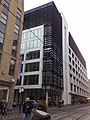
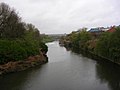
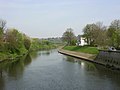
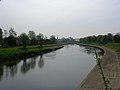
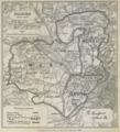
English: Salford, in Greater Manchester, England, is part of the City of Salford, a metropolitan borough of Greater Manchester, in North West England. Salford is sited in a meander of the River Irwell, which forms its boundary with the city of Manchester to the east. Together with its neighbouring towns to the west, Salford forms the local government district of the City of Salford, which is administered from Swinton. The former County Borough of Salford, which included Broughton, Pendleton and Kersal, was granted honorific city status in 1926; it has a resident population of 72,750 and occupies an area of 8.1 square miles (21 km2). The wider City of Salford district has a population of 219,200.
Subcategories
This category has the following 13 subcategories, out of 13 total.
C
- Castle Irwell, Salford (14 F)
E
- Encombe Place, Salford (1 F)
G
L
- Lowry Hotel, Salford (20 F)
M
- Murder of Anuj Bidve (1 F)
N
- New Bailey, Salford (12 F)
P
- Pubs in Salford (36 F)
S
- Salford Town Hall (21 F)
W
Media in category "Salford"
The following 126 files are in this category, out of 126 total.
-
 A Christmas community event in Walkden Town Centre.jpg 4,032 × 3,024; 4.21 MB
-
 Arriva North West bus 3603 (N603 DWY), 26 January 2008.jpg 2,400 × 1,800; 1.28 MB
-
 Blackfriars bridge by night.jpg 3,456 × 4,608; 3.98 MB
-
 Blackfriars, Salford.jpg 1,536 × 2,048; 948 KB
-
 Boundary Stone at the Salford Prestwich boundary.jpg 2,268 × 4,032; 5.17 MB
-
 Bridging the Irwell - geograph.org.uk - 282090.jpg 640 × 480; 118 KB
-
 Bu-Val Buses T206 CLO.jpg 4,000 × 3,000; 4.84 MB
-
 Closed ! (7477870100).jpg 4,344 × 1,789; 1.36 MB
-
 Door, Salford (15393990312).jpg 2,763 × 3,933; 8.35 MB
-
 Dump it here ! (6847240282).jpg 4,370 × 3,290; 2.15 MB
-
 Dump it here ! (6847242178).jpg 3,290 × 4,370; 2.62 MB
-
 Dump it here ! (6993362009).jpg 4,370 × 3,290; 2.8 MB
-
 Dump it here ! (6993363647).jpg 3,290 × 4,370; 3.64 MB
-
 Dump it here ! (6993365223).jpg 4,370 × 3,290; 2.76 MB
-
 Dump it here ! (6993365627).jpg 4,370 × 3,290; 2.04 MB
-
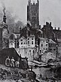
 Earliest known photograph of salford.jpg 1,590 × 1,139; 436 KB
-
 Flag of Salford.png 4,130 × 2,475; 3.17 MB
-
 Flying the flag - geograph.org.uk - 195471.jpg 640 × 480; 72 KB
-
 GMG Radio.png 313 × 100; 13 KB
-
 Irwell Riverside - geograph.org.uk - 4959649.jpg 4,000 × 2,623; 1.89 MB
-
 Irwell, Salford.jpg 1,600 × 1,200; 426 KB
-
 Kitler on a fence.jpg 5,184 × 3,456; 3.63 MB
-
 Lancashire United Transport bus 6990 (DWH 706W), 12 November 2006 (02).jpg 1,600 × 1,200; 571 KB
-
 Lancashire United Transport bus 6990 (DWH 706W), 12 November 2006 (17).jpg 1,600 × 1,200; 550 KB
-
 Liverpool Street, Langworthy.jpg 3,072 × 2,304; 1.86 MB
-
 Mancentral Trading Estate - geograph.org.uk - 4980381.jpg 4,352 × 2,649; 1.63 MB
-
 Manchester - panoramio (1).jpg 2,560 × 1,920; 946 KB
-
 Manchester - panoramio (3).jpg 1,944 × 2,592; 824 KB
-
 Manchester Cathedral viewed from Salford.jpg 1,884 × 2,518; 1.55 MB
-
 Media City.jpg 973 × 1,297; 169 KB
-
 MediaCityUK Openstreetmap.png 1,728 × 763; 410 KB
-
 ModernStudiesSalford.jpg 3,929 × 2,945; 2.36 MB
-
 Motorway Bridges (6781676020).jpg 4,360 × 2,248; 1.43 MB
-
 New Manchester - panoramio - dzidek (2).jpg 3,264 × 2,448; 4.08 MB
-
 New Manchester - panoramio - dzidek (3).jpg 3,264 × 2,448; 3.78 MB
-

-

-

-
 Old Milepost by the A665, Bury Old Road, Salford parish (geograph 6096167).jpg 989 × 1,704; 328 KB
-
 Old street light and GMPTE bus stop - panoramio.jpg 4,000 × 3,000; 3.9 MB
-
 Ordsall Chord, Prince's Bridge and the River Irwell, Manchester.jpg 4,426 × 1,581; 2.58 MB
-
 Peel Park from behind Salford Museum.jpg 4,032 × 3,024; 6.26 MB
-
 Ponder ! (7217551438).jpg 3,971 × 1,523; 315 KB
-
 Poster- County Borough of Salford - Venereal diseases, 1920. (22896503976).jpg 2,487 × 3,780; 1.32 MB
-
 Reservoir in Blackleach Country Park.jpg 4,032 × 3,024; 3.74 MB
-
 River Irwell - geograph.org.uk - 47491.jpg 640 × 480; 76 KB
-
 River Irwell - geograph.org.uk - 531385.jpg 640 × 480; 138 KB
-
 River Irwell - geograph.org.uk - 531387.jpg 640 × 480; 166 KB
-
 River Irwell at Adelphi - geograph.org.uk - 586333.jpg 640 × 480; 55 KB
-
 River Irwell at Salford Crescent - geograph.org.uk - 2088.jpg 640 × 480; 32 KB
-
 River Irwell at Salford Crescent - geograph.org.uk - 2091.jpg 640 × 480; 54 KB
-
 River irwell on border of salford and manchester.jpg 3,504 × 2,336; 2.65 MB
-
 River Irwell, looking east - geograph.org.uk - 1181715.jpg 640 × 480; 76 KB
-
 River Irwell, Salford - geograph.org.uk - 5345.jpg 640 × 480; 52 KB
-
 River Irwell, Salford - geograph.org.uk - 5346.jpg 640 × 480; 35 KB
-
 River Irwell, Salford - geograph.org.uk - 7743.jpg 640 × 480; 89 KB
-
 Riverside - geograph.org.uk - 4414622.jpg 5,184 × 2,672; 1.96 MB
-
 Robert Owen Jones (1885) Salford Parliamentary Borough.png 673 × 743; 876 KB
-
 Row of shops along Fitzwarren Street - panoramio.jpg 4,000 × 3,000; 4.89 MB
-
 Salford - geograph.org.uk - 4980526.jpg 4,352 × 2,352; 1.6 MB
-
 Salford - geograph.org.uk - 5008853.jpg 3,031 × 3,470; 2.01 MB
-
 Salford - geograph.org.uk - 5008854.jpg 5,184 × 3,456; 1.97 MB
-
 Salford - geograph.org.uk - 5092393.jpg 4,679 × 3,022; 1.66 MB
-
 Salford Arches, Ordsall Lane (7477869518).jpg 4,344 × 1,065; 1.09 MB
-
 Salford Cinema (4806110820).jpg 1,702 × 1,702; 2.19 MB
-
 Salford dawn - geograph.org.uk - 696885.jpg 640 × 353; 64 KB
-
 Salford Flats (7477869740).jpg 4,344 × 2,456; 1.84 MB
-
 Salford Graffiti (7379911994).jpg 4,000 × 2,170; 2.85 MB
-
 Salford Graffiti B&W (7379911154).jpg 4,000 × 2,187; 2.83 MB
-
 Salford Montage (2) 2022.png 1,000 × 1,200; 2.21 MB
-
 Salford Rooftops, 11 Norway St, Gtr Manchester - panoramio.jpg 2,048 × 1,394; 563 KB
-
 Salford Symphony Orchestra.jpg 770 × 578; 88 KB
-
 Salford Tourist Information Centre - DSC05604.JPG 3,648 × 2,736; 3.57 MB
-
 Salford UK ward map 2021.svg 623 × 538; 145 KB
-
 Salford UK ward map 2022.svg 623 × 538; 135 KB
-
 Salford UK ward map 2023.svg 623 × 538; 135 KB
-
 Salford, Urban Splash cropped.jpg 767 × 588; 148 KB
-
 Salford, Urban Splash.jpg 768 × 1,024; 463 KB
-
 SalfordSkyline.jpg 800 × 302; 219 KB
-
 Self-portrait by James Parry (1795-1877).jpg 921 × 1,200; 75 KB
-
 Singleton Road, Broughton Park - geograph.org.uk - 1185113.jpg 640 × 480; 241 KB
-
 Sleeping Rough - geograph.org.uk - 5791958.jpg 978 × 768; 554 KB
-
 Soon to be not of this world - geograph.org.uk - 681177.jpg 640 × 480; 161 KB
-
 Stanley Street Car Park - geograph.org.uk - 6126353.jpg 3,535 × 3,618; 1.8 MB
-
 Straight Line To Manchester - geograph.org.uk - 1381031.jpg 640 × 480; 216 KB
-
 Sun glasses required 1 - geograph.org.uk - 686710.jpg 480 × 640; 175 KB
-
 Sun glasses required 2 - geograph.org.uk - 686711.jpg 474 × 632; 175 KB
-
 System Fault (band) in Salford.jpg 2,048 × 1,365; 346 KB
-
 The Bull's Head Hotel Wetherspoons Pub, Walkden.jpg 3,288 × 2,352; 1.89 MB
-
 The Edge Apartments on The Irwell.jpg 3,456 × 4,608; 3.89 MB
-
 The Edge, Salford.jpg 640 × 853; 500 KB
-
 The Fireman A Sociological Profile.pdf 1,243 × 1,756, 217 pages; 6.22 MB
-
 The glacial erratic in Parr Fold Park, Walkden.jpg 4,032 × 3,024; 4.22 MB
-
 The Glass Tower (8395434499).jpg 1,960 × 4,614; 1.29 MB
-
 The Meeting (22342041).jpeg 852 × 1,280; 101 KB
-
 The NV Buildings (8020511261).jpg 4,340 × 2,452; 1.26 MB
-
 The Paddock, Cross Lane, Salford (6856189599).jpg 3,050 × 4,050; 2.89 MB
-
 The preliminary version of The Fireman A Sociological Profile.pdf 1,283 × 1,783, 174 pages; 4.84 MB
-
 Tribute to L.S Lowry - geograph.org.uk - 5892890.jpg 1,024 × 751; 185 KB
-
 Trinity Bridge House - geograph.org.uk - 3886220.jpg 480 × 640; 273 KB
-
 Trinity Bridge, Salford and Manchester.jpg 1,600 × 1,200; 794 KB
-
 Under the bridges ! (8303674130).jpg 4,032 × 3,032; 574 KB
-
 Urban Open Space - geograph.org.uk - 1945662.jpg 640 × 426; 65 KB
-
 View from Centenary Bridge (8015240456).jpg 4,628 × 3,092; 826 KB
-

-

-
 View of Salford2.JPG 2,816 × 2,112; 1.51 MB
-
 View towards Salford Cathedral - geograph.org.uk - 5441861.jpg 1,000 × 1,000; 737 KB
-
 Vimto - geograph.org.uk - 4323160.jpg 5,184 × 3,141; 1.72 MB
-
 Walkden Town Centre Shopping Centre.jpg 4,032 × 3,024; 3.16 MB
-
 Wheaters Crescent bus shelter.jpg 1,600 × 1,200; 289 KB
-
 Wilburn Street Basin - geograph.org.uk - 4414601.jpg 5,184 × 3,456; 1.96 MB
-
 Woden's Den.jpg 2,947 × 1,937; 1.87 MB
-
 Betfred - geograph.org.uk - 449262.jpg 640 × 480; 104 KB
-
 Brindleheath Cemetery - geograph.org.uk - 362669.jpg 640 × 480; 154 KB
-
 Evergreen Mews, Salford - geograph.org.uk - 528455.jpg 640 × 480; 154 KB
-
 High Security^ - geograph.org.uk - 47495.jpg 640 × 480; 70 KB
-
 Irwell at Adelphi - geograph.org.uk - 586342.jpg 640 × 480; 64 KB
-
 Moss Vale Estate - geograph.org.uk - 253369.jpg 640 × 480; 76 KB
-
 New Housing - geograph.org.uk - 384606.jpg 640 × 480; 132 KB
-
 Old and new - geograph.org.uk - 195479.jpg 480 × 640; 90 KB
-
 Queensmere - geograph.org.uk - 46792.jpg 640 × 480; 69 KB
-
 River Irwell - geograph.org.uk - 47486.jpg 640 × 480; 74 KB
-
 Site cleared - geograph.org.uk - 470372.jpg 640 × 480; 55 KB
-

-
 Woods - geograph.org.uk - 465373.jpg 640 × 480; 153 KB

,_26_January_2008.jpg)


.jpg)
.jpg)
.jpg)
.jpg)
.jpg)
.jpg)
.jpg)


.jpg)
.jpg)


.jpg)
.jpg)
.jpg)


.jpg)


.jpg)


_Salford_Parliamentary_Borough.png)


.jpg)

.jpg)
.jpg)
.jpg)
_2022.png)


.jpg)


_in_Salford.jpg)


.jpg)
.jpeg)
.jpg)
.jpg)


.jpg)

.jpg)


.jpg)
,_12_November_2006_(02).jpg)
,_12_November_2006_(17).jpg)
.jpg)
.jpg)