Category:Salsburgh
Jump to navigation
Jump to search
village in North Lanarkshire, Scotland, UK  | |||||
| Upload media | |||||
| Instance of | |||||
|---|---|---|---|---|---|
| Location |
| ||||
| Population |
| ||||
 | |||||
English: Salsburgh is a small rural ex coal mining village in North Lanarkshire, Scotland. It lies 5 km northwest of Shotts, 7 km southeast of Airdrie and south of the M8 motorway, at grid reference . Salsburgh is perhaps best known for the Kirk O' Shott's Church (affectionately known as "The M8 Church") which sits on a hillock as visitors enter the village from the east on the B7066 Whitburn to Newhouse road. Salsburgh is also home to the Black Hill Transmitter, which towers along beside the Church and can be seen as far a field as Blackburn West Lothian to the east and Glasgow to the west.
Subcategories
This category has the following 16 subcategories, out of 16 total.
B
- Bogfoot sluice (2 F)
C
- Cant Hills (12 F)
D
- Duntillan Hill (4 F)
- Duntilland Quarry (2 F)
H
J
- Jersay Farm (10 F)
K
P
R
- Roughrigg Reservoir (14 F)
S
- Salsburgh Bridge (2 F)
- Salsburgh footbridge (4 F)
- Salsburgh sewage works (2 F)
T
- Tipperdavie (2 F)
- Torrance Hill (4 F)
Media in category "Salsburgh"
The following 48 files are in this category, out of 48 total.
-
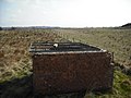 Air shaft - geograph.org.uk - 1254962.jpg 640 × 480; 73 KB
-
 Birdbath - geograph.org.uk - 199189.jpg 640 × 480; 115 KB
-
 Bridge at Springfield Road - geograph.org.uk - 199180.jpg 640 × 480; 121 KB
-
 Bridge over the M8 - geograph.org.uk - 199186.jpg 640 × 480; 125 KB
-
 Craigends Farm - geograph.org.uk - 1254782.jpg 640 × 480; 69 KB
-
 Craigends Moss - geograph.org.uk - 1516042.jpg 640 × 427; 96 KB
-
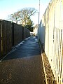
 Cycle path, Salsburgh - geograph.org.uk - 1212428.jpg 640 × 480; 125 KB
-
 Disused railway, Salsburgh - geograph.org.uk - 1212457.jpg 640 × 395; 111 KB
-
 Double fence - geograph.org.uk - 1250615.jpg 640 × 480; 74 KB
-
 Drumbowie - geograph.org.uk - 525702.jpg 640 × 480; 73 KB
-
 East from Roughrigg road - geograph.org.uk - 199152.jpg 640 × 480; 84 KB
-
 Edge of embankment - geograph.org.uk - 1254987.jpg 640 × 480; 110 KB
-
 Farm track off Wilson's Road - geograph.org.uk - 1312872.jpg 640 × 480; 66 KB
-
 Frozen Pond - geograph.org.uk - 1109072.jpg 640 × 480; 95 KB
-

-
 Goodockhill Farm - geograph.org.uk - 1538922.jpg 640 × 480; 105 KB
-
 Grass verge by the B7066 - geograph.org.uk - 1538953.jpg 640 × 480; 107 KB
-
 Grossart Street - geograph.org.uk - 1255016.jpg 640 × 480; 59 KB
-
 Ironstone or clay mine - geograph.org.uk - 1538915.jpg 640 × 480; 113 KB
-
 Kate's Well Drive - geograph.org.uk - 1109074.jpg 640 × 480; 67 KB
-
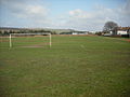 King George V Park Salsburgh. - geograph.org.uk - 1254996.jpg 640 × 480; 65 KB
-
 M8 crosses Shotts Burn - geograph.org.uk - 1109060.jpg 640 × 480; 74 KB
-
 M8 from Bogfoot Bridge - geograph.org.uk - 1515976.jpg 640 × 427; 77 KB
-
 M8 looking west from Bogfoot bridge. - geograph.org.uk - 1109042.jpg 640 × 480; 81 KB
-
 Mineral line, Salsburgh - geograph.org.uk - 1515996.jpg 640 × 427; 113 KB
-
 Mineral line, Salsburgh - geograph.org.uk - 1516003.jpg 640 × 427; 107 KB
-
 Muirhall Garage - geograph.org.uk - 1255026.jpg 640 × 480; 45 KB
-
 Old mine workings - geograph.org.uk - 1538911.jpg 640 × 562; 108 KB
-
 Old pinewoods - geograph.org.uk - 1254909.jpg 640 × 480; 121 KB
-
 Old railway junction - geograph.org.uk - 1538937.jpg 640 × 480; 118 KB
-
 Old road west of Salsburgh - geograph.org.uk - 1109068.jpg 480 × 640; 112 KB
-
 Pedestrian barrier, Salsburgh - geograph.org.uk - 1212437.jpg 640 × 480; 123 KB
-
 Railway bridge on A8 (B7066) - geograph.org.uk - 1109070.jpg 640 × 480; 104 KB
-
 Road re-alignment - geograph.org.uk - 1109067.jpg 640 × 480; 148 KB
-
 Rough grazing SW of Salsburgh - geograph.org.uk - 1538918.jpg 640 × 425; 65 KB
-
 Salsburgh (geograph 6945762).jpg 1,024 × 683; 194 KB
-
 Salsburgh Junction (North) - geograph.org.uk - 422168.jpg 640 × 480; 106 KB
-
 Salsburgh Post Office - geograph.org.uk - 1523244.jpg 427 × 640; 91 KB
-
 Salsburgh War Memorial - geograph.org.uk - 1209500.jpg 640 × 480; 119 KB
-
 Shotts Burn - geograph.org.uk - 1109061.jpg 640 × 480; 109 KB
-
 Spike topped fence - geograph.org.uk - 1254857.jpg 640 × 480; 92 KB
-
 Spoil heap - geograph.org.uk - 1209538.jpg 640 × 480; 117 KB
-
 The 'Avenue' - geograph.org.uk - 1109081.jpg 480 × 640; 89 KB
-
 The Shotts Burn - geograph.org.uk - 1457046.jpg 640 × 480; 101 KB
-
 Turdees branch - geograph.org.uk - 1254918.jpg 640 × 480; 98 KB
-
 Two old bings - geograph.org.uk - 202273.jpg 640 × 480; 73 KB
-
 View to ironstone bing - geograph.org.uk - 1254936.jpg 640 × 480; 78 KB
-
 Wee road and big road - geograph.org.uk - 199172.jpg 640 × 480; 78 KB


_-_geograph.org.uk_-_1109070.jpg)


.jpg)
_-_geograph.org.uk_-_422168.jpg)


