Category:Samborowo Valley
Jump to navigation
Jump to search
| Object location | | View all coordinates using: OpenStreetMap |
|---|
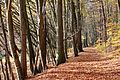
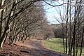
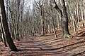
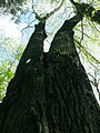
valley in VII Dwór, Poland  | |||||
| Upload media | |||||
| Instance of | |||||
|---|---|---|---|---|---|
| Location | VII Dwór, Gdańsk, Pomeranian Voivodeship, Poland | ||||
 | |||||
Media in category "Samborowo Valley"
The following 25 files are in this category, out of 25 total.
-
 Dolina samborowo 1.JPG 4,392 × 3,256; 5.62 MB
-
 Dolina Samborowo 2.JPG 3,456 × 2,304; 3.78 MB
-
 Dolina samborowo 2.JPG 4,512 × 3,032; 4.67 MB
-
 Dolina Samborowo 3.JPG 2,304 × 3,456; 5.38 MB
-
 Dolina samborowo 3.JPG 4,392 × 3,072; 4.81 MB
-
 Dolina Samborowo 4.JPG 3,456 × 2,304; 5 MB
-
 Dolina samborowo 4.JPG 4,264 × 3,288; 4.85 MB
-
 Dolina samborowo buki.JPG 3,080 × 4,488; 4.92 MB
-
 Dolina samborowo carex.JPG 3,384 × 4,168; 5.28 MB
-
 Dolina samborowo ficaria.JPG 2,856 × 3,664; 3.79 MB
-
 Dolina samborowo krzyż i.JPG 2,896 × 3,800; 4.13 MB
-
 Dolina Samborowo.JPG 3,456 × 2,304; 4.13 MB
-
 Gdansk Dolina Henrietty 1.jpg 6,000 × 4,000; 15.67 MB
-
 Gdansk Dolina Henrietty 2.jpg 6,000 × 4,000; 15.77 MB
-
 Gdansk Dolina Henrietty 3.jpg 6,000 × 4,000; 16.9 MB
-
 Gdansk pomnik przyr 206.JPG 3,456 × 4,456; 6.25 MB
-
 Gdansk pomnik przyr 302 1.JPG 3,280 × 4,416; 5.16 MB
-
 Gdansk pomnik przyr 302 2.JPG 3,392 × 4,512; 5.77 MB
-
 Gdansk pomnik przyr 302 3.JPG 3,424 × 4,112; 5.77 MB
-
 Gdansk pomnik przyr 302 4.JPG 3,016 × 4,496; 4.87 MB
-
 Gdansk pomnik przyr 302 5.JPG 3,360 × 4,432; 5.76 MB
-
 Gdansk pomnik przyr 302 6.JPG 3,360 × 4,480; 5.66 MB
-
 Gdańsk Dolina Samborowo.JPG 4,224 × 2,816; 1.85 MB
-
 Gdańsk VII Dwór, krzyż na końcu ulicy Abrahama.jpg 2,816 × 4,224; 5.84 MB
-
 Samoborowo Valley - panoramio.jpg 1,536 × 2,048; 1.32 MB


