Category:San Juan County, Colorado
Mine navigeerimisribale
Mine otsikasti
Counties of Colorado: Adams · Alamosa · Arapahoe · Archuleta · Baca · Bent · Boulder · Chaffee · Cheyenne · Clear Creek · Conejos · Costilla · Crowley · Custer · Delta · Dolores · Douglas · Eagle · El Paso · Elbert · Fremont · Garfield · Gilpin · Grand · Gunnison · Hinsdale · Huerfano · Jackson · Jefferson · Kiowa · Kit Carson · Lake · La Plata · Larimer · Las Animas · Lincoln · Logan · Mesa · Mineral · Moffat · Montezuma · Montrose · Morgan · Otero · Ouray · Park · Phillips · Pitkin · Prowers · Pueblo · Rio Blanco · Rio Grande · Routt · Saguache · San Juan · San Miguel · Sedgwick · Summit · Teller · Washington · Weld · Yuma
City-counties: Broomfield · Denver
City-counties: Broomfield · Denver
county in Colorado, United States   | |||||
| Laadi fail üles | |||||
| Üksikjuht nähtusest | |||||
|---|---|---|---|---|---|
| Nimetatud ... järgi | |||||
| Asukoht | Colorado, Ameerika Ühendriigid | ||||
| Keskus | |||||
| Asutamise või loomise aeg |
| ||||
| Rahvaarv |
| ||||
| Pindala |
| ||||
| Mitte segamini ajada | |||||
| koduleht | |||||
 | |||||
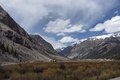
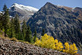
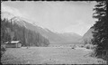
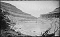
San Juan County is a county in Colorado, United States.
Alamkategooriad
Järgmised 10 alamkategooriat on selles kategoorias (kokku 10).
G
M
P
Failid kategoorias "San Juan County, Colorado"
Järgmised 88 faili on selles kategoorias (kokku 88).
-
 16 21 2438 one hundred.jpg 2048 × 1367; 1,92 MB
-
 16 21 2454 road.jpg 2048 × 1367; 1,77 MB
-
 16 21 2457 one hundred.jpg 2048 × 1367; 1,85 MB
-
 16 21 2462 one hundred.jpg 2048 × 1366; 1,85 MB
-
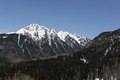
 16 21 2587 twilight peak.jpg 2048 × 1367; 1,74 MB
-
-

-
 Abandoned mine in the San Juan Mountains, just above Silverton, Colorado.jpg 1920 × 1080; 1,9 MB
-

-

-
 Abandoned railroad San Juan County 1940.jpg 279 × 374; 48 KB
-

-

-
 Aspens, Pines and Niagara Peak (6337104587).jpg 1000 × 667; 453 KB
-
 Baker's Park between Howardsville and Silverton. Colorado - NARA - 517604.jpg 3000 × 1828; 1,35 MB
-

-
-
 Baker's Park, Silverton Quadrangle. San Juan County, Colorado. - NARA - 517603.jpg 3000 × 1785; 1,31 MB
-
 Baker's Park. South from Howardsville. San Juan County, Utah. - NARA - 517612.jpg 3000 × 1861; 1,54 MB
-
 Battle Rock, McElmo Canyon. San Juan County, Utah - NARA - 517140.jpg 3000 × 1866; 1,8 MB
-

-

-

-

-
 Canyon of the Rio San Juan. San Juan County, Utah - NARA - 517137.jpg 3000 × 1853; 1,72 MB
-
 Canyon of the Rio San Juan. San Juan County, Utah - NARA - 517138.jpg 3000 × 1842; 1,53 MB
-
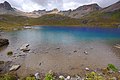
 Clear Lake 2006-07-18 (200063578).jpg 1830 × 2336; 1,12 MB
-
 Clear Lake 2006-07-18 (200065235).jpg 3504 × 2336; 2,81 MB
-
 Clear Lake 2006-07-18 (200065827).jpg 2796 × 1864; 1,87 MB
-
 Clear Lake 2006-07-18 (200068100).jpg 3504 × 2336; 3,03 MB
-
 Cluster of columbines (200069098).jpg 2692 × 1795; 1,31 MB
-
-

-

-

-

-

-
 Golden Horn, San Juan Mountains.jpg 3872 × 2592; 5,19 MB
-
-
 Highland Mary Lakes Above Lake Verde - panoramio.jpg 3648 × 2736; 2,18 MB
-
 Hiking trail in the Ice Lake Basin.jpg 3872 × 2592; 5,88 MB
-

-
 Howardsville Mill.jpg 640 × 480; 77 KB
-
 Howardsville, Baker's Park. San Juan County, Colorado - NARA - 517600.jpg 3000 × 1773; 1,4 MB
-
 Howardsville, Baker's Park. San Juan County, Colorado - NARA - 517601.jpg 3000 × 1812; 1,57 MB
-

-
 Lake Molas in the San Juan Mountains of southwestern Colorado's San Juan County, below Silverton LCCN2015632267.tif 7360 × 4912, 2 lehekülge; 206,9 MB
-
-
-

-
 Maggie Gulch B (6621096755).jpg 3168 × 4752; 2,66 MB
-
 Maggie Gulch HDR (5996675206).jpg 3176 × 4769; 2,09 MB
-
 OldHundred3.jpg 648 × 427; 46 KB
-

-

-

-
 Rd550 Durango to Silverton - panoramio - Frans-Banja Mulder (1).jpg 1280 × 960; 1,52 MB
-
 Rd550 Durango to Silverton - panoramio - Frans-Banja Mulder.jpg 1280 × 960; 1,45 MB
-
 RedMountainPassSign.jpg 1200 × 864; 205 KB
-

-

-

-

-
 San Juan County (Colorado) sign.JPG 4400 × 3623; 10,93 MB
-

-
 San Juan County, CO, USA - panoramio (1).jpg 3648 × 2736; 2,12 MB
-
 San Juan County, CO, USA - panoramio (2).jpg 3648 × 2736; 2,06 MB
-
 San Juan County, CO, USA - panoramio (3).jpg 3648 × 2736; 2,13 MB
-

-

-

-

-
 Silverton - panoramio.jpg 858 × 643; 698 KB
-

-
 The San Juan Mountains of southwestern Colorado's San Juan County, below Silverton LCCN2015632266.tif 7360 × 4912, 2 lehekülge; 206,9 MB
-
 Top of the world (5996120711).jpg 640 × 427; 85 KB
-
 Trail to the Ice Lake - panoramio (1).jpg 4608 × 3456; 3,08 MB
-
 Trail to the Ice Lake - panoramio.jpg 4608 × 3456; 3,2 MB
-
 Twilightpeak.JPG 2560 × 1920; 505 KB
-
 Unnamed(13230ft), Pilot Knob, unnamed(13333ft), and Ice Lake.jpg 3872 × 2592; 5,2 MB
-
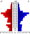 USA San Juan County, Colorado age pyramid.svg 520 × 600; 8 KB
-
 V 4 above Ice Lake.jpg 2936 × 1971; 2,31 MB
-
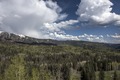
 Very Rocky Indeed (14938307068).jpg 3264 × 2448; 2,43 MB
-
 View from Durango Mountain Resort - panoramio (1).jpg 3264 × 2448; 4,6 MB
-
 View from Durango Mountain Resort - panoramio (2).jpg 3264 × 2448; 3,79 MB
-
 View from Durango Mountain Resort - panoramio.jpg 3264 × 2448; 3,98 MB
-
-
 Kendal Mountain, by Kuhn & Wheeler.jpg 760 × 437; 40 KB


.jpg)


.jpg)


.jpg)
.jpg)

.jpg)


_sign.JPG)

.jpg)
.jpg)
.jpg)

.jpg)
.jpg)


,_Pilot_Knob,_unnamed(13333ft),_and_Ice_Lake.jpg)


.jpg)
.jpg)
.jpg)


.jpg)
.jpg)
.jpg)
.jpg)