Category:Sanborn Fire Insurance Map from Lawrenceburg, Anderson County, Kentucky
Jump to navigation
Jump to search
Subcategories
This category has the following 2 subcategories, out of 2 total.
Media in category "Sanborn Fire Insurance Map from Lawrenceburg, Anderson County, Kentucky"
The following 54 files are in this category, out of 54 total.
-
-
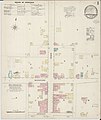
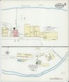
 Sanborn Fire Insurance Map from Lawrenceburg, Anderson County, Kentucky. LOC sanborn03195 001-1.tif 6,450 × 7,650; 141.17 MB
-

-
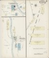
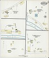
 Sanborn Fire Insurance Map from Lawrenceburg, Anderson County, Kentucky. LOC sanborn03195 001-2.tif 6,450 × 7,650; 141.17 MB
-

-
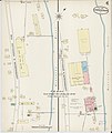
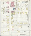
 Sanborn Fire Insurance Map from Lawrenceburg, Anderson County, Kentucky. LOC sanborn03195 001-3.tif 6,450 × 7,650; 141.17 MB
-
-
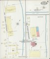
 Sanborn Fire Insurance Map from Lawrenceburg, Anderson County, Kentucky. LOC sanborn03195 001-4.tif 6,450 × 7,650; 141.17 MB
-

-
 Sanborn Fire Insurance Map from Lawrenceburg, Anderson County, Kentucky. LOC sanborn03195 001-5.tif 6,450 × 7,650; 141.17 MB
-

-
 Sanborn Fire Insurance Map from Lawrenceburg, Anderson County, Kentucky. LOC sanborn03195 001-6.tif 6,450 × 7,650; 141.17 MB
-

-
 Sanborn Fire Insurance Map from Lawrenceburg, Anderson County, Kentucky. LOC sanborn03195 001-7.tif 6,450 × 7,650; 141.17 MB
-

-
 Sanborn Fire Insurance Map from Lawrenceburg, Anderson County, Kentucky. LOC sanborn03195 001-8.tif 6,450 × 7,650; 141.17 MB
-

-
 Sanborn Fire Insurance Map from Lawrenceburg, Anderson County, Kentucky. LOC sanborn03195 002-1.tif 6,450 × 7,650; 141.17 MB
-

-
 Sanborn Fire Insurance Map from Lawrenceburg, Anderson County, Kentucky. LOC sanborn03195 002-2.tif 6,450 × 7,650; 141.17 MB
-

-
 Sanborn Fire Insurance Map from Lawrenceburg, Anderson County, Kentucky. LOC sanborn03195 002-3.tif 6,450 × 7,650; 141.17 MB
-

-
 Sanborn Fire Insurance Map from Lawrenceburg, Anderson County, Kentucky. LOC sanborn03195 002-4.tif 6,450 × 7,650; 141.17 MB
-

-
 Sanborn Fire Insurance Map from Lawrenceburg, Anderson County, Kentucky. LOC sanborn03195 002-5.tif 6,450 × 7,650; 141.17 MB
-

-
 Sanborn Fire Insurance Map from Lawrenceburg, Anderson County, Kentucky. LOC sanborn03195 002-6.tif 6,450 × 7,650; 141.17 MB
-
-
 Sanborn Fire Insurance Map from Lawrenceburg, Anderson County, Kentucky. LOC sanborn03195 002-7.tif 6,450 × 7,650; 141.17 MB
-

-
 Sanborn Fire Insurance Map from Lawrenceburg, Anderson County, Kentucky. LOC sanborn03195 002-8.tif 6,450 × 7,650; 141.17 MB
-

-
 Sanborn Fire Insurance Map from Lawrenceburg, Anderson County, Kentucky. LOC sanborn03195 002-9.tif 6,450 × 7,650; 141.17 MB
-

-
 Sanborn Fire Insurance Map from Lawrenceburg, Anderson County, Kentucky. LOC sanborn03195 003-1.tif 6,450 × 7,650; 141.17 MB
-

-
 Sanborn Fire Insurance Map from Lawrenceburg, Anderson County, Kentucky. LOC sanborn03195 003-10.tif 6,450 × 7,650; 141.17 MB
-

-
 Sanborn Fire Insurance Map from Lawrenceburg, Anderson County, Kentucky. LOC sanborn03195 003-2.tif 6,450 × 7,650; 141.17 MB
-
-
 Sanborn Fire Insurance Map from Lawrenceburg, Anderson County, Kentucky. LOC sanborn03195 003-3.tif 6,450 × 7,650; 141.17 MB
-

-
 Sanborn Fire Insurance Map from Lawrenceburg, Anderson County, Kentucky. LOC sanborn03195 003-4.tif 6,450 × 7,650; 141.17 MB
-

-
 Sanborn Fire Insurance Map from Lawrenceburg, Anderson County, Kentucky. LOC sanborn03195 003-5.tif 6,450 × 7,650; 141.17 MB
-

-
 Sanborn Fire Insurance Map from Lawrenceburg, Anderson County, Kentucky. LOC sanborn03195 003-6.tif 6,450 × 7,650; 141.17 MB
-

-
 Sanborn Fire Insurance Map from Lawrenceburg, Anderson County, Kentucky. LOC sanborn03195 003-7.tif 6,450 × 7,650; 141.17 MB
-

-
 Sanborn Fire Insurance Map from Lawrenceburg, Anderson County, Kentucky. LOC sanborn03195 003-8.tif 6,450 × 7,650; 141.17 MB
-

-
 Sanborn Fire Insurance Map from Lawrenceburg, Anderson County, Kentucky. LOC sanborn03195 003-9.tif 6,450 × 7,650; 141.17 MB


