Category:Sanborn Fire Insurance Map from Long Prairie, Todd County, Minnesota
Jump to navigation
Jump to search
Media in category "Sanborn Fire Insurance Map from Long Prairie, Todd County, Minnesota"
The following 16 files are in this category, out of 16 total.
-
-
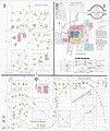
 Sanborn Fire Insurance Map from Long Prairie, Todd County, Minnesota. LOC sanborn04331 001-1.tif 6,450 × 7,650; 141.17 MB
-

-
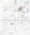
 Sanborn Fire Insurance Map from Long Prairie, Todd County, Minnesota. LOC sanborn04331 001-2.tif 6,450 × 7,650; 141.17 MB
-
-
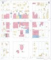
 Sanborn Fire Insurance Map from Long Prairie, Todd County, Minnesota. LOC sanborn04331 001-3.tif 6,450 × 7,650; 141.17 MB
-

-
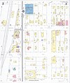
 Sanborn Fire Insurance Map from Long Prairie, Todd County, Minnesota. LOC sanborn04331 001-4.tif 6,450 × 7,650; 141.17 MB
-

-
 Sanborn Fire Insurance Map from Long Prairie, Todd County, Minnesota. LOC sanborn04331 002-1.tif 6,450 × 7,650; 141.17 MB
-

-
 Sanborn Fire Insurance Map from Long Prairie, Todd County, Minnesota. LOC sanborn04331 002-2.tif 6,450 × 7,650; 141.17 MB
-

-
 Sanborn Fire Insurance Map from Long Prairie, Todd County, Minnesota. LOC sanborn04331 002-3.tif 6,450 × 7,650; 141.17 MB
-

-
 Sanborn Fire Insurance Map from Long Prairie, Todd County, Minnesota. LOC sanborn04331 002-4.tif 6,450 × 7,650; 141.17 MB


