Category:Sand Hutton
Jump to navigation
Jump to search
village and civil parish in North Yorkshire, United Kingdom  | |||||
| Upload media | |||||
| Instance of | |||||
|---|---|---|---|---|---|
| Location |
| ||||
| Different from | |||||
| Said to be the same as | Sand Hutton (Wikimedia duplicated page, civil parish) | ||||
 | |||||
English: Sand Hutton is a village and civil parish in the Ryedale district of North Yorkshire, England, about 6 miles (9.7 km) north-east of York.
Subcategories
This category has the following 7 subcategories, out of 7 total.
Media in category "Sand Hutton"
The following 83 files are in this category, out of 83 total.
-
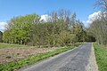
 A minor road opposite Kissthorn farm - geograph.org.uk - 2325925.jpg 800 × 600; 253 KB
-
 Bridle Lane Cottage, Sand Hutton Common - geograph.org.uk - 5775380.jpg 1,600 × 1,200; 686 KB
-
 Bridleway through White Syke Plantation - geograph.org.uk - 6372798.jpg 4,000 × 3,000; 4.27 MB
-
 Bridleway to Claxton - geograph.org.uk - 786856.jpg 640 × 478; 270 KB
-
 Claxton to Sand Hutton bridleway at Whey Carr - geograph.org.uk - 5773755.jpg 1,600 × 1,200; 671 KB
-
 Common near Bridle Lane Cottage - geograph.org.uk - 5488259.jpg 640 × 427; 218 KB
-
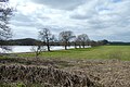
 Countryside South of Sand Hutton - geograph.org.uk - 1801463.jpg 2,816 × 2,112; 1.8 MB
-
 Driveway of Pasture Farm near Sand Hutton - geograph.org.uk - 350112.jpg 640 × 480; 124 KB
-
 Entering Sand Hutton - geograph.org.uk - 6419570.jpg 1,024 × 768; 531 KB
-
 Entering Sand Hutton, North Yorkshire - geograph.org.uk - 2263984.jpg 800 × 600; 239 KB
-
 Entrance to Central Science Laboratory - geograph.org.uk - 2372248.jpg 1,600 × 1,200; 314 KB
-
 Entrance to Low Moor Farm - geograph.org.uk - 790695.jpg 478 × 640; 310 KB
-
 Farm Track East of Low Moor Farm - geograph.org.uk - 2469831.jpg 3,901 × 2,795; 2.97 MB
-
 Farm track, Scrogs Bottoms - geograph.org.uk - 2372273.jpg 1,600 × 1,200; 417 KB
-
 Farmland close to Sand Hutton - geograph.org.uk - 778781.jpg 640 × 478; 320 KB
-
 Farmland looking towards Woodhouse Farm - geograph.org.uk - 2372200.jpg 1,600 × 1,200; 358 KB
-
 Farmland near Buttercrambe Moor - geograph.org.uk - 2469828.jpg 3,615 × 2,344; 2.34 MB
-
 Farmland near Pasture Farm - geograph.org.uk - 2372196.jpg 640 × 480; 76 KB
-
 Fields near Aldby Field House - geograph.org.uk - 3245484.jpg 640 × 480; 61 KB
-
 Flooded field - geograph.org.uk - 3245480.jpg 640 × 480; 54 KB
-
 Foss Drain - geograph.org.uk - 6123786.jpg 1,024 × 683; 627 KB
-
 Foss Drain, Sand Hutton Common - geograph.org.uk - 5775382.jpg 1,600 × 1,200; 839 KB
-
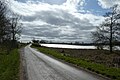
 Hall Drive (road) towards Sand Hutton - geograph.org.uk - 2263978.jpg 800 × 600; 178 KB
-
 Kissthorn Farm - geograph.org.uk - 5492648.jpg 5,184 × 3,456; 6.36 MB
-
 Lab at Sand Hutton - geograph.org.uk - 3710013.jpg 2,000 × 1,500; 2.71 MB
-
 Minor road at the entrance to Pasture Farm - geograph.org.uk - 6372802.jpg 4,000 × 3,000; 2.74 MB
-
 Minor road near to Pasture Farm - geograph.org.uk - 6372823.jpg 4,000 × 3,000; 3.62 MB
-
 Minor road towards Sand Hutton - geograph.org.uk - 2372145.jpg 640 × 480; 104 KB
-
 Minor road towards Sand Hutton - geograph.org.uk - 2372252.jpg 1,600 × 1,200; 681 KB
-
 Minor road towards Sand Hutton - geograph.org.uk - 2372263.jpg 640 × 480; 96 KB
-
 Minor road towards Woodhouse Farm - geograph.org.uk - 2372202.jpg 1,600 × 1,200; 539 KB
-

-
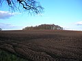
 Near Buttercrambe Moor Wood - geograph.org.uk - 5315675.jpg 2,048 × 1,536; 1.4 MB
-
 Near Sand Hutton - geograph.org.uk - 5315674.jpg 2,048 × 1,536; 1,023 KB
-
 Ordnance Survey Cut Mark - geograph.org.uk - 6372840.jpg 4,000 × 3,000; 3.76 MB
-
 Path across the common - geograph.org.uk - 3401120.jpg 640 × 427; 74 KB
-
 Postbox - Sand Hutton - geograph.org.uk - 790700.jpg 640 × 478; 244 KB
-
 Road from Sand Hutton heading towards the A64 - geograph.org.uk - 6372794.jpg 4,000 × 3,000; 3.08 MB
-
 Road to Upper Helmsley - geograph.org.uk - 6123794.jpg 1,024 × 683; 530 KB
-
 Ruins of St Leonard's Church, Sand Hutton - geograph.org.uk - 5775371.jpg 1,600 × 1,200; 641 KB
-
 Sand Hutton - geograph.org.uk - 1801554.jpg 2,816 × 2,112; 1.85 MB
-
 Sand Hutton - geograph.org.uk - 52482.jpg 640 × 479; 130 KB
-
 Sand Hutton - geograph.org.uk - 6419573.jpg 1,024 × 768; 644 KB
-
 Sand Hutton - Houses - geograph.org.uk - 189332.jpg 640 × 479; 51 KB
-
 Sand Hutton Common - geograph.org.uk - 3245458.jpg 640 × 480; 72 KB
-
 Sand Hutton Common - geograph.org.uk - 3401119.jpg 640 × 427; 86 KB
-
 Sand Hutton Common - geograph.org.uk - 5315707.jpg 2,048 × 1,536; 1.02 MB
-
 Sand Hutton School - geograph.org.uk - 522045.jpg 640 × 480; 111 KB
-
 Sand Hutton to Bossall road - geograph.org.uk - 3245471.jpg 640 × 480; 76 KB
-
 Sand Hutton Village - geograph.org.uk - 3401123.jpg 640 × 427; 68 KB
-
 Sand Hutton Village Green - geograph.org.uk - 189331.jpg 464 × 640; 72 KB
-
 Sand Hutton, North Yorkshire, St Mary - geograph.org.uk - 5926692.jpg 4,608 × 3,456; 5.37 MB
-
 Scrogs Bottom - geograph.org.uk - 6123795.jpg 1,024 × 683; 641 KB
-
 Scrogs Wood - geograph.org.uk - 5492614.jpg 5,184 × 3,456; 4.27 MB
-
 South towards Upper Helmsley - geograph.org.uk - 2319764.jpg 800 × 600; 316 KB
-
 St Mary's, Sand Hutton - geograph.org.uk - 3107559.jpg 768 × 1,024; 403 KB
-

-
 The way to Low Moor Farm - geograph.org.uk - 2325918.jpg 800 × 600; 316 KB
-
 Towards The Warren - geograph.org.uk - 6123793.jpg 1,024 × 683; 575 KB
-
 Track across the common - geograph.org.uk - 3245380.jpg 640 × 480; 85 KB
-
 Track across the common - geograph.org.uk - 3483675.jpg 640 × 427; 89 KB
-
 Track over the common - geograph.org.uk - 6123790.jpg 1,024 × 683; 497 KB
-
 Track to Gravel Pit Farm - geograph.org.uk - 2372258.jpg 1,600 × 1,200; 701 KB
-
 Track to White Syke Farm - geograph.org.uk - 5775376.jpg 1,600 × 1,200; 677 KB
-
 Transmission lines over Sand Hutton Common - geograph.org.uk - 6123791.jpg 1,024 × 683; 459 KB
-
 War Memorial near Sand Hutton - geograph.org.uk - 5492637.jpg 5,184 × 3,456; 3.54 MB
-
 Waterlogged field edge - geograph.org.uk - 6419577.jpg 1,024 × 768; 631 KB
-
 White Sike Plantation - geograph.org.uk - 3401122.jpg 427 × 640; 120 KB
-
 White Syke Farm - geograph.org.uk - 786852.jpg 640 × 478; 232 KB
-
 White Syke Plantation - geograph.org.uk - 6123792.jpg 1,024 × 683; 689 KB
-
 Whitehills Wood - geograph.org.uk - 2372142.jpg 640 × 480; 80 KB
-
 Between Sand Hutton and Claxton - geograph.org.uk - 189334.jpg 640 × 479; 55 KB
-
 Carr lane Sand Hutton - geograph.org.uk - 322928.jpg 640 × 480; 100 KB
-
 Clearing in Buttercrambe Moor Wood - geograph.org.uk - 242044.jpg 640 × 479; 99 KB
-
 Clump of trees - geograph.org.uk - 778788.jpg 640 × 478; 246 KB
-
 Field boundary - geograph.org.uk - 778792.jpg 640 × 478; 224 KB
-
 Field for newborn lambs - geograph.org.uk - 778812.jpg 640 × 478; 273 KB
-

-
 Near Sand Hutton - geograph.org.uk - 105138.jpg 426 × 640; 116 KB
-
 Road in Sand Hutton - geograph.org.uk - 450585.jpg 640 × 480; 87 KB
-
 Road to Claxton - geograph.org.uk - 522058.jpg 640 × 480; 149 KB
-
 Stubbs Wood - geograph.org.uk - 189524.jpg 640 × 479; 53 KB
-
 Towards First Rush - geograph.org.uk - 242047.jpg 640 × 479; 86 KB


_towards_Sand_Hutton_-_geograph.org.uk_-_2263978.jpg)


