Category:Sandgate, Kent
Jump to navigation
Jump to search
Deutsch: Sandgate ist ein Ort in der Grafschaft Kent, England. Der Ort hat etwa 3800 Einwohner und gehört verwaltungstechnisch zu Folkestone. Er liegt direkt an der Ärmelkanalküste.
English: Sandgate is a village in the Folkestone & Hythe Urban Area in the Folkestone and Hythe district of Kent County, England. In 2004, the town re-acquired civil parish status.
Français : Sandgate est un village anglais du comté du Kent, district du Folkestone and Hythe, situé près de Folkestone en face de Boulogne-sur-Mer dans le sud-est de l'Angleterre. C'est une station balnéaire réputée de la côte du Kent.
Nederlands: Sandgate is een dorp en civil parishin het stedelijk gebied Folkestone in het Folkestone and Hythe district in Kent. In 2004 werd het dorp gedegradeerd tot civil parish. Sandgate staat bekend om het Kasteel van Sandgate. Ook het bekende Spade House waar onder andere Herbert George Wells, een beroemd auteur, in woonde is gevestigd in Sandgate. Tevens bracht het dorp inspiratie voor Sandgate in Queensland.
village in the Folkestone and Hythe Urban Area in the Shepway district of Kent, England  | |||||
| Upload media | |||||
| Instance of | |||||
|---|---|---|---|---|---|
| Location | Folkestone and Hythe, Kent, South East England, England | ||||
| Different from | |||||
 | |||||
Subcategories
This category has the following 16 subcategories, out of 16 total.
1
G
M
- Martello Tower 5 (2 F)
- Martello Tower 8 (3 F)
- Martello Tower 9, Folkestone (2 F)
- Martello Tower No. 6 (8 F)
O
- Old Sandgate School (5 F)
P
S
- Sandgate Castle (23 F)
- Sandgate railway station (2 F)
- Sandgate War Memorial, Kent (2 F)
- Shorncliffe Redoubt (4 F)
- Spade House (10 F)
Media in category "Sandgate, Kent"
The following 200 files are in this category, out of 382 total.
(previous page) (next page)-
 16 - 18 Radnor Cliff - geograph.org.uk - 4837929.jpg 662 × 1,000; 1.01 MB
-
 31 - 33 Radnor Cliff - geograph.org.uk - 4842510.jpg 662 × 1,000; 536 KB
-
 41 Radnor Cliff - geograph.org.uk - 4842654.jpg 1,000 × 662; 657 KB
-
 57 Radnor Cliff - geograph.org.uk - 4842662.jpg 1,000 × 662; 676 KB
-
 57 Radnor Cliff - geograph.org.uk - 4842663.jpg 1,000 × 662; 815 KB
-
 591 metres - geograph.org.uk - 5265830.jpg 662 × 1,000; 834 KB
-
 A blue cottage - geograph.org.uk - 4147513.jpg 640 × 430; 63 KB
-

-
 A259 - geograph.org.uk - 4835637.jpg 640 × 426; 52 KB
-
 A259 - geograph.org.uk - 4835650.jpg 640 × 426; 54 KB
-
 A259, Sandgate - geograph.org.uk - 4147434.jpg 640 × 430; 77 KB
-
 Alleyway off Sandgate Esplanade - geograph.org.uk - 4147479.jpg 640 × 430; 79 KB
-
 Alterations to Encombe Lodge, 115 Sandgate Road - geograph.org.uk - 4752372.jpg 3,264 × 2,448; 3.76 MB
-
 Barbers, 21a, Sandgate High Street - geograph.org.uk - 5468436.jpg 3,264 × 2,448; 1.93 MB
-
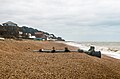
 Beach at Sandgate - geograph.org.uk - 4142559.jpg 640 × 382; 91 KB
-
 Beach at Sandgate - geograph.org.uk - 4155263.jpg 640 × 430; 103 KB
-
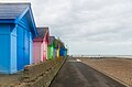 Beach huts - geograph.org.uk - 4837906.jpg 1,000 × 662; 491 KB
-
 Beach huts at Folkestone - geograph.org.uk - 4370567.jpg 640 × 463; 54 KB
-
 Beach Huts Near Sandgate, Kent - geograph.org.uk - 1361588.jpg 640 × 360; 54 KB
-
 Beach, Sandgate - geograph.org.uk - 4147445.jpg 640 × 430; 77 KB
-
 Beach, West Folkestone - geograph.org.uk - 4156082.jpg 640 × 381; 83 KB
-
 Beacon - geograph.org.uk - 4172687.jpg 427 × 640; 38 KB
-
 Beacon, Sandgate - geograph.org.uk - 4147519.jpg 427 × 640; 35 KB
-
 Beacon, Sandgate - geograph.org.uk - 4835653.jpg 640 × 426; 25 KB
-
 Bend in the seawall - geograph.org.uk - 4156077.jpg 640 × 430; 70 KB
-
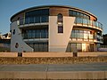
 Building in progress, Sandgate Esplanade - geograph.org.uk - 3458706.jpg 991 × 732; 177 KB
-
 Building site, Military Road - geograph.org.uk - 5468421.jpg 3,264 × 2,448; 3.85 MB
-
 Building site, Military Road - geograph.org.uk - 5468427.jpg 3,264 × 2,448; 3.99 MB
-
 Building site, Sandgate Esplanade - geograph.org.uk - 4752366.jpg 3,264 × 2,448; 2.4 MB
-
 Castle Bay - geograph.org.uk - 3022808.jpg 800 × 600; 130 KB
-
 Castle Bay - geograph.org.uk - 4147440.jpg 640 × 430; 78 KB
-
 Castle Bay - geograph.org.uk - 5265098.jpg 1,000 × 662; 610 KB
-
 Castle Bay - geograph.org.uk - 5265101.jpg 1,000 × 662; 761 KB
-
 Castle Bay at Sandgate - geograph.org.uk - 5433977.jpg 4,000 × 3,000; 4.64 MB
-
 Castle Road, Sandgate - geograph.org.uk - 4649343.jpg 2,272 × 1,704; 810 KB
-
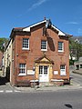 Chichester Memorial Hall, Sandgate - geograph.org.uk - 1274662.jpg 480 × 640; 79 KB
-
 Chinnor House - geograph.org.uk - 4839258.jpg 1,000 × 662; 688 KB
-
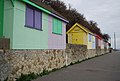
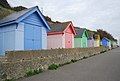 Colourful beach huts - geograph.org.uk - 4156106.jpg 640 × 430; 65 KB
-
 Colourful beach huts - geograph.org.uk - 4156114.jpg 640 × 430; 65 KB
-
 Crescent, Sandgate - geograph.org.uk - 4142555.jpg 640 × 430; 64 KB
-
 Curved seawall - geograph.org.uk - 4147589.jpg 640 × 430; 79 KB
-
 Desirable residence - panoramio.jpg 2,048 × 1,536; 1.17 MB
-
 Detail of a Window on the Eart of Clarendon - geograph.org.uk - 2170789.jpg 2,304 × 3,072; 1.84 MB
-
 Development Site on Sandgate Esplanade - geograph.org.uk - 2170820.jpg 3,072 × 2,304; 1.87 MB
-
 Dog Training Area - geograph.org.uk - 2170727.jpg 3,072 × 2,304; 2.56 MB
-
 Drinking trough - geograph.org.uk - 4839276.jpg 1,000 × 662; 846 KB
-
 Drinking water fountain in Sandgate.jpg 1,728 × 3,072; 791 KB
-
 Earl of Clarendon Pub Sign, Sandgate - geograph.org.uk - 2170794.jpg 2,304 × 3,072; 1.74 MB
-
 Early morning, Sandgate beach - geograph.org.uk - 3297904.jpg 640 × 480; 101 KB
-
 Early morning, Sandgate beach - geograph.org.uk - 3297928.jpg 640 × 480; 94 KB
-
 Enbrook House SAGA Building - panoramio.jpg 2,048 × 1,536; 1.14 MB
-
 Endcombe - geograph.org.uk - 4147509.jpg 640 × 430; 89 KB
-
 Entering the beach at Sandgate - geograph.org.uk - 4902072.jpg 2,048 × 1,536; 1.52 MB
-
 Entrance to Enbrook Park - geograph.org.uk - 4839262.jpg 662 × 1,000; 893 KB
-
 Folkestone - 2013 - geograph.org.uk - 4108529.jpg 3,648 × 2,736; 1.5 MB
-
 Folkestone - 2013 - geograph.org.uk - 4109715.jpg 3,648 × 2,736; 1.36 MB
-
 Folkestone - 2013 - geograph.org.uk - 4109717.jpg 3,648 × 2,736; 4 MB
-
 Folkestone - 2013 - geograph.org.uk - 4109718.jpg 3,648 × 2,736; 2.61 MB
-
 Folkestone - 2013 - geograph.org.uk - 4109723.jpg 3,648 × 2,736; 4.24 MB
-
 Folkestone - 2013 - geograph.org.uk - 4109725.jpg 3,648 × 2,736; 4.24 MB
-
 Folkestone - 2013 - geograph.org.uk - 4109728.jpg 3,648 × 2,736; 4.35 MB
-
 Folkestone - 2013 - geograph.org.uk - 4109730.jpg 3,648 × 2,736; 4.24 MB
-
 Folkestone - 2013 - geograph.org.uk - 4109735.jpg 3,648 × 2,736; 4.04 MB
-
 Folkestone - 2013 - geograph.org.uk - 4109737.jpg 3,648 × 2,736; 4.28 MB
-
 Folkestone - 2013 - geograph.org.uk - 4109738.jpg 3,648 × 2,736; 4.28 MB
-
 Folkestone Rowing Club - geograph.org.uk - 4147578.jpg 640 × 430; 62 KB
-
 Folkestone, Lower Leas Coastal Park - geograph.org.uk - 2201479.jpg 2,272 × 1,704; 770 KB
-
 Folkestone, Sandgate Point - geograph.org.uk - 3161111.jpg 3,648 × 2,736; 3.96 MB
-
 Folkestone, Sandgate Point - geograph.org.uk - 3161113.jpg 3,648 × 2,736; 4.28 MB
-
 Folkestone, Sandgate, Parade Road - geograph.org.uk - 2584834.jpg 3,648 × 2,736; 1.87 MB
-
 Folkestone, The Leas - geograph.org.uk - 3161102.jpg 3,648 × 2,736; 3.56 MB
-
 Folkestone, The Leas - geograph.org.uk - 3161106.jpg 3,648 × 2,736; 3.7 MB
-
 Folkestone, The Leas - geograph.org.uk - 3161179.jpg 3,648 × 2,736; 4.19 MB
-
 Folkestone, The Leas - geograph.org.uk - 3161568.jpg 3,648 × 2,736; 4.29 MB
-
 Folkestone, The Leas - geograph.org.uk - 3161570.jpg 3,648 × 2,736; 3.12 MB
-
 Folkestone, The Leas - geograph.org.uk - 3161571.jpg 3,648 × 2,736; 4.19 MB
-
 Footbridge beside Martello Tower No.6 - geograph.org.uk - 2170746.jpg 3,072 × 2,304; 2.14 MB
-
 Forebeach at Sandgate - geograph.org.uk - 4147542.jpg 640 × 430; 102 KB
-
 Former Congregational Chapel, Sandgate - geograph.org.uk - 3302076.jpg 640 × 480; 100 KB
-
 General view Sandgate England.jpg 1,065 × 837; 172 KB
-
 General view, Sandgate, England-LCCN2002708090.jpg 3,659 × 2,748; 3.19 MB
-
 General view, Sandgate, England-LCCN2002708090.tif 3,659 × 2,748; 28.77 MB
-
 Gloster Terrace - geograph.org.uk - 5265097.jpg 1,000 × 662; 476 KB
-
 Grafton and Regency Cottages - geograph.org.uk - 2170811.jpg 3,072 × 2,304; 1.87 MB
-
 Grafton Cottage and Regency Cottage - geograph.org.uk - 5265161.jpg 1,000 × 662; 631 KB
-
 Grafton Cottage, Sandgate Esplanade - geograph.org.uk - 4752348.jpg 3,264 × 2,448; 2.24 MB
-
 Granville Parade - geograph.org.uk - 4147584.jpg 640 × 465; 57 KB
-
 Granville Parade, Sandgate - geograph.org.uk - 4649374.jpg 2,272 × 1,704; 774 KB
-
 Granville Place - geograph.org.uk - 4147581.jpg 640 × 430; 60 KB
-
 Granville Place, Sandgate - geograph.org.uk - 4649354.jpg 2,272 × 1,704; 721 KB
-
 Granville Road East, Sandgate - geograph.org.uk - 4649341.jpg 2,272 × 1,704; 670 KB
-
 Harrisons, 53, Sandgate High Street - geograph.org.uk - 5468440.jpg 2,448 × 3,264; 2.09 MB
-
 High Street - geograph.org.uk - 4840408.jpg 1,000 × 662; 626 KB
-
 High Street, Sandgate - geograph.org.uk - 4649324.jpg 2,272 × 1,704; 755 KB
-
 High Street, Sandgate - geograph.org.uk - 4649337.jpg 2,272 × 1,704; 767 KB
-
 Houses on the A259 - geograph.org.uk - 4835930.jpg 640 × 426; 59 KB
-
 Invasion Defences in the United Kingdom H2187.jpg 800 × 621; 94 KB
-
 John Gough plaque Sandgate.jpg 3,456 × 4,608; 2.09 MB
-
 Labyrinth in Lower Leas Country Park - geograph.org.uk - 1355495.jpg 640 × 480; 118 KB
-
 Landslip below East Cliff House - geograph.org.uk - 3314319.jpg 734 × 976; 163 KB
-
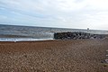
 Large breakwater - geograph.org.uk - 4142550.jpg 640 × 430; 69 KB
-
 Looking towards Seabrook - panoramio.jpg 2,048 × 1,536; 1.17 MB
-
 Low tide at Sandgate - geograph.org.uk - 4147536.jpg 640 × 430; 101 KB
-
 Lower Leas Coastal Park - geograph.org.uk - 4843225.jpg 1,000 × 662; 752 KB
-

-
 Martello Terrace, Sandgate - geograph.org.uk - 1412670.jpg 640 × 480; 56 KB
-
 Martello Tower 5 - geograph.org.uk - 4889195.jpg 1,600 × 1,055; 759 KB
-
 Martello Tower 7 - geograph.org.uk - 360219.jpg 640 × 480; 145 KB
-
 Martello Tower 8 - geograph.org.uk - 368269.jpg 640 × 480; 101 KB
-
 Martello Tower number 7, Folkestone - geograph.org.uk - 1969948.jpg 1,024 × 768; 290 KB
-
 Martello Tower number 8, Folkestone - geograph.org.uk - 1957011.jpg 1,024 × 768; 232 KB
-
 Martello Tower number 8, Folkestone - geograph.org.uk - 1959333.jpg 800 × 600; 153 KB
-
 Martello Tower number 9, Folkestone - geograph.org.uk - 1957008.jpg 1,024 × 768; 292 KB
-
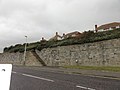
 Metropole Steps - geograph.org.uk - 4847407.jpg 662 × 1,000; 747 KB
-
 Name board of former Restaurant Boleyn - geograph.org.uk - 3321572.jpg 979 × 734; 125 KB
-
 National Cycle Route 2 - geograph.org.uk - 4142558.jpg 640 × 430; 48 KB
-
 National Cycle Route 2 - geograph.org.uk - 4147455.jpg 640 × 430; 47 KB
-
 National Cycle Route 2 - geograph.org.uk - 4155258.jpg 640 × 430; 69 KB
-
 National Cycle Route 2 - geograph.org.uk - 4156081.jpg 640 × 430; 83 KB
-
 National Cycle Route 2 - geograph.org.uk - 4156084.jpg 640 × 430; 73 KB
-
 National Cycle Route 2 - geograph.org.uk - 4156086.jpg 640 × 430; 65 KB
-
 National Cycle Route 2 and seawall - geograph.org.uk - 4156075.jpg 640 × 430; 73 KB
-
 National Cycle Route 2, Sandgate - geograph.org.uk - 4147547.jpg 640 × 430; 74 KB
-
 National Cycle Route 2, Sandgate - geograph.org.uk - 4147567.jpg 640 × 430; 66 KB
-
 Nick's View - geograph.org.uk - 2170755.jpg 3,072 × 2,304; 2.22 MB
-
 Nick's View Memorial Bench - geograph.org.uk - 2170749.jpg 3,072 × 2,304; 2.68 MB
-
 North Lane, Sandgate - geograph.org.uk - 4649330.jpg 2,272 × 1,704; 941 KB
-
 Old foundation, Military Road - geograph.org.uk - 3096667.jpg 640 × 480; 90 KB
-
 Outfall of Enbrook Stream - geograph.org.uk - 4839238.jpg 1,000 × 662; 738 KB
-
 Path to the beach, Folkestone - geograph.org.uk - 5292870.jpg 640 × 480; 71 KB
-
 Pillbox near Martello Tower 6 - geograph.org.uk - 1960188.jpg 800 × 600; 195 KB
-
 Pillbox near Military Road - geograph.org.uk - 2170743.jpg 3,072 × 2,304; 3.11 MB
-
 Prospect Rd - geograph.org.uk - 4147508.jpg 640 × 430; 71 KB
-
 Providence Inn, Sandgate - geograph.org.uk - 1274702.jpg 640 × 480; 71 KB
-
 Providence Inn, Sandgate - geograph.org.uk - 1412645.jpg 640 × 480; 68 KB
-
 Radnor Cliff - geograph.org.uk - 4842019.jpg 662 × 1,000; 482 KB
-
 Radnor Cliff Crescent - geograph.org.uk - 3313449.jpg 979 × 734; 171 KB
-
 Radnor Cliff, Sandgate - geograph.org.uk - 4649346.jpg 2,272 × 1,704; 863 KB
-
 Radnor Cliff, Sandgate - geograph.org.uk - 4649378.jpg 2,272 × 1,704; 835 KB
-
 Radnor Cliff, Sandgate - geograph.org.uk - 4649382.jpg 2,272 × 1,704; 801 KB
-
 Radnor Cliff, Sandgate - geograph.org.uk - 4649387.jpg 2,272 × 1,704; 726 KB
-
 Radnor Cliff, Sandgate - geograph.org.uk - 4649395.jpg 2,272 × 1,704; 875 KB
-
 Reef off Sandgate beach - geograph.org.uk - 3301239.jpg 640 × 480; 99 KB
-
 Reef off Sandgate beach - geograph.org.uk - 3301247.jpg 640 × 480; 72 KB
-
 Regency Cottage (geograph 6814656).jpg 1,024 × 684; 147 KB
-
 Riviera Court - geograph.org.uk - 4835928.jpg 640 × 426; 51 KB
-
 Rock breakwater - geograph.org.uk - 4142557.jpg 640 × 430; 76 KB
-
 Rock Breakwater - geograph.org.uk - 4330041.jpg 640 × 427; 82 KB
-
 Rock groyne - geograph.org.uk - 4156109.jpg 640 × 413; 71 KB
-
 Rock groyne - geograph.org.uk - 4156121.jpg 640 × 430; 74 KB
-
 Rocks off the beach, Sandgate - geograph.org.uk - 4147543.jpg 640 × 430; 98 KB
-
 Rocks on the beach - geograph.org.uk - 4147549.jpg 640 × 430; 84 KB
-
 Royal Norfolk Hotel, Sandgate - geograph.org.uk - 1412651.jpg 640 × 480; 66 KB
-

-
 Sandgate (A259) - geograph.org.uk - 2293101.jpg 2,272 × 1,704; 704 KB
-
 Sandgate - 1990 - geograph.org.uk - 4112025.jpg 640 × 428; 75 KB
-
 Sandgate - 1990 - geograph.org.uk - 4208763.jpg 2,272 × 1,521; 697 KB
-
 Sandgate - 1996 - geograph.org.uk - 3298045.jpg 2,272 × 1,515; 423 KB
-
 Sandgate - 2008 - geograph.org.uk - 3459949.jpg 2,272 × 1,704; 612 KB
-
 Sandgate - 2008 - geograph.org.uk - 3460997.jpg 2,272 × 1,704; 690 KB
-
 Sandgate - 2008 - geograph.org.uk - 3460999.jpg 2,272 × 1,704; 815 KB
-
 Sandgate - 2008 - geograph.org.uk - 3461001.jpg 2,272 × 1,704; 1,021 KB
-
 Sandgate - 2008 - geograph.org.uk - 3461003.jpg 2,272 × 1,704; 896 KB
-
 Sandgate - 2008 - geograph.org.uk - 3461005.jpg 2,272 × 1,704; 915 KB
-
 Sandgate - 2008 - geograph.org.uk - 3461006.jpg 2,272 × 1,704; 1.03 MB
-
 Sandgate - 2008 - geograph.org.uk - 3461007.jpg 2,272 × 1,704; 1.11 MB
-
 Sandgate - 2014 - geograph.org.uk - 4219110.jpg 3,648 × 2,736; 4.03 MB
-
 Sandgate - 2014 - geograph.org.uk - 4219114.jpg 3,648 × 2,736; 1.95 MB
-
 Sandgate - 2014 - geograph.org.uk - 4219117.jpg 3,648 × 2,736; 2.16 MB
-
 Sandgate - 2014 - geograph.org.uk - 4219121.jpg 3,648 × 2,736; 4.06 MB
-
 Sandgate - 2014 - geograph.org.uk - 4219125.jpg 3,648 × 2,736; 3.6 MB
-
 Sandgate - 2014 - geograph.org.uk - 4224207.jpg 3,648 × 2,736; 1.32 MB
-
 Sandgate - 2014 - geograph.org.uk - 4224208.jpg 3,648 × 2,736; 1.2 MB
-
 Sandgate - 2014 - geograph.org.uk - 4224209.jpg 3,648 × 2,736; 468 KB
-
 Sandgate 01.jpg 4,000 × 3,000; 2.16 MB
-
 Sandgate 02.jpg 4,000 × 3,000; 1.8 MB
-
 Sandgate 03.jpg 4,000 × 3,000; 1.53 MB
-
 Sandgate 04.jpg 4,000 × 3,000; 2.72 MB
-
 Sandgate 05.jpg 4,000 × 3,000; 2.07 MB
-
 Sandgate 06.jpg 4,000 × 3,000; 2.41 MB
-
 Sandgate Beach - geograph.org.uk - 1333222.jpg 640 × 480; 46 KB
-
 Sandgate Beach - geograph.org.uk - 1970035.jpg 1,024 × 683; 230 KB
-
 Sandgate beach - geograph.org.uk - 4147564.jpg 640 × 430; 92 KB
-
 Sandgate beach - geograph.org.uk - 4156074.jpg 640 × 400; 93 KB
-
 Sandgate Beach - geograph.org.uk - 4649351.jpg 2,272 × 1,704; 702 KB
-
 Sandgate Beach - geograph.org.uk - 4835639.jpg 640 × 378; 52 KB
-
 Sandgate Beach - geograph.org.uk - 4835648.jpg 640 × 426; 54 KB
-
 Sandgate beach at sunset - geograph.org.uk - 1837276.jpg 640 × 485; 253 KB
-
 Sandgate Beach View - geograph.org.uk - 3023977.jpg 800 × 600; 82 KB
-
 Sandgate Beacon - geograph.org.uk - 3023968.jpg 640 × 480; 40 KB
-
 Sandgate Breakwater View - geograph.org.uk - 3022796.jpg 800 × 600; 62 KB
-
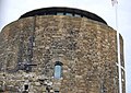
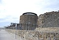
 Sandgate Castle - geograph.org.uk - 1969970.jpg 1,024 × 768; 234 KB
-
 Sandgate Castle - geograph.org.uk - 4155240.jpg 640 × 430; 71 KB
-
 Sandgate Castle - geograph.org.uk - 4155245.jpg 640 × 455; 98 KB
-
 Sandgate Castle - geograph.org.uk - 4155249.jpg 430 × 640; 95 KB
-
 Sandgate Castle - geograph.org.uk - 4155255.jpg 640 × 430; 83 KB
-
 Sandgate Castle - geograph.org.uk - 4155256.jpg 640 × 430; 70 KB
-
 Sandgate Castle - geograph.org.uk - 6241475.jpg 3,776 × 2,520; 4.02 MB
-
 Sandgate Castle, Sandgate, Kent.jpg 1,600 × 721; 261 KB
-
 Sandgate Esplanade - geograph.org.uk - 1412675.jpg 640 × 480; 53 KB


.jpg)


_-_geograph.org.uk_-_2293101.jpg)


