Category:Sant Andreu d'Ullà
Jump to navigation
Jump to search
| Object location | | View all coordinates using: OpenStreetMap |
|---|
church building in Ullà, Spain  | |||||
| Upload media | |||||
| Instance of | |||||
|---|---|---|---|---|---|
| Location | Ullà, Baix Empordà, Province of Girona, Catalonia | ||||
| Architectural style | |||||
| Heritage designation |
| ||||
 | |||||
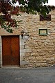
Català: Església de Sant Andreu d'Ullà. Placeta de Sant Andreu (Ullà)
This is a category about a building indexed in the Catalan heritage register as Bé Cultural d'Interès Local (BCIL) under the reference IPA-7499. |
Media in category "Sant Andreu d'Ullà"
This category contains only the following file.
-
 Vista lateral de l'Església de Sant Andreu d'Ullà.JPG 2,000 × 3,008; 1.5 MB