Category:Sant Miquel d'Engolasters
Jump to navigation
Jump to search
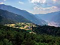
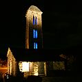
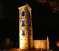
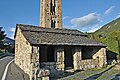
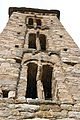
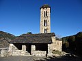
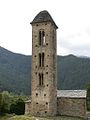
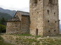
- Català: Església romànica de Sant Miquel d'Engolasters, situada al llogarret d'Engolasters, a Escaldes-Engordany (Andorra).
- Español: Iglesia de San Miguel de Engolasters.
- English: Església de Sant Miquel d'Engolasters.
|
This is a category about a heritage property registered in the General Inventory of Cultural Heritage of Andorra
|
| Camera location | | View all coordinates using: OpenStreetMap |
|---|
church building in Escaldes-Engordany, Andorra  | |||||
| Upload media | |||||
| Instance of | |||||
|---|---|---|---|---|---|
| Part of | |||||
| Named after | |||||
| Location | Escaldes-Engordany, Andorra | ||||
| Street address |
| ||||
| Architectural style | |||||
| Diocese | |||||
| Heritage designation |
| ||||
| Elevation above sea level |
| ||||
| Religion or worldview | |||||
 | |||||
Subcategories
This category has the following 4 subcategories, out of 4 total.
A
- Apse of Engolasters (6 F)
- Apse of Engolasters (interior) (29 F)
P
Media in category "Sant Miquel d'Engolasters"
The following 97 files are in this category, out of 97 total.
-
 2013. Església romànica de Sant Miquel d'Engolasters. Andorra 304.jpg 3,522 × 4,740; 10.77 MB
-
 Andorra07.jpg 600 × 800; 127 KB
-

-
 Camí a una ermita amb les muntanyes de fons (AFCEC DEGOLLADA X 075).jpeg 1,024 × 456; 65 KB
-
 Camí a una ermita amb les muntanyes de fons.jpeg 1,024 × 455; 76 KB
-
 Catalan Wikipedians during Wikipedia Takes Andorra (3).jpg 1,936 × 2,592; 1.27 MB
-
 Engolasters (15223008204).jpg 2,000 × 1,333; 1.58 MB
-
 Engolasters (15844643012).jpg 2,000 × 1,333; 1.93 MB
-
 Engolasters (15845275255).jpg 2,000 × 1,335; 1.32 MB
-

-
 Engolasters des del Mirador del Circuit de les Fonts.jpg 4,160 × 3,120; 2.71 MB
-
 Esglesia de sant miquel d'engolasters.jpg 3,264 × 2,448; 2.08 MB
-
 Esglèsia de Sant Miquel d'Engolasters.JPG 2,048 × 1,536; 666 KB
-
 Església de Sant Miquel d'Engolasters - 1.jpg 504 × 800; 119 KB
-
 Església de Sant Miquel d'Engolasters - 10.jpg 681 × 1,024; 300 KB
-
 Església de Sant Miquel d'Engolasters - 12.jpg 1,024 × 623; 475 KB
-
 Església de Sant Miquel d'Engolasters - 14.jpg 3,072 × 4,608; 7.8 MB
-
 Església de Sant Miquel d'Engolasters - 15.jpg 4,608 × 3,072; 6.77 MB
-
 Església de Sant Miquel d'Engolasters - 18.jpg 3,064 × 4,119; 5.83 MB
-
 Església de Sant Miquel d'Engolasters - 19.jpg 3,127 × 4,789; 10.25 MB
-
 Església de Sant Miquel d'Engolasters - 2.jpg 454 × 800; 127 KB
-
 Església de Sant Miquel d'Engolasters - 20.jpg 4,858 × 3,239; 9.28 MB
-
 Església de Sant Miquel d'Engolasters - 21.jpg 5,184 × 3,456; 14.38 MB
-
 Església de Sant Miquel d'Engolasters - 22.jpg 5,184 × 3,456; 15.12 MB
-
 Església de Sant Miquel d'Engolasters - 23.jpg 5,184 × 3,456; 14.35 MB
-
 Església de Sant Miquel d'Engolasters - 24.jpg 4,581 × 3,054; 8.3 MB
-
 Església de Sant Miquel d'Engolasters - 25.jpg 3,456 × 5,184; 14.32 MB
-
 Església de Sant Miquel d'Engolasters - 3.jpg 2,736 × 3,482; 2.74 MB
-
 Església de Sant Miquel d'Engolasters - 38.jpg 3,008 × 2,000; 2.37 MB
-
 Església de Sant Miquel d'Engolasters - 39.jpg 3,008 × 2,000; 2.47 MB
-
 Església de Sant Miquel d'Engolasters - 4.jpg 1,936 × 1,288; 1.11 MB
-
 Església de Sant Miquel d'Engolasters - 41.jpg 3,332 × 4,998; 4.67 MB
-
 Església de Sant Miquel d'Engolasters - 42.jpg 3,416 × 5,124; 4.19 MB
-
 Església de Sant Miquel d'Engolasters - 43.jpg 1,237 × 2,752; 3.21 MB
-
 Església de Sant Miquel d'Engolasters - 44.jpg 1,242 × 2,113; 2.43 MB
-
 Església de Sant Miquel d'Engolasters - 45.jpg 3,803 × 3,072; 4.13 MB
-
 Església de Sant Miquel d'Engolasters - 46.jpg 4,608 × 3,072; 5.41 MB
-
 Església de Sant Miquel d'Engolasters - 5.jpg 3,008 × 2,000; 1.61 MB
-
 Església de Sant Miquel d'Engolasters - 6.jpg 3,872 × 2,592; 3.07 MB
-
 Església de Sant Miquel d'Engolasters - 7.jpg 3,872 × 2,592; 4.93 MB
-
 Església de Sant Miquel d'Engolasters - 8.jpg 2,971 × 3,000; 2.01 MB
-
 Església de Sant Miquel d'Engolasters - 9.jpg 2,615 × 2,272; 3.81 MB
-
 Església de Sant Miquel d'Engolasters.jpg 2,460 × 3,280; 684 KB
-
 Església de Sant Miquel d'Engolasters2.jpg 2,460 × 3,280; 707 KB
-
 Església de Sant Miquel d'Engolasters3.jpg 2,456 × 3,280; 724 KB
-
 Església romànica de Sant Miquel d'Engolasters. Andorra 303.jpg 1,675 × 2,512; 2.75 MB
-
 Face, Sant Miquel d'Engolasters.JPG 3,072 × 2,304; 2.76 MB
-
 Iglesia de San Miguel de Engolasters, Engolasters, Andorra, 2013-12-30, DD 01.JPG 5,017 × 3,293; 6.27 MB
-
 Iglesia de San Miguel de Engolasters, Engolasters, Andorra, 2013-12-30, DD 02.JPG 3,036 × 4,574; 7.97 MB
-
 Iglesia de San Miguel de Engolasters, Engolasters, Andorra, 2013-12-30, DD 03.JPG 2,699 × 3,725; 5.68 MB
-
 Iglesia de San Miguel de Engolasters, Engolasters, Andorra, 2013-12-30, DD 04.JPG 4,057 × 2,728; 6.48 MB
-
 Iglesia de San Miguel de Engolasters, Engolasters, Andorra, 2013-12-30, DD 06.JPG 2,784 × 3,948; 6.43 MB
-
 Iglesia de Sant Miquel d'Engolasters (1).jpg 2,724 × 4,005; 9.01 MB
-
 Iglesia de Sant Miquel d'Engolasters (2).jpg 4,288 × 2,848; 9.02 MB
-
 Iglesia de Sant Miquel d'Engolasters (3).jpg 2,848 × 4,288; 10.89 MB
-
 Iglesia de Sant Miquel d'Engolasters (4).jpg 2,848 × 4,288; 11.9 MB
-
 Iglesia de Sant Miquel d'Engolasters (5).jpg 4,288 × 2,848; 9.89 MB
-
 Iglesia de Sant Miquel d'Engolasters (6).jpg 2,758 × 4,109; 8.59 MB
-
 Llac d'Engolasters (15422785643).jpg 1,620 × 1,080; 1 MB
-

-
 Part posterior de Sant Miquel d'Engolasters amb les muntanyes al fons.jpg 1,024 × 442; 52 KB
-
 Pintura mural de l'església de Sant Miquel d'Engolasters.jpeg 1,574 × 720; 159 KB
-
 Sant Miquel d Engolasters - 2009-05-02 - Jorge Franganillo.jpg 1,200 × 800; 327 KB
-
 Sant Miquel d'Engolasters (15659498947).jpg 2,000 × 1,333; 894 KB
-
 Sant Miquel d'Engolasters (15819434916).jpg 2,000 × 1,333; 1.69 MB
-
 Sant Miquel d'Engolasters (16016668516).jpg 2,100 × 1,400; 1.18 MB
-
 Sant Miquel d'Engolasters (25873885678).jpg 4,000 × 3,380; 1.74 MB
-
 Sant Miquel d'Engolasters (Andorra) 1.JPG 2,896 × 1,936; 2.13 MB
-
 Sant Miquel d'Engolasters (Andorra) 10.JPG 1,936 × 2,896; 2.19 MB
-
 Sant Miquel d'Engolasters (Andorra) 11.JPG 2,896 × 1,936; 2.16 MB
-
 Sant Miquel d'Engolasters (Andorra) 12.JPG 1,936 × 2,896; 1.26 MB
-
 Sant Miquel d'Engolasters (Andorra) 13.JPG 1,936 × 2,896; 1.28 MB
-
 Sant Miquel d'Engolasters (Andorra) 14.JPG 1,936 × 2,896; 1.39 MB
-
 Sant Miquel d'Engolasters (Andorra) 2.JPG 2,896 × 1,936; 2.31 MB
-
 Sant Miquel d'Engolasters (Andorra) 7.JPG 1,936 × 2,896; 1.95 MB
-
 Sant Miquel d'Engolasters (Andorra) 8.JPG 1,936 × 2,896; 2.82 MB
-
 Sant Miquel d'Engolasters (Andorra) 9.JPG 1,936 × 2,896; 1.3 MB
-
 Sant Miquel d'Engolasters - panoramio (1).jpg 948 × 1,200; 262 KB
-
 Sant Miquel d'Engolasters 03.JPG 3,672 × 4,896; 5.86 MB
-
 Sant Miquel d'Engolasters 04.JPG 4,896 × 3,672; 6.01 MB
-
 Sant Miquel d'Engolasters 05.JPG 3,672 × 4,896; 6.53 MB
-
 Sant Miquel d'Engolasters set2011 (3).JPG 1,936 × 2,592; 2.02 MB
-
 Sant Miquel d'Engolasters set2011 (4).JPG 1,936 × 2,592; 3.13 MB
-
 Sant Miquel d'Engolasters set2011 (5).JPG 1,936 × 2,592; 1.51 MB
-
 Sant Miquel d'Engolasters set2011 (6).JPG 1,936 × 2,592; 1.61 MB
-
 Sant Miquel d'Engolasters set2011-1.JPG 1,936 × 2,592; 1.51 MB
-
 Sant Miquel d'Engolasters set2011.JPG 1,192 × 1,600; 381 KB
-
 Sant Miquel d'Engolasters, Escaldes, Engordany, Andorra.jpg 4,800 × 3,200; 3.93 MB
-
 Sant Miquel d'Engolasters.jpg 768 × 1,024; 228 KB
-
 SANT MIQUEL D'ENGOLASTERS.JPG 1,600 × 1,200; 431 KB
-
 Sant Miquel Engolasters1.jpg 768 × 1,024; 231 KB
-
 Sant Miquel Engolasters2.jpg 1,024 × 768; 339 KB
-
 Sant Miquel Engolasters3.jpg 768 × 1,024; 247 KB
-
 Sant Miquel Engolasters6.jpg 768 × 1,024; 243 KB
-
 Sant Miquel Engolasters7.jpg 1,200 × 1,600; 649 KB
-
 Sant Miquel Engolasters8.jpg 1,200 × 1,600; 620 KB
-
 Vista de l'església de Sant Miquel d'Engolasters.jpeg 1,574 × 720; 179 KB


_(Extracted_-_Restored).jpg)
.jpeg)

.jpg)
.jpg)
.jpg)
.jpg)
._Sant_Miquel_d%E2%80%99Engolasters_church_and_bell_tower._(15104579201).jpg)


.jpg)
.jpg)
.jpg)
.jpg)
.jpg)
.jpg)
.jpg)
.jpg)


.jpg)
.jpg)
.jpg)
.jpg)
_1.JPG)
_10.JPG)
_11.JPG)
_12.JPG)
_13.JPG)
_14.JPG)
_2.JPG)
_7.JPG)
_8.JPG)
_9.JPG)
.jpg)


.JPG)
.JPG)
.JPG)
.JPG)


