Category:Santa Magdalena de Castellserà
Jump to navigation
Jump to search
| Object location | | View all coordinates using: OpenStreetMap |
|---|
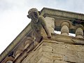
church building in Castellserà, Spain  | |||||
| Upload media | |||||
| Instance of | |||||
|---|---|---|---|---|---|
| Location | Castellserà, Urgell, Ponent, Lleida Province, Catalonia | ||||
| Street address |
| ||||
| Architectural style | |||||
| Heritage designation |
| ||||
| Inception |
| ||||
| Elevation above sea level |
| ||||
 | |||||
Català: Església de Santa Magdalena (Castellserà)
This is a category about a building listed in the Catalan heritage register as Bé Cultural d'Interès Local (BCIL) under the reference IPA-29746. |
Media in category "Santa Magdalena de Castellserà"
The following 6 files are in this category, out of 6 total.
-
 Església de Santa Magdalena de Castellserà, Urgell.jpg 6,000 × 4,000; 7.33 MB
-
 Iglesia de Santa Maria Magdalena.jpg 4,912 × 7,360; 12.02 MB
-
 SANTA MAGDALENA - CASTELLSERÀ - IB-573.jpg 1,536 × 2,048; 951 KB
-
 SANTA MAGDALENA - CASTELLSERÀ - IB-574.jpg 2,048 × 1,536; 1.02 MB
-
 SANTA MAGDALENA - CASTELLSERÀ - IB-575.jpg 1,536 × 2,048; 1,000 KB
-
 SANTA MAGDALENA - CASTELLSERÀ - IB-577.jpg 2,048 × 1,536; 1.12 MB


