Category:Satellite pictures of February 2021 nor'easter
Jump to navigation
Jump to search
Media in category "Satellite pictures of February 2021 nor'easter"
The following 13 files are in this category, out of 13 total.
-
 February 1 2021 nor'easter peak sandwich.jpg 2,000 × 2,000; 836 KB
-
 February 1 2021 nor'easter peak visible.jpg 2,000 × 2,000; 2.82 MB
-
 February 2021 nor'easter 2021-02-01 0356Z.jpg 1,231 × 847; 159 KB
-
 February 2021 nor'easter 2021-02-01 2126Z.jpg 1,739 × 2,006; 2.47 MB
-
 February 2021 nor'easter 2021-02-02 1430Z.jpg 2,625 × 2,721; 5.76 MB
-
 February 2021 nor'easter satellite imagery February 2 1546Z.jpg 2,400 × 2,400; 3.33 MB
-
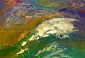
 January 27 west coast storm complex.jpg 2,500 × 1,500; 727 KB
-
 Late January 2021 North American winter storm 2021-01-30 2116Z.jpg 986 × 794; 132 KB
-
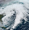
 Nor'easter 2021-02-01 1800Z.jpg 3,975 × 5,300; 17.44 MB
-
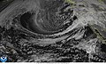
 Orlena 2021-02-01 cloudtops.png 2,442 × 2,548; 9.18 MB
-
 Winter Storm Orlena on 2021-02-02 1736Z.jpg 2,232 × 2,400; 4.44 MB
-
 Winter Storm Orlena on February 1, 2021.jpg 6,938 × 6,255; 6.54 MB
-
 Winter Storm Orlena on January 26, 2021.jpg 6,479 × 6,055; 7.09 MB


