Category:Satellite pictures of the Marlborough Region
Jump to navigation
Jump to search
Subcategories
This category has only the following subcategory.
Media in category "Satellite pictures of the Marlborough Region"
The following 12 files are in this category, out of 12 total.
-
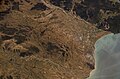
 Cape Campbell, New Zealand, looking east (ISS018-E-44097).jpg 3,072 × 2,040; 377 KB
-
 Cloudy Bay and Wairau River, New Zealand (ISS016-E-12382).jpg 3,032 × 2,008; 1.2 MB
-
 D'Urville and Stephens Islands, New Zealand (STS112-E-5914).jpg 3,032 × 2,064; 1.66 MB
-
 D'Urville and Stephens Islands, New Zealand.jpg 3,032 × 2,008; 1.65 MB
-
 ISS Blenheim, New Zealand.jpg 1,024 × 679; 156 KB
-
 Lakes Rotoroa and Rotoiti, and Wairau Valley, New Zealand (ISS016-E-12379).jpg 3,032 × 2,008; 1.4 MB
-
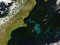
 Making Waves in Marlborough Sounds.jpeg 5,186 × 6,418; 9.27 MB
-
 Mouths of the Wairau River, Cloudy Bay, New Zealand, looking east (ISS014-E-18091).jpg 3,032 × 2,064; 990 KB
-
 Nzealand tmo 2008004 lrg.jpg 2,400 × 1,800; 515 KB
-
 Pelorus Sound and the Rai Valley, New Zealand (ISS016-E-12373).jpg 3,032 × 2,008; 1,012 KB
-
 Wairau and Branch Rivers, New Zealand (ISS016-E-12380).jpg 3,032 × 2,008; 1.39 MB
-
 Wairau and Spray Rivers, New Zealand (ISS016-E-12381).jpg 3,032 × 2,008; 1.33 MB
.jpg)
.jpg)
.jpg)


.jpg)

.jpg)

.jpg)
.jpg)
.jpg)