Category:Satellite pictures of the West Coast Region
Jump to navigation
Jump to search
Media in category "Satellite pictures of the West Coast Region"
The following 18 files are in this category, out of 18 total.
-
 Alpine Fault SRTM (vertical).jpg 1,746 × 5,342; 4.16 MB
-
 Alpine Fault SRTM.jpg 5,342 × 1,746; 4.16 MB
-
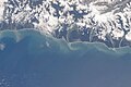
 Aoraki-Mount Cook and coast from Okarito to Haast, New Zealand (ISS030-E-7704.jpg 4,288 × 2,848; 1.43 MB
-
 Cook and Karangarua River mouths, New Zealand, looking southeast (ISS016-E-24567).jpg 3,032 × 2,008; 1,008 KB
-
 Cook River mouth, New Zealand, looking southeast (ISS016-E-24564).jpg 3,032 × 2,008; 1,015 KB
-
 Cook River mouth, New Zealand, looking southeast (ISS016-E-24565).jpg 3,032 × 2,008; 866 KB
-
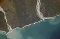
 Haast River mouth and Jackson Bay, New Zealand, looking southeast (ISS030-E-7703).jpg 4,288 × 2,848; 1.35 MB
-
 ISS-46 New Zealand, Canterbury Region and Christchurch.jpg 4,928 × 3,280; 1.71 MB
-
 Kahurangi Point, New Zealand, looking northwest (ISS016-E-12366).jpg 3,032 × 2,008; 1.09 MB
-
 Karamea Bight and Karamea River Mouth, New Zealand (ISS016-E-12377).jpg 3,032 × 2,008; 1.16 MB
-
 Lake Pukaki - STS088-721-15.JPG 4,099 × 4,096; 1.88 MB
-
 Mtcook.nz.750pix.jpg 6,108 × 5,637; 4.66 MB
-
 Murchison and Whataroa Rivers, New Zealand (ISS015-E-10544).jpg 3,032 × 2,008; 1.5 MB
-
 NASA-SLakes.png 289 × 263; 57 KB
-
 Okarito Lagoon, New Zealand, looking southeast (ISS030-E-7705).jpg 4,288 × 2,848; 1.24 MB
-

-
 Southern Alps from Lake Wakatipu to Lake Tekapo, New Zealand (ISS017-E-10675).jpg 3,072 × 2,040; 1.04 MB
-
 Westport and Buller River, New Zealand, looking southwest (ISS015-E-36395).jpg 3,032 × 2,008; 1.11 MB

.jpg)
.jpg)
.jpg)
.jpg)

.jpg)
.jpg)


.jpg)

.jpg)
.jpg)
.jpg)
.jpg)
.jpg)