Category:Sausthorpe
Jump to navigation
Jump to search
English: Sausthorpe (also called Saucethorpe) is a village in the valley of the River Lymn in the Lincolnshire Wolds, England. It is situated 3 miles from Spilsby and 137 miles from London.
village and civil parish in Lincolnshire, UK  | |||||
| Upload media | |||||
| Instance of | |||||
|---|---|---|---|---|---|
| Location | East Lindsey, Lincolnshire, East Midlands, England | ||||
 | |||||
Subcategories
This category has the following 2 subcategories, out of 2 total.
O
- Sausthorpe Hall (4 F)
S
- St Andrew's Church, Sausthorpe (26 F)
Media in category "Sausthorpe"
The following 43 files are in this category, out of 43 total.
-
 A158 approaching Sausthorpe - geograph.org.uk - 3526261.jpg 640 × 374; 45 KB
-
 A158 eastbound nears Partney Farm - geograph.org.uk - 3663112.jpg 640 × 481; 49 KB
-
 A158 Partney Road leaving Sausthorpe - geograph.org.uk - 3663111.jpg 640 × 480; 52 KB
-
 A158 Partney Road, Sausthorpe - geograph.org.uk - 4086790.jpg 640 × 426; 90 KB
-
 A158 Partney Road, Sausthorpe - geograph.org.uk - 4088690.jpg 640 × 426; 83 KB
-
 Across the fields to Sausthorpe - geograph.org.uk - 426292.jpg 640 × 480; 128 KB
-
 Approaching Sausthorpe on the A158 - geograph.org.uk - 1151661.jpg 640 × 480; 74 KB
-
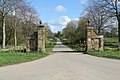
 Coronation gateway in Sausthorpe - geograph.org.uk - 4070280.jpg 640 × 427; 101 KB
-
 Crossroads, Sausthorpe - geograph.org.uk - 4086741.jpg 640 × 640; 114 KB
-
 Entering Sausthorpe, Partney Road - geograph.org.uk - 2694636.jpg 1,280 × 960; 290 KB
-
 Entrance to Sausthorpe Hall - geograph.org.uk - 2910151.jpg 1,280 × 853; 431 KB
-
 Farmland, Sausthorpe - geograph.org.uk - 4086749.jpg 640 × 426; 99 KB
-
 Farmland, Sausthorpe - geograph.org.uk - 4086764.jpg 640 × 426; 126 KB
-
 Farmland, Sausthorpe - geograph.org.uk - 4086775.jpg 426 × 640; 126 KB
-
 Farmland, Sausthorpe - geograph.org.uk - 4086777.jpg 426 × 640; 106 KB
-
 Footbridge near Hundleby - geograph.org.uk - 551278.jpg 640 × 480; 128 KB
-
 Footpath from Hundleby to Sausthorpe - geograph.org.uk - 554854.jpg 640 × 480; 121 KB
-
 Footpath from Sausthorpe to Hundleby - geograph.org.uk - 4129055.jpg 640 × 427; 53 KB
-

-
 Lane from Sausthorpe Bridge - geograph.org.uk - 512932.jpg 640 × 427; 106 KB
-
 Old Hall Cottage, Sausthorpe - geograph.org.uk - 4150160.jpg 1,600 × 1,125; 385 KB
-
 River Lymn - geograph.org.uk - 512914.jpg 640 × 427; 89 KB
-

-

-

-
 Road to Aswardby Mill, off A158 - geograph.org.uk - 2910144.jpg 1,280 × 853; 360 KB
-
 Road to East Farm - geograph.org.uk - 3633538.jpg 2,256 × 1,504; 1.82 MB
-
 Roundabout Plantation - geograph.org.uk - 4049114.jpg 640 × 427; 61 KB
-
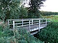
 Sausthorpe Bridge - geograph.org.uk - 2694642.jpg 1,280 × 960; 540 KB
-
 Sausthorpe harvest - geograph.org.uk - 512910.jpg 640 × 427; 85 KB
-
 Sausthorpe, aerial 2016 - geograph.org.uk - 5229817.jpg 640 × 427; 44 KB
-
 Strip Farming - geograph.org.uk - 778092.jpg 640 × 480; 69 KB
-
 Stubble field - geograph.org.uk - 1019351.jpg 640 × 480; 124 KB
-
 Telephone Box, Sausthorpe - geograph.org.uk - 4150149.jpg 1,200 × 1,600; 535 KB
-
 Tennyson's Brook south of Sausthorpe - geograph.org.uk - 4128569.jpg 640 × 427; 102 KB
-
 Tennyson's Brook south of Sausthorpe - geograph.org.uk - 4128570.jpg 640 × 427; 101 KB
-

-
 Tree-lined road, Sausthorpe - geograph.org.uk - 4086758.jpg 426 × 640; 120 KB
-
 Tree-lined road, Sausthorpe - geograph.org.uk - 4086770.jpg 426 × 640; 135 KB
-
 Unloved telephone box, Sausthorpe - geograph.org.uk - 4150146.jpg 1,146 × 1,600; 492 KB
-

-
 View to Sausthorpe school - geograph.org.uk - 1019349.jpg 640 × 353; 58 KB
-
 View west from the churchyard - geograph.org.uk - 1019355.jpg 640 × 480; 72 KB


