Category:Sawbridge
Jump to navigation
Jump to search
hamlet in Warwickshire, England, UK  | |||||
| Upload media | |||||
| Instance of | |||||
|---|---|---|---|---|---|
| Location | Wolfhampcote, Rugby, Warwickshire, West Midlands, England | ||||
 | |||||
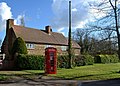
English: Sawbridge is a tiny hamlet in Warwickshire, England. It is 4 km north-west of Daventry and 8 km south of Rugby. The Grand Union Canal and Rains Brook run nearby as did the now-defunct Great Central main line railway track. Sawbridge does not have two of the most common features of the English village a public house or a church. It does, however, have a telephone box. In 1689 an old Roman water well was discovered in the village which contained a dozen or so Roman urns.
Media in category "Sawbridge"
The following 38 files are in this category, out of 38 total.
-
 A new kissing gate near Sawbridge - geograph.org.uk - 1339667.jpg 640 × 438; 134 KB
-
 Autumn colours north of Sawbridge - geograph.org.uk - 1545168.jpg 640 × 426; 116 KB
-
 Byre near Sawbridge - geograph.org.uk - 1103662.jpg 640 × 468; 95 KB
-
 Cattle shed, Sawbridge - geograph.org.uk - 1103666.jpg 640 × 451; 100 KB
-

-
 East of Sawbridge - geograph.org.uk - 1090647.jpg 640 × 523; 86 KB
-

-

-
 Farmyard clutter, Sawbridge - geograph.org.uk - 1090652.jpg 640 × 456; 85 KB
-
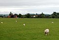 Footpath across a sheep field - geograph.org.uk - 1424598.jpg 640 × 433; 74 KB
-

-
 House being built, Sawbridge - geograph.org.uk - 1090650.jpg 640 × 436; 92 KB
-
 Looking east to Sawbridge - geograph.org.uk - 1104179.jpg 640 × 476; 86 KB
-

-
 Postbox at Sawbridge - geograph.org.uk - 1335118.jpg 480 × 640; 194 KB
-
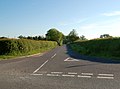
 Road junction at Sawbridge - geograph.org.uk - 1335121.jpg 640 × 443; 78 KB
-
 Sawbridge - geograph.org.uk - 52774.jpg 640 × 480; 117 KB
-
 Sawbridge - geograph.org.uk - 730891.jpg 640 × 480; 91 KB
-
 Sawbridge byway. - geograph.org.uk - 2040914.jpg 640 × 480; 113 KB
-
 Sawbridge Farm Building - geograph.org.uk - 3879943.jpg 1,024 × 683; 182 KB
-
 Sawbridge Farms - geograph.org.uk - 3867538.jpg 1,024 × 683; 277 KB
-
 Sawbridge Footbridge - geograph.org.uk - 731922.jpg 640 × 480; 151 KB
-
 Sawbridge phonebox - geograph.org.uk - 1090644.jpg 640 × 460; 105 KB
-
 Sawbridge Road heading towards Sawbridge - geograph.org.uk - 4483289.jpg 1,024 × 689; 247 KB
-
 Sawbridge Unclassified Road - geograph.org.uk - 3886309.jpg 1,024 × 683; 143 KB
-
 Sawbridge village entrance - geograph.org.uk - 2153374.jpg 603 × 424; 145 KB
-
-
 Sawbridge-Disused Railway - geograph.org.uk - 729612.jpg 640 × 480; 87 KB
-
 Sawbridge-Disused Railway - geograph.org.uk - 729623.jpg 640 × 480; 123 KB
-
 Sawbridge-Merriemore Cottage - geograph.org.uk - 3879948.jpg 1,024 × 731; 266 KB
-
 Sawbridge-Shuckburgh Road. - geograph.org.uk - 1334483.jpg 640 × 480; 103 KB
-
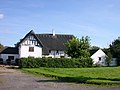
 Sawbridge-The Farm - geograph.org.uk - 1335151.jpg 640 × 480; 92 KB
-
 Sawbridge-The Farm - geograph.org.uk - 1344845.jpg 640 × 480; 81 KB
-
 Telephone box at Sawbridge - geograph.org.uk - 2132229.jpg 1,280 × 856; 332 KB
-
 The centre of Sawbridge - geograph.org.uk - 731923.jpg 640 × 480; 101 KB
-
 The Farm in Sawbridge - geograph.org.uk - 4483277.jpg 1,024 × 819; 256 KB
-
 Wolfhampcote Parish, 1946.jpg 1,344 × 912; 756 KB
-


_-_geograph.org.uk_-_1339664.jpg)