Category:Schleuse Lexfähre
Jump to navigation
Jump to search
| Object location | | View all coordinates using: OpenStreetMap |
|---|
 | |||||
| Upload media | |||||
| Instance of | |||||
|---|---|---|---|---|---|
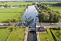
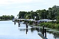
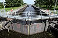
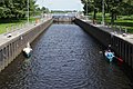
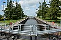
| Location | Wrohm, Dithmarschen, Schleswig-Holstein, Germany | ||||
| Located in or next to body of water | |||||
 | |||||
Media in category "Schleuse Lexfähre"
The following 47 files are in this category, out of 47 total.
-
 Eiderbrücke Lexfähre.JPG 3,648 × 2,736; 6.37 MB
-
 Schleuse Lexfähre Eider (49617159958).jpg 3,000 × 1,999; 6.07 MB
-
 Schleuse Lexfähre Eider (49617160203).jpg 3,000 × 1,999; 5.72 MB
-
 Schleuse Lexfähre Eider (49617160268).jpg 3,000 × 1,999; 5.37 MB
-
 Schleuse Lexfähre Eider (49617678091).jpg 3,000 × 1,999; 5.81 MB
-
 Schleuse Lexfähre Eider (49617678146).jpg 3,000 × 1,999; 5.8 MB
-
 Schleuse Lexfähre Eider (49617678431).jpg 3,000 × 1,999; 6.64 MB
-
 Schleuse Lexfähre Eider (49617678636).jpg 3,000 × 1,999; 6.71 MB
-
 Schleuse Lexfähre Eider (49617678746).jpg 3,000 × 1,999; 5.91 MB
-
 Schleuse Lexfähre Eider (49617678946).jpg 3,000 × 1,999; 6.41 MB
-
 Schleuse Lexfähre Eider (49617679076).jpg 3,000 × 1,999; 6.47 MB
-
 Schleuse Lexfähre Eider (49617936352).jpg 3,000 × 1,999; 5.81 MB
-
 Schleuse Lexfähre Eider (49617936382).jpg 3,000 × 1,998; 5.84 MB
-
 Schleuse Lexfähre Eider (49617937052).jpg 3,000 × 1,999; 6.71 MB
-
 Schleuse Lexfähre Eider (49617937422).jpg 3,000 × 1,999; 6.03 MB
-
 Wrohm - Lexfähre - Schleuse 01 ies.jpg 5,616 × 3,744; 17.38 MB
-
 Wrohm - Lexfähre - Schleuse 02 ies.jpg 5,616 × 3,744; 15.96 MB
-
 Wrohm - Lexfähre - Schleuse 03 ies.jpg 5,616 × 3,744; 13.03 MB
-
 Wrohm - Lexfähre - Schleuse 04 ies.jpg 5,616 × 3,744; 14.16 MB
-
 Wrohm - Lexfähre - Schleuse 05 ies.jpg 5,616 × 3,744; 16.86 MB
-
 Wrohm - Lexfähre - Schleuse 06 ies.jpg 5,616 × 3,744; 13.15 MB
-
 Wrohm - Lexfähre - Schleuse 07 ies.jpg 5,616 × 3,744; 16.09 MB
-
 Wrohm - Lexfähre - Schleuse 08 ies.jpg 5,616 × 3,744; 12.51 MB
-
 Wrohm - Lexfähre - Schleuse 09 ies.jpg 5,616 × 3,744; 14.92 MB
-
 Wrohm - Lexfähre - Schleuse 10 ies.jpg 5,616 × 3,744; 21.03 MB
-
 Wrohm - Lexfähre - Schleuse 11 ies.jpg 5,616 × 3,744; 20.35 MB
-
 Wrohm - Lexfähre - Schleuse 12 ies.jpg 5,616 × 3,744; 14.75 MB
-
 Wrohm - Lexfähre - Schleuse 13 ies.jpg 5,616 × 3,744; 13.71 MB
-
 Wrohm - Lexfähre - Schleuse 14 ies.jpg 5,616 × 3,744; 14.9 MB
-
 Wrohm - Lexfähre - Schleuse 15 ies.jpg 5,616 × 3,744; 19.8 MB
-
 Wrohm - Lexfähre - Schleuse 16 ies.jpg 5,616 × 3,744; 15.22 MB
-
 Wrohm - Lexfähre - Schleuse 17 ies.jpg 5,616 × 3,744; 12.55 MB
-
 Wrohm Lexfähre Klappbrücke über die Eider 1.jpg 3,648 × 2,736; 1.78 MB
-
 Wrohm Lexfähre Klappbrücke über die Eider 2.jpg 3,648 × 2,736; 2.69 MB
-
 Wrohm, Schleuse Lexfähre NIK 1639.JPG 6,000 × 4,000; 12.02 MB
-
 Wrohm, Schleuse Lexfähre NIK 1641.JPG 6,000 × 4,000; 11.29 MB
-
 Wrohm, Schleuse Lexfähre NIK 1642.JPG 6,000 × 4,000; 13.99 MB
-
 Wrohm, Schleuse Lexfähre NIK 1643.JPG 6,000 × 4,000; 13.74 MB
-
 Wrohm, Schleuse Lexfähre NIK 1645.JPG 6,000 × 4,000; 13.73 MB
-
 Wrohm, Schleuse Lexfähre NIK 1646.JPG 6,000 × 4,000; 11.42 MB
-
 Wrohm, Schleuse Lexfähre NIK 1647.JPG 6,000 × 4,000; 13.9 MB
-
 Wrohm, Schleuse Lexfähre NIK 1648.JPG 6,000 × 4,000; 11.85 MB
-
 Wrohm, Schleuse Lexfähre NIK 1650.JPG 6,000 × 4,000; 12.16 MB
-
 Wrohm, Schleuse Lexfähre NIK 1651.JPG 6,000 × 4,000; 12.47 MB
-
 Wrohm, Schleuse Lexfähre NIK 1652.JPG 6,000 × 4,000; 11.29 MB
-
 Wrohm, Schleuse Lexfähre NIK 1653.JPG 6,000 × 4,000; 13.94 MB
-
 Wrohm, Schleuse Lexfähre NIK 1655.JPG 6,000 × 4,000; 14.92 MB

.jpg)
.jpg)
.jpg)
.jpg)
.jpg)
.jpg)
.jpg)
.jpg)
.jpg)
.jpg)
.jpg)
.jpg)
.jpg)
.jpg)


