Category:Schulgarten im Stadtpark (Fürth)
Jump to navigation
Jump to search
| Object location | | View all coordinates using: OpenStreetMap |
|---|
Media in category "Schulgarten im Stadtpark (Fürth)"
The following 4 files are in this category, out of 4 total.
-
 Fuerth Schulgarten Entrance f nne.jpg 800 × 600; 183 KB
-
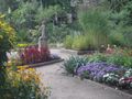
 Fürth Schulgarten im Stadtpark 001.JPG 3,484 × 2,496; 2.84 MB
-
 Fürth Schulgarten im Stadtpark Gieß-Mädle 001.JPG 2,032 × 3,235; 1.97 MB
-
 Fürth Schulgarten im Stadtpark Lesender Knabe 001.JPG 2,167 × 3,300; 2.28 MB


