Category:Schutzengel (Gebr. Acker, Bonn)
Jump to navigation
Jump to search
| Object location | | View all coordinates using: OpenStreetMap |
|---|
Media in category "Schutzengel (Gebr. Acker, Bonn)"
The following 4 files are in this category, out of 4 total.
-
 2018-06-01-bonn-koelnstrasse-413-collegium-josephinum-schutzengel-01.jpg 2,681 × 3,780; 1.39 MB
-
 2018-06-01-bonn-koelnstrasse-413-collegium-josephinum-schutzengel-02.jpg 3,000 × 4,000; 1.15 MB
-
 2018-06-01-bonn-koelnstrasse-413-collegium-josephinum-schutzengel-03.jpg 4,000 × 3,000; 2.39 MB
-
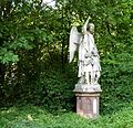 Acker Engel CoJoBo.jpg 2,352 × 2,280; 4.16 MB


