Category:Sciuridae distribution maps
Jump to navigation
Jump to search
Pages in category "Sciuridae distribution maps"
This category contains only the following page.
Media in category "Sciuridae distribution maps"
The following 82 files are in this category, out of 82 total.
-
 Ammospermophilus distribution map.png 954 × 1,005; 867 KB
-
 Ammospermophilus harrisii distribution map.png 1,276 × 1,064; 1.01 MB
-
 Ammospermophilus insularis distribution map.png 915 × 906; 522 KB
-
 Ammospermophilus interpres distribution map.png 1,336 × 1,289; 1.22 MB
-
 Ammospermophilus leucurus distribution map.png 766 × 996; 655 KB
-
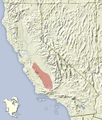 Ammospermophilus nelsoni distribution map.png 720 × 849; 503 KB
-
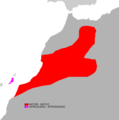
 Atlantoxerus getulus distribution map.png 887 × 738; 338 KB
-
 Atlantoxerus getulus range map.png 1,664 × 1,683; 76 KB
-

-
 Verbreitung des Utah-Präriehundes 1920, 1970 und 1991.png 1,700 × 2,199; 738 KB
-
 Eoglaucomys fimbriatus distribution map.png 1,426 × 1,173; 1.83 MB
-
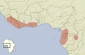 Epixerus ebii distribution map.png 1,492 × 976; 695 KB
-
 Funisciurus pyrropus distribution.svg 501 × 430; 201 KB
-
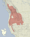
 Glaucomys distribution map.png 992 × 1,010; 1.59 MB
-
 Hàbitat d'Urocitellus parryyi.jpg 200 × 183; 34 KB
-
 Ictidomys distribution map.png 1,719 × 1,919; 2.7 MB
-
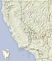
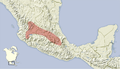 Ictidomys mexicanus distribution map.png 865 × 495; 291 KB
-
 Ictidomys parvidens distribution map.png 621 × 683; 360 KB
-
 Ictidomys tridecemlineatus distribution map.png 1,719 × 1,517; 2.35 MB
-
 Marmota monax range.png 1,440 × 1,392; 173 KB
-
 Microsciurus alfari range map.svg 940 × 415; 1.49 MB
-
 Microsciurus flaviventer range map.svg 940 × 415; 1.5 MB
-
 Microsciurus mimulus range map.svg 940 × 415; 1.49 MB
-
 Microsciurus santanderensis range map.svg 940 × 415; 1.49 MB
-
 Myosciurus pumilio range map.png 456 × 473; 19 KB
-
 NorthwestNorthAmericaRangeMapOlympicMarmot.JPG 358 × 599; 107 KB
-
 Notocitellus adocetus distribution map.png 1,584 × 996; 899 KB
-
 Notocitellus annulatus distribution map.png 1,584 × 996; 902 KB
-
 Notocitellus distribution map.png 1,584 × 996; 913 KB
-
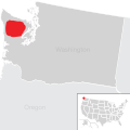
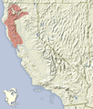
 Olympic marmot range map.png 800 × 353; 54 KB
-
 Olympic Marmot Range Map.svg 240 × 240; 82 KB
-
 Olympic Marmot range.png 587 × 403; 436 KB
-
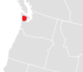
 OlympicMarmotCloseUpRangeMap.jpg 559 × 411; 66 KB
-
 OlympicMarmotRangeMap2.png 190 × 167; 4 KB
-
 Otospermophilus atricapillus distribution map.png 759 × 894; 373 KB
-
 Otospermophilus beecheyi distribution map.png 484 × 891; 388 KB
-
 Otospermophilus distribution map.png 1,042 × 1,392; 1.15 MB
-
 Otospermophilus variegatus distribution map.png 1,042 × 1,110; 858 KB
-
 Petaurista alborufus distribution map.png 2,000 × 1,283; 4.24 MB
-
 Pteromys volans range map.svg 1,119 × 461; 551 KB
-
 Range Tamiops mcclellandii.png 1,006 × 844; 99 KB
-
 Rangemap.png 2,420 × 1,624; 91 KB
-
 Ratufa affinis range map.svg 940 × 415; 1.49 MB
-
 Ratufa indica range map.svg 940 × 415; 1.51 MB
-
 Ratufa macroura zoomed range map.png 207 × 92; 9 KB
-
 Rheithrosciurus macrotis range map.png 800 × 353; 71 KB
-
 Rheithrosciurus macrotis range map.svg 940 × 415; 1.49 MB
-
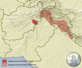
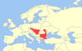 Spermophilus citellus distribution.svg 411 × 253; 137 KB
-
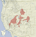
 Spermophilus parryii map.svg 1,125 × 1,126; 743 KB
-
 Tamias alpinus distribution map.png 720 × 849; 502 KB
-
 Tamias amoenus distribution map.png 855 × 1,033; 902 KB
-
 Tamias bulleri distribution map.png 861 × 721; 426 KB
-
 Tamias canipes distribution map.png 843 × 523; 387 KB
-
 Tamias cinereicollis distribution map.png 568 × 745; 425 KB
-
 Tamias dorsalis distribution map.png 763 × 934; 632 KB
-
 Tamias durangae distribution map.png 861 × 721; 428 KB
-
 Tamias merriami distribution map.png 720 × 926; 531 KB
-
 Tamias minimus distribution map.png 2,163 × 2,036; 3.38 MB
-
 Tamias obscurus distribution map.png 544 × 808; 325 KB
-
 Tamias ochrogenys distribution map.png 720 × 849; 502 KB
-
 Tamias palmeri distribution map.png 720 × 849; 514 KB
-
 Tamias panamintinus distribution map.png 720 × 849; 512 KB
-
 Tamias quadrimaculatus distribution map.png 720 × 849; 506 KB
-
 Tamias quadrivittatus distribution map.png 568 × 745; 430 KB
-
 Tamias ruficaudus distribution map.png 1,343 × 858; 1.05 MB
-
 Tamias rufus distribution map.png 568 × 745; 427 KB
-
 Tamias senex distribution map.png 774 × 1,208; 780 KB
-
 Tamias siskiyou distribution map.png 774 × 1,208; 763 KB
-
 Tamias sonomae distribution map.png 720 × 849; 511 KB
-
 Tamias sonomae distribution map2.png 720 × 849; 530 KB
-
 Tamias speciosus distribution map.png 720 × 849; 516 KB
-
 Tamias townsendii distribution map.png 695 × 713; 436 KB
-
 Tamias umbrinus distribution map.png 744 × 762; 583 KB
-
 Urocitellus beldingi species distribution map.svg 393 × 393; 1.78 MB
-
 Urocitellus columbianus species distribution map.svg 500 × 500; 1.78 MB
-
 White-tailed Antelope Squirrel.png 1,740 × 1,993; 140 KB
-
 Xerospermophilus distribution map.png 1,057 × 1,267; 996 KB
-
 Xerospermophilus mohavensis distribution map.png 720 × 849; 503 KB
-
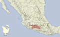
 Xerospermophilus perotensis distribution map.png 865 × 495; 285 KB
-
 Xerospermophilus spilosoma distribution map.png 817 × 1,067; 761 KB
-
 Xerospermophilus tereticaudus distribution map.png 605 × 706; 367 KB
-
 Xerus inauris range map.png 532 × 520; 36 KB


_(1918)_(20326858010).jpg)


