Category:Scotch Street
Jump to navigation
Jump to search
village in the United Kingdom | |||||
| Upload media | |||||
| Instance of | |||||
|---|---|---|---|---|---|
| Location | Northern Ireland | ||||
 | |||||
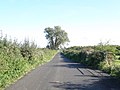
English: Scotch Street is a small village in County Armagh, Northern Ireland. In the 2001 Census it had a population of 120 people. It is within the townland of Timakeel and part of the Craigavon Borough Council area.
Media in category "Scotch Street"
The following 29 files are in this category, out of 29 total.
-
 Breagh Church hall - geograph.org.uk - 553427.jpg 640 × 480; 85 KB
-
 Cannagola Road Railway Bridge - geograph.org.uk - 568829.jpg 640 × 480; 114 KB
-
 Clantilew Road Railway Bridge - geograph.org.uk - 568827.jpg 480 × 640; 159 KB
-
 Creator- H. Allison & Co. Photographers (5455776949).jpg 800 × 611; 156 KB
-
 Drumnevan Road - Dismantled Bridge - geograph.org.uk - 568731.jpg 640 × 480; 96 KB
-

-

-
 Moy Road, B28 - geograph.org.uk - 567846.jpg 640 × 480; 69 KB
-
 Near Portadown (1) - geograph.org.uk - 5509340.jpg 4,608 × 3,456; 7.1 MB
-
 Near Portadown (2) - geograph.org.uk - 5509343.jpg 4,608 × 3,456; 7.57 MB
-
 Near Portadown - geograph.org.uk - 5509371.jpg 4,284 × 2,442; 5.26 MB
-
 Overhanging tree - geograph.org.uk - 567863.jpg 640 × 480; 95 KB
-
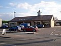
 Scotch Street TakeAway - geograph.org.uk - 583523.jpg 640 × 480; 78 KB
-
 Stewart's Terrace - geograph.org.uk - 5509370.jpg 4,608 × 2,520; 5.35 MB
-
-
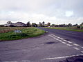
 Ardress Road B28 Junction - geograph.org.uk - 568726.jpg 640 × 480; 77 KB
-
 Derrylettiff Road Junction - geograph.org.uk - 568721.jpg 640 × 480; 73 KB
-

-
 Drumanphy Road - geograph.org.uk - 567851.jpg 640 × 480; 119 KB
-
 Drumanphy Road and Tower - geograph.org.uk - 568724.jpg 640 × 480; 88 KB
-
 Drumanphy Road Junction - geograph.org.uk - 568725.jpg 640 × 480; 83 KB
-
 Foy Lane Junction - geograph.org.uk - 568578.jpg 640 × 480; 83 KB
-
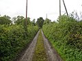 Foy Lane, End of the road. - geograph.org.uk - 568585.jpg 640 × 480; 124 KB
-
 Foy Mobile Mast - geograph.org.uk - 568584.jpg 640 × 480; 66 KB
-
 Moy Road. Portadown. - geograph.org.uk - 580920.jpg 640 × 480; 61 KB
-
 Richmount Controlled Primary School - geograph.org.uk - 205242.jpg 640 × 480; 82 KB
-
 Scotch Street - geograph.org.uk - 531617.jpg 640 × 480; 97 KB
-

-
 Tartaraghan Road - geograph.org.uk - 567871.jpg 640 × 480; 78 KB


.jpg)


_-_geograph.org.uk_-_5509340.jpg)
_-_geograph.org.uk_-_5509343.jpg)


