Category:Scotland
Jump to navigation
Jump to search
Constituent countries of the United Kingdom: England · Northern Ireland · Scotland · Wales – British Crown dependencies: Bailiwick of Guernsey · Isle of Man · Jersey
British overseas territories: Akrotiri and Dhekelia · Anguilla · Bermuda · British Antarctic Territory · British Indian Ocean Territory · British Virgin Islands · Cayman Islands · Falkland Islands · Gibraltar · Pitcairn Islands · Saint Helena, Ascension and Tristan da Cunha · South Georgia and the South Sandwich Islands · Turks and Caicos Islands
British overseas territories: Akrotiri and Dhekelia · Anguilla · Bermuda · British Antarctic Territory · British Indian Ocean Territory · British Virgin Islands · Cayman Islands · Falkland Islands · Gibraltar · Pitcairn Islands · Saint Helena, Ascension and Tristan da Cunha · South Georgia and the South Sandwich Islands · Turks and Caicos Islands
country in north-west Europe, part of the United Kingdom     | |||||
| Upload media | |||||
| Instance of | |||||
|---|---|---|---|---|---|
| Part of | |||||
| Patron saint | |||||
| Location |
| ||||
| Capital | |||||
| Legislative body | |||||
| Executive body | |||||
| Official language | |||||
| Anthem |
| ||||
| Currency | |||||
| Head of state | |||||
| Highest point |
| ||||
| Population |
| ||||
| Area |
| ||||
| Replaces | |||||
| Top-level Internet domain |
| ||||
| Different from | |||||
| Partially coincident with |
| ||||
| official website | |||||
 | |||||

Scotland is a country that is part of the United Kingdom, located in northeast Europe.
| ||||||||||||

Subcategories
This category has the following 35 subcategories, out of 35 total.
Media in category "Scotland"
The following 25 files are in this category, out of 25 total.
-
 At Loth Ferry Terminal, Sanday - fishing vessel - geograph.org.uk - 6331113.jpg 5,184 × 2,920; 5.29 MB
-
 Briaghlann - geograph.org.uk - 6330531.jpg 3,520 × 2,303; 1.12 MB
-
 Bull Hole from the granite quarry pier - geograph.org.uk - 6329528.jpg 1,600 × 1,067; 365 KB
-
 Cairn on Holm of Huip as seen from ferry to Stronsay - geograph.org.uk - 6331178.jpg 5,184 × 2,920; 4.32 MB
-
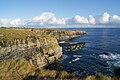
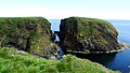
 Cliffs at Old Wick - geograph.org.uk - 6326705.jpg 1,280 × 852; 1.07 MB
-
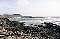
 Coastline at South Point - geograph.org.uk - 6327230.jpg 1,280 × 852; 831 KB
-
 Eilean Chaluim Cille - geograph.org.uk - 6330537.jpg 3,520 × 2,304; 1.15 MB
-
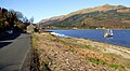 Fishing boat at Ardentinney - geograph.org.uk - 6327953.jpg 1,024 × 563; 327 KB
-
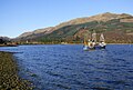 Fishing boat at Ardentinny - geograph.org.uk - 6328928.jpg 1,024 × 687; 286 KB
-
 Fishing boat at Ardentinny - geograph.org.uk - 6328934.jpg 1,024 × 594; 252 KB
-
 Glen Finart - geograph.org.uk - 6328931.jpg 1,024 × 768; 305 KB
-
 Helliar Holm Lighthouse from MV Shapinsay - geograph.org.uk - 6330996.jpg 5,184 × 2,920; 4.35 MB
-
 Holm of Huip as seen from ferry to Stronsay - geograph.org.uk - 6331181.jpg 5,184 × 2,920; 5.51 MB
-
 Holms of Spurness (Sanday) from MV Sigurd - geograph.org.uk - 6331117.jpg 5,184 × 2,920; 5.06 MB
-
 Huip Farm, Stronsay as seen from ferry - geograph.org.uk - 6331187.jpg 5,184 × 2,920; 5.46 MB
-
 On Stronsay - Coastal scenery at Outspay - geograph.org.uk - 6331320.jpg 5,184 × 2,920; 5.62 MB
-
 On Stronsay - The Brough at Burgh Head - geograph.org.uk - 6331331.jpg 5,184 × 2,920; 5.52 MB
-
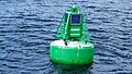 Quaibow Buoy on entry to Whitehall, Stronsay - geograph.org.uk - 6331184.jpg 5,184 × 2,920; 6.99 MB
-
 Rocky headland at Ardentinny - geograph.org.uk - 6327907.jpg 1,024 × 462; 202 KB
-
 Rocky headland at Ardentinny - geograph.org.uk - 6327914.jpg 1,024 × 595; 351 KB
-

-
 Spurness Wind Farm, Sanday from MV Earl Sigurd - geograph.org.uk - 6331112.jpg 5,184 × 2,920; 4.56 MB
-
 The shore at Ardentinny - geograph.org.uk - 6327908.jpg 1,024 × 461; 253 KB
-
 Thieves Holm off Car Ness near Kirkwall from MV Shapinsay - geograph.org.uk - 6330999.jpg 5,184 × 2,920; 3.51 MB
-
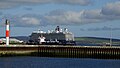 View to cruise ship Mein Schiff from Kirkwall Harbour - geograph.org.uk - 6331143.jpg 5,184 × 2,920; 5.23 MB


_from_MV_Sigurd_-_geograph.org.uk_-_6331117.jpg)


