Category:Scottow
Jump to navigation
Jump to search
English: Scottow is a village and civil parish in the English county of Norfolk. It is located some south of North Walsham.
village in Norfolk, UK  | |||||
| Upload media | |||||
| Instance of | |||||
|---|---|---|---|---|---|
| Location | North Norfolk, Norfolk, East of England, England | ||||
| Area |
| ||||
 | |||||
Subcategories
This category has the following 5 subcategories, out of 5 total.
Media in category "Scottow"
The following 188 files are in this category, out of 188 total.
-
 A big puddle - geograph.org.uk - 1031001.jpg 640 × 532; 101 KB
-
 A unique formation of Lightnings - geograph.org.uk - 4625855.jpg 1,024 × 683; 207 KB
-
 Art Deco water tower - geograph.org.uk - 4164473.jpg 640 × 517; 109 KB
-
 B1150 towards North Walsham - geograph.org.uk - 5877283.jpg 1,024 × 684; 260 KB
-
 B1150 towards North Walsham - geograph.org.uk - 5877286.jpg 1,024 × 684; 250 KB
-
 B1150 towards North Walsham - geograph.org.uk - 5877290.jpg 1,024 × 684; 233 KB
-
 Barn at The Laurels - geograph.org.uk - 3966792.jpg 640 × 439; 106 KB
-
 Barn belonging to Grove Farm - geograph.org.uk - 1099777.jpg 640 × 449; 137 KB
-
 Barns at The Laurels - geograph.org.uk - 3966794.jpg 640 × 480; 145 KB
-
 Blast walls - geograph.org.uk - 2092545.jpg 1,280 × 960; 231 KB
-
 Blast walls from the Cold War period - geograph.org.uk - 4164383.jpg 640 × 480; 118 KB
-
 Boathouse beside Scottow Row - geograph.org.uk - 1031126.jpg 480 × 640; 134 KB
-
 Boathouse on Scottow Pond - geograph.org.uk - 1031122.jpg 640 × 464; 161 KB
-
 Bracken fronds still green - geograph.org.uk - 1031206.jpg 480 × 640; 167 KB
-

-
 Building 295 - geograph.org.uk - 4163895.jpg 640 × 480; 107 KB
-
 Building by the entry control point - geograph.org.uk - 4164333.jpg 640 × 478; 160 KB
-
 Building Col 22C - geograph.org.uk - 4163724.jpg 640 × 480; 188 KB
-
 Building Col 22D (7) - geograph.org.uk - 4163735.jpg 640 × 474; 191 KB
-
 Buildings in fuel storage compound - geograph.org.uk - 4172850.jpg 640 × 480; 186 KB
-

-
 Buildings on the Technical site - geograph.org.uk - 4164452.jpg 640 × 480; 140 KB
-
 Buildings on the Technical site - geograph.org.uk - 4164456.jpg 640 × 480; 128 KB
-
 Buildings on the Technical site - geograph.org.uk - 4164465.jpg 640 × 480; 65 KB
-
 Buildings on the Technical site - geograph.org.uk - 4164467.jpg 640 × 480; 62 KB
-

-
 Bus parked by Steward's Plantation - geograph.org.uk - 3966800.jpg 640 × 491; 155 KB
-
 Cemetery at Scottow - geograph.org.uk - 4162496.jpg 640 × 480; 120 KB
-
 Cold War blast walls - geograph.org.uk - 4164382.jpg 640 × 480; 110 KB
-
 Coppiced beeches - geograph.org.uk - 1031193.jpg 640 × 480; 178 KB
-
 Cross of sacrifice, Scottow cemetery - geograph.org.uk - 4757359.jpg 427 × 640; 37 KB
-
 Crossing a drain - geograph.org.uk - 1030929.jpg 480 × 640; 88 KB
-
 Crossroads at Scottow - geograph.org.uk - 4364092.jpg 1,024 × 768; 277 KB
-
 Discarded tyres - geograph.org.uk - 1099706.jpg 480 × 640; 161 KB
-
 Drain traversing Long Plantation - geograph.org.uk - 1099738.jpg 640 × 480; 172 KB
-
 Emergency water supply - geograph.org.uk - 4164471.jpg 640 × 568; 219 KB
-
 Engine shed on the Technical site - geograph.org.uk - 4164461.jpg 640 × 480; 122 KB
-
 Entry Prohibited - geograph.org.uk - 4172859.jpg 640 × 480; 149 KB
-
 Exiting Long Plantation - geograph.org.uk - 1099819.jpg 640 × 480; 150 KB
-
 Fallen tree - geograph.org.uk - 1031134.jpg 480 × 640; 134 KB
-

-
 Farm track towards The Grange - geograph.org.uk - 3793070.jpg 640 × 480; 99 KB
-
 Farmhouse in Scottow - geograph.org.uk - 3966798.jpg 640 × 480; 182 KB
-
 Field boundary hedge - geograph.org.uk - 4177387.jpg 640 × 480; 153 KB
-
 Fire lane on taxiway - geograph.org.uk - 4163855.jpg 640 × 525; 158 KB
-
 Fire training area - geograph.org.uk - 4164284.jpg 640 × 483; 122 KB
-
 Firing butts - geograph.org.uk - 4164439.jpg 640 × 480; 126 KB
-

-
 Flowering gorse - geograph.org.uk - 1099858.jpg 633 × 640; 225 KB
-
 Flytipping in Long Plantation - geograph.org.uk - 1099703.jpg 640 × 480; 176 KB
-
 Following the woodland edge - geograph.org.uk - 1099851.jpg 640 × 480; 149 KB
-
 Footpath across meadowland - geograph.org.uk - 4162389.jpg 640 × 480; 119 KB
-
 Fuel dump - geograph.org.uk - 2092553.jpg 1,280 × 960; 304 KB
-
 Fuel storage compound - geograph.org.uk - 4164302.jpg 640 × 467; 150 KB
-
 Gate in the perimeter fence - geograph.org.uk - 4172888.jpg 640 × 480; 215 KB
-
 Gate into a pasture - geograph.org.uk - 1030921.jpg 480 × 640; 108 KB
-
 Gatepost beside track - geograph.org.uk - 1170051.jpg 480 × 640; 128 KB
-
 Gnarly old tree by the path - geograph.org.uk - 1030945.jpg 480 × 640; 150 KB
-
 Grassed-over fuel tank - geograph.org.uk - 4164304.jpg 640 × 527; 147 KB
-
 Green and rust - geograph.org.uk - 1099903.jpg 640 × 480; 144 KB
-
 Guardroom at the main gate (detail) - geograph.org.uk - 4163637.jpg 640 × 605; 182 KB
-
 Heavy machine gun post hidden by ivy - geograph.org.uk - 4364101.jpg 1,024 × 768; 557 KB
-
 House in Tunstead Road - geograph.org.uk - 4760263.jpg 640 × 395; 301 KB
-
 Houses in Badersfield - geograph.org.uk - 4364065.jpg 640 × 568; 617 KB
-
 Houses in Tunstead Road - geograph.org.uk - 4760262.jpg 640 × 430; 316 KB
-
 Jaguar paint shop - geograph.org.uk - 4164443.jpg 640 × 480; 93 KB
-
 Lines of light and shadow - geograph.org.uk - 4364116.jpg 1,024 × 768; 607 KB
-
 Logs stored beside farm track - geograph.org.uk - 4172817.jpg 640 × 480; 157 KB
-
 Machine gun mount in an extension of a loohole - geograph.org.uk - 4364104.jpg 1,024 × 768; 272 KB
-
 Magpie Cap - geograph.org.uk - 4162407.jpg 640 × 480; 161 KB
-

-

-
 Mk V Lightnings - geograph.org.uk - 2210921.jpg 693 × 468; 92 KB
-
 New use for the NAAFI - geograph.org.uk - 2092745.jpg 1,280 × 1,006; 263 KB
-
 Oak growing by drain - geograph.org.uk - 1099915.jpg 480 × 640; 132 KB
-
 Oil Seed Rape in full flower in November - geograph.org.uk - 5981754.jpg 1,600 × 1,064; 571 KB
-
 Old RAF building - geograph.org.uk - 4163669.jpg 640 × 480; 213 KB
-
 Old ridge boundaries - geograph.org.uk - 1099743.jpg 480 × 640; 154 KB
-

-
 Paper bank beside The Fairstead - geograph.org.uk - 3966796.jpg 640 × 480; 216 KB
-
 Pasture beside stream - geograph.org.uk - 1030927.jpg 640 × 414; 63 KB
-
 Path crossing wet pasture - geograph.org.uk - 1030933.jpg 640 × 412; 78 KB
-
 Path through Long Plantation - geograph.org.uk - 1099749.jpg 640 × 480; 159 KB
-
 Photo reconnaissance building - geograph.org.uk - 4163892.jpg 640 × 480; 110 KB
-
 Plank bridge over drain - geograph.org.uk - 1099733.jpg 480 × 640; 159 KB
-
 Pond at Malthouse Farm - geograph.org.uk - 4364106.jpg 1,024 × 768; 535 KB
-
 RAF Coltishall - geograph.org.uk - 1945478.jpg 5,184 × 3,360; 897 KB
-
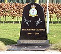 RAF Coltishall Memorial - geograph.org.uk - 4364081.jpg 640 × 566; 545 KB
-
 Remains of a landing stage - geograph.org.uk - 1031129.jpg 480 × 640; 105 KB
-
 Remains of old trees - geograph.org.uk - 1099757.jpg 640 × 480; 152 KB
-
 Road from Swanton Abbott - geograph.org.uk - 452655.jpg 640 × 480; 42 KB
-
 Rookery Farm (farmhouse) - geograph.org.uk - 4172816.jpg 640 × 547; 134 KB
-
 Rubbish and barbed wire - geograph.org.uk - 1099724.jpg 480 × 640; 173 KB
-
 Ruin by Steward's Plantation - geograph.org.uk - 4172812.jpg 640 × 480; 254 KB
-
 Rust-coloured water - geograph.org.uk - 1099889.jpg 640 × 480; 160 KB
-
 Scottow cemetery - geograph.org.uk - 4757354.jpg 640 × 360; 48 KB
-
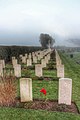 Scottow cemetery - geograph.org.uk - 4757364.jpg 427 × 640; 65 KB
-
 Scottow Pond - geograph.org.uk - 4162420.jpg 640 × 480; 181 KB
-
 Scottow Pond - geograph.org.uk - 4162424.jpg 640 × 480; 192 KB
-
 Scottow Pond and Oak Belt - geograph.org.uk - 1031108.jpg 640 × 544; 105 KB
-
 Scottow Pond outfall - geograph.org.uk - 1031113.jpg 480 × 640; 160 KB
-
 Scottow Road from Scottow Row - geograph.org.uk - 5966826.jpg 1,600 × 1,064; 569 KB
-
 Scottow School Hall - geograph.org.uk - 615809.jpg 640 × 480; 68 KB
-
 Scottow Village sign - geograph.org.uk - 4162396.jpg 360 × 480; 108 KB
-

-
 Sections of disused piping - geograph.org.uk - 1031157.jpg 480 × 640; 195 KB
-

-
 Sheep sheltering by blast wall - geograph.org.uk - 4164385.jpg 640 × 480; 143 KB
-
 Sloley Lodge frontage, Sloley, Norfolk - geograph.org.uk - 2307540.jpg 760 × 570; 210 KB
-
 Small Arms Range - geograph.org.uk - 3514788.jpg 640 × 480; 298 KB
-
 Stile - geograph.org.uk - 4162391.jpg 640 × 480; 171 KB
-
 Stile at Stakebridge Beck - geograph.org.uk - 4162415.jpg 640 × 480; 173 KB
-
 Stile into the fields - geograph.org.uk - 1030978.jpg 480 × 640; 122 KB
-
 Stile to Stakebridge Beck - geograph.org.uk - 4162392.jpg 640 × 480; 188 KB
-
 Stream running off Scottow Pond - geograph.org.uk - 1031115.jpg 480 × 640; 176 KB
-
 Stubble field - geograph.org.uk - 1030962.jpg 640 × 480; 110 KB
-
 Sugar beet field near Stakebridge beck - geograph.org.uk - 4162394.jpg 640 × 480; 138 KB
-
 Supply and Movements Section building - geograph.org.uk - 4164468.jpg 640 × 480; 156 KB
-

-

-
 The eastern edge - geograph.org.uk - 1031181.jpg 480 × 640; 144 KB
-
 The Fairstead - geograph.org.uk - 4172825.jpg 640 × 480; 304 KB
-
 The Fairstead - this is where it ends - geograph.org.uk - 4172830.jpg 640 × 480; 185 KB
-
 The Fire station - geograph.org.uk - 4163838.jpg 640 × 480; 124 KB
-
 The front of the Station headquarters - geograph.org.uk - 4163655.jpg 640 × 480; 147 KB
-
 The fuel compound - geograph.org.uk - 4172838.jpg 640 × 480; 136 KB
-
 The fuel compound - sign - geograph.org.uk - 4172840.jpg 516 × 640; 223 KB
-
 The Laurels - geograph.org.uk - 1170048.jpg 640 × 480; 120 KB
-
 The Norfolk Area Pupil Referral Unit - geograph.org.uk - 4364071.jpg 640 × 480; 464 KB
-
 The Norfolk Area Pupil Referral Unit - geograph.org.uk - 4364073.jpg 640 × 614; 616 KB
-

-

-
 The remains of Rookery Farm - geograph.org.uk - 4172820.jpg 640 × 569; 215 KB
-
 The road to Scottow - geograph.org.uk - 1046110.jpg 640 × 349; 68 KB
-
 The ruins of Rookery Farm - geograph.org.uk - 4364126.jpg 1,024 × 768; 493 KB
-
 The Station hospital - geograph.org.uk - 4163676.jpg 640 × 498; 157 KB
-
 The Station hospital - geograph.org.uk - 4163680.jpg 640 × 481; 134 KB
-
 This way to the Isolation Switch - geograph.org.uk - 4164343.jpg 513 × 640; 261 KB
-
 Thorougoods Select Convenience Store - geograph.org.uk - 5966836.jpg 1,600 × 1,064; 643 KB
-
 Thorougoods supermarket - geograph.org.uk - 4172676.jpg 640 × 480; 122 KB
-
 Towards The Fairsteads past the War Memorial - geograph.org.uk - 4364127.jpg 1,024 × 768; 280 KB
-
 Track beside airfield - geograph.org.uk - 4172867.jpg 640 × 480; 149 KB
-
 Trees beside the pond at Malthouse Farm - geograph.org.uk - 4364109.jpg 1,024 × 768; 547 KB
-
 Trees near Stakebridge Beck - geograph.org.uk - 4162397.jpg 640 × 480; 124 KB
-
 Trimming the verges at Scottow - geograph.org.uk - 4364111.jpg 1,024 × 768; 386 KB
-
 Tunstead Road - geograph.org.uk - 4760258.jpg 640 × 360; 248 KB
-
 Two loops of steel - detail - geograph.org.uk - 1031219.jpg 480 × 640; 171 KB
-
 Two loops of steel - geograph.org.uk - 1031214.jpg 480 × 640; 184 KB
-
 Two pastures adjoining - geograph.org.uk - 1030941.jpg 640 × 480; 111 KB
-
 Unmarked track - geograph.org.uk - 1031146.jpg 480 × 640; 187 KB
-
 Unnamed road past Oak Belt - geograph.org.uk - 1099698.jpg 640 × 480; 117 KB
-
 View across Scottow Pond - geograph.org.uk - 1031141.jpg 602 × 640; 107 KB
-
 View across stream - geograph.org.uk - 1030982.jpg 480 × 640; 185 KB
-
 View across the water - geograph.org.uk - 1031151.jpg 480 × 640; 154 KB
-
 View along the main runway - geograph.org.uk - 4164395.jpg 640 × 480; 154 KB
-
 View along the south side of hangar 1 - geograph.org.uk - 4163753.jpg 640 × 472; 118 KB
-
 View into Further Plantation - geograph.org.uk - 1031118.jpg 580 × 640; 174 KB
-
 View into Steward's Plantation - geograph.org.uk - 615780.jpg 480 × 640; 119 KB
-
 View towards Scottow Row - geograph.org.uk - 1031086.jpg 640 × 480; 115 KB
-
 View west along a field boundary - geograph.org.uk - 1031092.jpg 480 × 640; 108 KB
-
 Waterlogged pasture - geograph.org.uk - 1030995.jpg 640 × 556; 130 KB
-
 Well-weathered remains - geograph.org.uk - 1099964.jpg 640 × 480; 157 KB
-
 Whilst the others are grazing - geograph.org.uk - 1031014.jpg 640 × 534; 152 KB
-
 Woodland near Grove Farm - geograph.org.uk - 3793063.jpg 640 × 480; 83 KB
-
 WW1 Roll of Honour - geograph.org.uk - 5969982.jpg 1,600 × 1,064; 426 KB
-
 WW2 defence post - geograph.org.uk - 4177391.jpg 640 × 480; 153 KB
-
 WW2 defence post - geograph.org.uk - 4177393.jpg 640 × 480; 151 KB
-
 WW2 defence post - geograph.org.uk - 4177395.jpg 640 × 523; 132 KB
-
 WW2 defence post - geograph.org.uk - 4177398.jpg 640 × 480; 166 KB
-
 WW2 fighter pen - geograph.org.uk - 4164277.jpg 640 × 480; 187 KB
-
 WW2 fighter pen - geograph.org.uk - 4164280.jpg 640 × 480; 222 KB
-
 WW2 fighter pen - geograph.org.uk - 4164281.jpg 640 × 480; 167 KB
-
 WW2 fighter pen - geograph.org.uk - 4164282.jpg 640 × 480; 212 KB
-
 WW2 Operations block - geograph.org.uk - 4163697.jpg 640 × 480; 106 KB
-
 Yarnold shelter - geograph.org.uk - 4164292.jpg 547 × 640; 253 KB
-
 A gloomy November day - geograph.org.uk - 1031188.jpg 640 × 593; 210 KB
-
 Access road to Malthouse Farm - geograph.org.uk - 615783.jpg 480 × 640; 45 KB
-
 An ancient field boundary - geograph.org.uk - 1031083.jpg 640 × 536; 110 KB
-
 Big barn - geograph.org.uk - 615811.jpg 640 × 480; 63 KB
-

-
 Driveway with black cat - geograph.org.uk - 615801.jpg 480 × 640; 63 KB
-
 Houses beside The Fairstead - geograph.org.uk - 615791.jpg 640 × 480; 51 KB
-
 Lay-by on the B1150 (Norwich Road) - geograph.org.uk - 548479.jpg 640 × 480; 110 KB
-
 Looking north across The Fairstead - geograph.org.uk - 615785.jpg 480 × 640; 34 KB
-

-
 Scottow houses - geograph.org.uk - 615788.jpg 640 × 480; 67 KB
-
 The Fairstead - geograph.org.uk - 615814.jpg 480 × 640; 118 KB
-
 The former School Hall - geograph.org.uk - 615806.jpg 480 × 640; 96 KB


_-_geograph.org.uk_-_4163735.jpg)


_-_geograph.org.uk_-_1170045.jpg)


_-_geograph.org.uk_-_4163637.jpg)


_-_geograph.org.uk_-_4172816.jpg)


_-_geograph.org.uk_-_548479.jpg)


