Category:Seaforth Container Terminal, Port of Liverpool
Jump to navigation
Jump to search
| Object location | | View all coordinates using: OpenStreetMap |
|---|
dock at the Port of Liverpool, in Merseyside, England, UK  | |||||
| Upload media | |||||
| Instance of | |||||
|---|---|---|---|---|---|
| Part of | |||||
| Location | Seaforth, Sefton, Merseyside, North West England, England | ||||
 | |||||
Subcategories
This category has only the following subcategory.
Media in category "Seaforth Container Terminal, Port of Liverpool"
The following 48 files are in this category, out of 48 total.
-
 Aerial photo of Seaforth Docks - geograph.org.uk - 611876.jpg 640 × 480; 77 KB
-
 Aggregates Plant at Seaforth - geograph.org.uk - 5233496.jpg 640 × 427; 389 KB
-
 Atlantic Cartier (ship, 1985) 001.jpg 2,605 × 1,768; 3.78 MB
-
 BBC Rio (IMO 9430222).jpg 4,000 × 2,763; 3.58 MB
-
 Ben Maye, River Mersey (geograph 4593069).jpg 1,024 × 683; 175 KB
-
 Benkid77 Promenade, Wallasey 1 090809.JPG 3,648 × 2,736; 3.59 MB
-
 Container port, Seaforth - geograph.org.uk - 979406.jpg 640 × 447; 49 KB
-
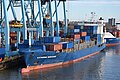
 Cranes at Seaforth Container Terminal 1.jpg 5,013 × 2,972; 16.27 MB
-
 Cranes at Seaforth Container Terminal 2.jpg 5,056 × 3,214; 16.97 MB
-
 Cranes at Seaforth Dock - geograph.org.uk - 641373.jpg 640 × 480; 61 KB
-
 Encounter and Sara Borchard.jpg 4,000 × 2,732; 4.25 MB
-
 Ensemble 2005.jpg 4,000 × 2,667; 2.27 MB
-
 Entrance to Seaforth Container Terminal, Port of Liverpool.jpg 4,944 × 3,024; 15.88 MB
-
 Katherine Borchard (IMO 9246530) Liverpool 2021.jpg 5,000 × 3,333; 8.77 MB
-

-

-
 Liverpool docks at Seaforth - geograph.org.uk - 3610882.jpg 4,608 × 3,072; 1.01 MB
-
 Mersey Estuary at Seaforth - geograph.org.uk - 5233507.jpg 640 × 427; 326 KB
-
 Mersey Estuary, Seaforth Docks - geograph.org.uk - 5281844.jpg 640 × 481; 358 KB
-
 Mersey Estuary, Seaforth Docks - geograph.org.uk - 5281847.jpg 640 × 481; 378 KB
-
 MSC Alyssa (ship, 2001) 001.jpg 3,895 × 1,861; 3.72 MB
-
 North West Passage - geograph.org.uk - 120091.jpg 640 × 480; 104 KB
-
 OOCL Belgium (ship, 1998) 001.jpg 3,754 × 1,945; 5.67 MB
-

-
 PORT OF LIVERPOOL AT SEAFORTH TAKEN FROM NEW BRIGHTON BEACH WIRRAL AUG 2013 (9432345803).jpg 5,149 × 2,444; 6.64 MB
-
 RMS Veritas (IMO 9138745).jpg 5,000 × 3,328; 6.21 MB
-
 Royal Seaforth Container Terminal - geograph.org.uk - 467716.jpg 640 × 480; 145 KB
-
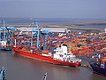
 Royal Seaforth Containerterminal.jpg 4,000 × 2,613; 2.57 MB
-
 Royal Seaforth Dock from Church Road, Seaforth - geograph.org.uk - 5027996.jpg 1,024 × 682; 166 KB
-
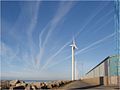
 Royal Seaforth Dock wind turbines - geograph.org.uk - 39835.jpg 640 × 480; 58 KB
-
 Royal Seaforth Dock, Liverpool Docks - geograph.org.uk - 2062693.jpg 640 × 424; 54 KB
-
 Sea Wall and Seaforth Radar Tower - geograph.org.uk - 5281850.jpg 640 × 427; 323 KB
-
 Seaforth Container Terminal Liverpool 2017.jpg 5,000 × 3,344; 8.89 MB
-

-
 Seaforth Dock 1.jpg 640 × 480; 125 KB
-
 Seaforth Docks with the Olive Branch No 2 railtour.jpg 3,200 × 2,235; 847 KB
-
 Seaforth Docks.jpg 468 × 299; 175 KB
-
 Ship-to-shore Cranes at Seaforth - geograph.org.uk - 5281838.jpg 640 × 427; 351 KB
-
 Thea II and Atlantic Comet in Liverpool.jpg 3,072 × 2,048; 4.11 MB
-
 Turbines on dock wall - geograph.org.uk - 3610929.jpg 4,608 × 3,072; 862 KB
-
 Wind Turbine - geograph.org.uk - 3610912.jpg 4,608 × 3,072; 900 KB
-

-
 Wind Turbine and Cranes, Seaforth Docks - geograph.org.uk - 5233487.jpg 640 × 481; 436 KB
-
 Wind Turbine at Seaforth - geograph.org.uk - 5281848.jpg 640 × 481; 335 KB
-
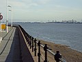
 End of the Jetty - geograph.org.uk - 120072.jpg 480 × 640; 96 KB
-
 Liverpool Freeport - geograph.org.uk - 72057.jpg 640 × 480; 58 KB
-
 Seaforth Container Port - geograph.org.uk - 72055.jpg 536 × 424; 131 KB
-
 Seaforth Dock - geograph.org.uk - 332335.jpg 414 × 640; 43 KB


_001.jpg)
.jpg)
.jpg)


_Liverpool_2021.jpg)
,_Seaforth_Dock_Pools_-_geograph.org.uk_-_2315736.jpg)


_001.jpg)

_001.jpg)

.jpg)
.jpg)


