Category:Seismology
Jump to navigation
Jump to search
Беларуская (тарашкевіца): сэйсмалёгія
· Italiano: sismologia
· 日本語: 地震学
· scientific study of earthquakes | |||||
| Upload media | |||||
| Instance of | |||||
|---|---|---|---|---|---|
| Subclass of | |||||
| Part of | |||||
| |||||
Subcategories
This category has the following 45 subcategories, out of 45 total.
*
+
2
- 2018 in seismology (1 F)
3
A
- Aseismic creep (5 F)
C
E
F
G
H
- Hypocenters (10 F)
I
- Induced seismicity (8 F)
M
- Mercalli scale (13 F)
- Mohorovičić discontinuity (12 F)
- Moment magnitude scale (1 F)
P
R
- Rajlich's Hypothesis (13 F)
S
- Seismic profiles (10 F)
- Seismic reflection (5 F)
- Seismic refraction (12 F)
- Seismic waves (25 F)
- Seismographs (18 F)
T
W
- Wadati-Benioff zone (7 F)
Media in category "Seismology"
The following 79 files are in this category, out of 79 total.
-
De-Seismologie.ogg 1.9 s; 19 KB
-
 1980 Dec Seismic Bashaw Alta (2).jpg 651 × 502; 41 KB
-
 1980 Dec Seismic near Bashaw (1).jpg 512 × 634; 198 KB
-
 1980 Dec Seismic near Bashaw (2).jpg 637 × 504; 171 KB
-
 1980 Dec Seismic near Bashaw (4).jpg 627 × 508; 194 KB
-
 1980 Seismic Ft St John Summer (2).jpg 642 × 505; 43 KB
-
 1980 Seismic Ft St John Summer (3).jpg 642 × 509; 41 KB
-
 1980 Seismic June north of Fort St. John (10).jpg 501 × 622; 225 KB
-
 1980 Seismic June north of Fort St. John (11).jpg 634 × 507; 218 KB
-
 1980 Seismic June north of Fort St. John (5).jpg 520 × 605; 201 KB
-
 1980 Seismic June north of Fort St. John (6).jpg 642 × 487; 196 KB
-
 1980 Seismic June north of Fort St. John (7).jpg 642 × 494; 199 KB
-
 1980 Seismic June north of Fort St. John (8).jpg 636 × 508; 192 KB
-
 1980 Seismic near Trutch, BC (10).jpg 640 × 492; 197 KB
-
 1980 Seismic near Trutch, BC (3).jpg 499 × 636; 228 KB
-
 1980 Seismic near Trutch, BC (6).jpg 515 × 621; 222 KB
-
 1980 Seismic Worsley, Hines Creek, Aberta Area (2).jpg 643 × 475; 195 KB
-
 360° Room of Mysteries.png 11,867 × 2,000; 30.93 MB
-
 A Data-Driven Journey to the Center of the Eath - 49749926628.jpg 1,879 × 1,030; 248 KB
-
 A rear view of the Earthquake House Observatory, The Ross, Comrie, Perthshire.jpg 4,896 × 3,672; 6.93 MB
-
 A view of the Earthquake House Observatory, The Ross, Comrie, Perthshire.jpg 4,896 × 3,672; 6.91 MB
-
 Actividad wikipedia.pdf 1,275 × 1,650, 4 pages; 543 KB
-
 Aerial view of seismic trail.jpg 2,346 × 1,866; 228 KB
-
 Air gun bubbles.jpg 2,028 × 3,388; 7.57 MB
-
 Airgun-array hg.jpg 2,521 × 1,615; 779 KB
-
 Alarma Sismica 2.JPG 397 × 298; 41 KB
-
 Alarma Sísmica.JPG 560 × 444; 61 KB
-
 Bldg 1sss.gif 66 × 100; 55 KB
-
 Chile earthquake on the radar ESA347519.jpg 1,613 × 1,292; 1.57 MB
-

-
 Explosion In MudHole.jpg 676 × 500; 83 KB
-
 Frontal view of the Earthquake House Observatory, The Ross, Comrie, Perthshire.jpg 4,896 × 3,672; 7.38 MB
-
 Geo Barents in Stavanger Harbour.jpg 1,600 × 688; 56 KB
-
 Golden Gate Bridge, San Francisco 10.jpg 3,456 × 5,184; 3.05 MB
-
 Hypocenter Calculation.png 556 × 425; 224 KB
-
 Iceseismic.jpg 3,488 × 2,616; 2.02 MB
-
 Insight seisanimate.gif 800 × 452; 1.08 MB
-
 Instrumentos sísmicos Museo OAQ.jpg 2,896 × 1,944; 2.4 MB
-
 Land Seismic Camp.jpg 1,600 × 1,200; 556 KB
-
 Litton LP Gun Strings.jpg 1,458 × 982; 268 KB
-
 Litton Streamer.png 1,422 × 918; 1.63 MB
-
 Mermaid technical diagram3.jpg 857 × 845; 236 KB
-
 NASA Hectormine Earthquake Interferogram.jpg 288 × 222; 25 KB
-
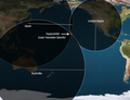
 NASA InSAR satellite measuring earthquakes.jpg 640 × 360; 70 KB
-
 NASA QuakeSim earthquake analysis.jpg 612 × 427; 120 KB
-
 Nojima-fault-museum-1.jpg 2,560 × 1,920; 2.11 MB
-
 Nojima-fault-museum-coupe.jpg 2,560 × 1,920; 2.23 MB
-
 Nomad 90 vibrating.jpg 2,326 × 1,488; 1.19 MB
-
 OBS deployment.jpg 550 × 375; 117 KB
-
 Phase unwrapping.jpg 1,287 × 458; 83 KB
-
 QuakeManager Report Screenshot.png 938 × 463; 182 KB
-
 Raspberry Shake Logo.svg 512 × 136; 16 KB
-
 Rear view of the Earthquake House Observatory, The Ross, Comrie, Perthshire.jpg 4,607 × 3,455; 2.8 MB
-
 Rockburst damage.jpg 914 × 745; 158 KB
-
 RV Western Atlas Recording Room.png 1,301 × 856; 1.18 MB
-
 RV Western Atlas.jpg 732 × 1,074; 146 KB
-
 RV Western Legend.jpg 1,224 × 641; 166 KB
-
 SEG2clrTagv.jpg 1,408 × 874; 312 KB
-
 Seismic Airgun.jpg 1,140 × 1,520; 347 KB
-
 Seismic plotter aboard the USNS Kane.jpg 1,696 × 1,735; 2.89 MB
-
 Seismic Recorder.jpg 4,288 × 2,848; 2.46 MB
-
 Seismite Ordovician Kentucky Close.jpg 4,000 × 3,000; 6.53 MB
-
 Seismite Ordovician Kentucky.jpg 4,000 × 3,000; 8.02 MB
-
 Seismograph recording.jpg 1,606 × 861; 131 KB
-
 Seismometer-iceland.JPG 3,072 × 2,304; 1.28 MB
-
 Side view of the Earthquake House Observatory, The Ross, Comrie, Perthshire.jpg 4,896 × 3,672; 7.33 MB
-
 Sismographe Vésuve.jpg 2,905 × 4,431; 12.02 MB
-
 Streamer winch hg.jpg 2,207 × 1,882; 560 KB
-
 Streamer-detail hg.jpg 4,256 × 2,832; 1.79 MB
-
 The Earthquake House Observatory, The Ross, Comrie, Perthshire.jpg 4,896 × 3,672; 3.43 MB
-
 Torseiselev.jpg 384 × 288; 20 KB
-
 Torseison.jpg 303 × 403; 12 KB
-
 View north from the Earthquake House Observatory, The Ross, Comrie, Perthshire.jpg 4,896 × 3,672; 7.5 MB
-
 View south from the Earthquake House Observatory, The Ross, Comrie, Perthshire.jpg 4,896 × 3,672; 6.68 MB
-
 VISCMA logo.png 362 × 100; 14 KB
-
 Whereismermaid 01152022.png 1,107 × 596; 954 KB
-
 Xəzərdə olan zəlzələlər.png 1,001 × 849; 453 KB
-
 Young Scientists.jpg 1,600 × 1,200; 269 KB
-
 هزازات وزاره النفط.jpg 3,096 × 4,128; 1.09 MB
.jpg)
.jpg)
.jpg)
.jpg)
.jpg)
.jpg)
.jpg)
.jpg)
.jpg)
.jpg)
.jpg)
.jpg)
.jpg)
.jpg)
.jpg)
.jpg)


