Category:September 2005 in Cornwall
Jump to navigation
Jump to search
Ceremonial counties of England: Bedfordshire · Berkshire · Buckinghamshire · Cambridgeshire · Cheshire · Cornwall · Cumbria · Derbyshire · Devon · Dorset · Durham · East Riding of Yorkshire · East Sussex · Essex · Gloucestershire · Greater London · Greater Manchester · Hampshire · Herefordshire · Hertfordshire · Isle of Wight · Kent · Lancashire · Leicestershire · Lincolnshire · Merseyside · Norfolk · North Yorkshire · Northamptonshire · Northumberland · Nottinghamshire · Oxfordshire · Rutland · Shropshire · Somerset · South Yorkshire · Staffordshire · Suffolk · Surrey · Tyne and Wear · Warwickshire · West Midlands · West Sussex · West Yorkshire · Wiltshire · Worcestershire
City-counties: Bristol ·
Former historic counties:
Other former counties:
City-counties: Bristol ·
Former historic counties:
Other former counties:
Deutsch: Bilder, die im September 2005 in Cornwall aufgenommen worden sind. Bitte beachten Sie, dass dies weder das Datum des Uploads noch das Datum des Scannens eines Fotos ist.
English: Images/pictures taken in Cornwall during September 2005. Note this is not the date of the upload, nor the date a photo was scanned.
Español: Fotografías o imágenes tomadas en Cornwall durante septiembre 2005. No es la fecha de subida ni escaneo, sino la fecha en que las fotografías o imágenes se crearon.
Esperanto: Bildoj faritaj en Cornwall en septembro 2005. Tio ne estas la dato, kiam la bildoj estis alŝutitaj aŭ skanitaj.
Français : Photographies ou images prises en Cornwall durant septembre 2005. Ce n'est pas la date du téléchargement ou du scan.
Galego: Fotografías ou imaxes tomadas en Cornwall durante setembro 2005. Non é a data de subida nin escaneamento, senón a data na que se crearon as fotografías ou imaxes.
Italiano: Fotografie o immagini scattate a Cornwall nel settembre 2005. Nota bene: la data non si riferisce né a quella di upload né a quella in cui la foto è stata digitalizzata.
Norsk bokmål: Bilder tatt i Cornwall i løpet av september 2005. Merk at dette ikke er datoen for opplasting, eller når et bilde har blitt skannet.
Norsk nynorsk: Bilete teke i Cornwall i løpet av september 2005. Merk at dette ikkje er datoen for opplasting, eller når eit bilete har vorte skanna.
Русский: Изображения, сделанные в Cornwall в течение сентябрь 2005 (не дата загрузки изображения).
Українська: Зображення, зроблені в Cornwall протягом вересень 2005. Зауважте, що це не дата завантаження чи дата сканування фотографії.
| September 2004 | ← | September 2005 | → | September 2006 | |||||||
| Jan | Feb | Mar | Apr | May | Jun | Jul | Aug | Sep | Oct | Nov | Dec |
| 3 | 10 | 62 | 13 | 35 | 58 | 46 | 105 | 86 | 63 | 47 | 51 |
|---|---|---|---|---|---|---|---|---|---|---|---|
Media in category "September 2005 in Cornwall"
The following 86 files are in this category, out of 86 total.
-
 Gannel Ferry - geograph.org.uk - 184701.jpg 640 × 427; 110 KB
-
 41518942 Barbara H..jpg 2,084 × 1,476; 773 KB
-
 A birds eye view Mevagissey - geograph.org.uk - 382697.jpg 640 × 480; 115 KB
-

-
 Ancient churchyard cross - geograph.org.uk - 342568.jpg 612 × 640; 221 KB
-
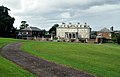 Antony House 01.jpg 640 × 412; 103 KB
-
 Barn at Tregolds, near St Merryn - geograph.org.uk - 50740.jpg 640 × 480; 215 KB
-

-
 Bedruthan Mill - geograph.org.uk - 54687.jpg 640 × 480; 122 KB
-

-
 Bedruthan Steps Hotel - geograph.org.uk - 50437.jpg 640 × 480; 99 KB
-

-
 Beyond the Harbour Wall at Boscastle - geograph.org.uk - 101358.jpg 640 × 480; 86 KB
-
 Black Head - geograph.org.uk - 51026.jpg 640 × 440; 116 KB
-
 Black Head - geograph.org.uk - 51027.jpg 640 × 480; 126 KB
-
 Black Rock - geograph.org.uk - 51042.jpg 640 × 380; 60 KB
-
 Bodmin Town Football Club - geograph.org.uk - 50317.jpg 640 × 480; 103 KB
-
 Boscastle - geograph.org.uk - 401609.jpg 640 × 480; 110 KB
-
 Boscastle Harbour - geograph.org.uk - 508167.jpg 640 × 476; 298 KB
-
 Boskenna Cross - geograph.org.uk - 62340.jpg 427 × 640; 122 KB
-
 Breage Church - geograph.org.uk - 54709.jpg 638 × 640; 92 KB
-
 Bus in narrow street - geograph.org.uk - 1733450.jpg 480 × 640; 60 KB
-
 Bussow Reservoir - geograph.org.uk - 48286.jpg 640 × 316; 98 KB
-
 Cabbage Field - geograph.org.uk - 58521.jpg 640 × 480; 97 KB
-
 Cadgwith Cove and Village - geograph.org.uk - 468660.jpg 640 × 479; 134 KB
-
 Cambeak - geograph.org.uk - 53343.jpg 640 × 480; 143 KB
-
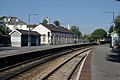
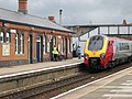 Camborne Railway Station - geograph.org.uk - 58568.jpg 640 × 480; 90 KB
-

-
 Camel Ski School - geograph.org.uk - 51072.jpg 640 × 400; 83 KB
-
 Cannalidgey - geograph.org.uk - 104993.jpg 640 × 480; 119 KB
-
 Capstan at Penberth Cove - geograph.org.uk - 307730.jpg 640 × 427; 114 KB
-
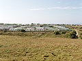 Caravan site at Mother Ivey's Bay - geograph.org.uk - 50620.jpg 640 × 480; 102 KB
-
 Carminowe Creek - geograph.org.uk - 54739.jpg 640 × 410; 54 KB
-
 Carnevas Farm, near Porthcothan - geograph.org.uk - 50961.jpg 640 × 479; 153 KB
-
 Cataclews Point, by Harlyn Bay - geograph.org.uk - 50646.jpg 640 × 480; 111 KB
-
 Chimney in the Bracken - geograph.org.uk - 336969.jpg 640 × 426; 101 KB
-
 China Clay Spoil Heap - geograph.org.uk - 54597.jpg 640 × 480; 69 KB
-
-

-
 Cliff top shrubs at Trenance Point - geograph.org.uk - 50429.jpg 640 × 480; 129 KB
-
 Coastal Plateau - geograph.org.uk - 48266.jpg 640 × 478; 83 KB
-
 Connor Down - geograph.org.uk - 57434.jpg 640 × 390; 68 KB
-
 Connor Downs Primary School - geograph.org.uk - 58508.jpg 640 × 480; 87 KB
-
 Delabole slate quarry.jpg 480 × 640; 118 KB
-
 Emmet Farming - geograph.org.uk - 48280.jpg 640 × 464; 86 KB
-
 Fishing boats at Coverack - geograph.org.uk - 369448.jpg 481 × 640; 93 KB
-
 Hayle Community School - geograph.org.uk - 57240.jpg 640 × 480; 87 KB
-
 Hellesveor Methodist Church - geograph.org.uk - 48285.jpg 640 × 480; 84 KB
-
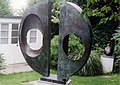
 Hepworth workshop.jpg 2,084 × 1,476; 530 KB
-
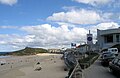
 HM Coastguard Looe - geograph.org.uk - 119670.jpg 640 × 480; 96 KB
-
 Lifeboat launch - geograph.org.uk - 61757.jpg 602 × 405; 71 KB
-
 Light over Cadgwith Cove - geograph.org.uk - 468632.jpg 640 × 479; 56 KB
-
 Mevagissey and the Inner Harbour - geograph.org.uk - 51062.jpg 640 × 480; 139 KB
-
 Minack Open-Air Theatre - geograph.org.uk - 1474252.jpg 640 × 480; 63 KB
-
 Morvah chapel cornwall.jpg 640 × 480; 123 KB
-
 Penrose - geograph.org.uk - 50735.jpg 640 × 480; 198 KB
-
 Porthmeor Beach - St Ives - geograph.org.uk - 70650.jpg 640 × 413; 68 KB
-
 Portloe slipway - geograph.org.uk - 184208.jpg 640 × 427; 88 KB
-
 Rocks at Penberth Cove - geograph.org.uk - 184223.jpg 640 × 427; 88 KB
-
 Roseworthy - geograph.org.uk - 58530.jpg 640 × 480; 80 KB
-
 Saltash Railway Station - geograph.org.uk - 56942.jpg 640 × 427; 267 KB
-
 Shire Hall, Bodmin - geograph.org.uk - 50323.jpg 640 × 480; 131 KB
-
 St Ives, Cornwall, Porthmeor Beach.jpg 1,295 × 839; 175 KB
-
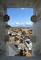 St Ives, Cornwall, Rooftops.jpg 801 × 1,176; 176 KB
-
 Steam Engine at Launceston - geograph.org.uk - 1193472.jpg 640 × 427; 99 KB
-
 Stennack Post Office - geograph.org.uk - 48288.jpg 640 × 428; 90 KB
-

-
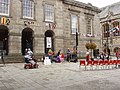
 The Atrium of the Tate Gallery - geograph.org.uk - 334346.jpg 480 × 640; 78 KB
-
 The Camborne Library Building - geograph.org.uk - 344956.jpg 640 × 480; 88 KB
-
 The Cricket Club - geograph.org.uk - 54720.jpg 640 × 427; 57 KB
-
 The Pink Post Office - geograph.org.uk - 54706.jpg 640 × 540; 83 KB
-
 The Post Box on the white wall - geograph.org.uk - 54684.jpg 640 × 427; 67 KB
-
 The post office - geograph.org.uk - 54694.jpg 640 × 427; 87 KB
-
 The Sand - geograph.org.uk - 54737.jpg 640 × 557; 110 KB
-
 The Train to Paddington - geograph.org.uk - 58541.jpg 640 × 530; 87 KB
-
 The village hall - geograph.org.uk - 54708.jpg 640 × 365; 45 KB
-
 Time to play - geograph.org.uk - 54704.jpg 640 × 391; 81 KB
-
 Todden Cottage, Cadgwith Cove - geograph.org.uk - 468654.jpg 640 × 479; 134 KB
-
 Boggy Valley Bottom - geograph.org.uk - 345027.jpg 640 × 427; 114 KB
-
 Disused Mine from the Coast Path - geograph.org.uk - 336832.jpg 640 × 426; 94 KB
-
 Hayle Football Club Pitches - geograph.org.uk - 57251.jpg 640 × 437; 67 KB
-
 Looking North from Sancreed Beacon - geograph.org.uk - 292428.jpg 640 × 426; 102 KB
-
 New affordable housing and a derelict Mill - geograph.org.uk - 57258.jpg 640 × 480; 108 KB
-
 Path to Bedruthan Beach - geograph.org.uk - 508004.jpg 640 × 394; 196 KB
-
 Roundhole Point, Trevone Bay - geograph.org.uk - 50925.jpg 480 × 640; 100 KB
-
 Sancreed Beacon - geograph.org.uk - 62346.jpg 640 × 427; 82 KB


