Category:September 2005 in the Metropolitan Borough of Calderdale
Jump to navigation
Jump to search
Media in category "September 2005 in the Metropolitan Borough of Calderdale"
The following 21 files are in this category, out of 21 total.
-
 Baitings and Baitings Pasture - geograph.org.uk - 52840.jpg 640 × 480; 94 KB
-
 Ben Royd Terrace, Jagger Green - geograph.org.uk - 52837.jpg 640 × 480; 134 KB
-
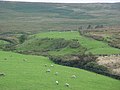 Blackwood Common, Rishworth - geograph.org.uk - 52843.jpg 640 × 480; 87 KB
-
 Brighouse Station - geograph.org.uk - 56390.jpg 640 × 480; 104 KB
-
 Calderdale Way, Dark Lane - geograph.org.uk - 47975.jpg 427 × 640; 141 KB
-
 Carr Bridge - geograph.org.uk - 103017.jpg 1,600 × 1,200; 317 KB
-
 Clough Foot - geograph.org.uk - 53976.jpg 640 × 480; 123 KB
-
 Flagged section of Pennine Way, Langfield Common - geograph.org.uk - 99529.jpg 1,600 × 1,200; 541 KB
-
 Junction of Pennine Way and Long Causeway - geograph.org.uk - 99541.jpg 1,600 × 1,200; 1.11 MB
-
 Langfield Edge - geograph.org.uk - 59480.jpg 640 × 480; 173 KB
-
 Market St, Todmorden - geograph.org.uk - 58200.jpg 609 × 640; 227 KB
-
 New Laithe, Halifax Lane, Luddenden - geograph.org.uk - 102980.jpg 640 × 480; 136 KB
-
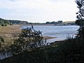 Ogden Water, near Halifax - geograph.org.uk - 609258.jpg 640 × 480; 75 KB
-
 Parrock Nook, Rishworth - geograph.org.uk - 52841.jpg 640 × 480; 104 KB
-
 Rain gauge near Rishworth Drain - geograph.org.uk - 99198.jpg 1,600 × 1,200; 514 KB
-
 Rishworth Drain - geograph.org.uk - 271255.jpg 1,200 × 1,600; 511 KB
-
 Rishworth Mill - geograph.org.uk - 52155.jpg 480 × 640; 106 KB
-
 Rishworth School - geograph.org.uk - 52150.jpg 640 × 480; 140 KB
-
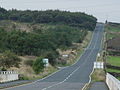 Road over Pike Law - geograph.org.uk - 52163.jpg 640 × 480; 107 KB
-
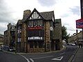 The Royal Oak, Halifax, West Yorkshire.jpg 2,592 × 1,944; 2.05 MB
-
 Vicars Lot, Stainland Moor - geograph.org.uk - 52534.jpg 640 × 480; 81 KB


