Category:September 2017 in Kent
Jump to navigation
Jump to search
Ceremonial counties of England: Bedfordshire · Berkshire · Buckinghamshire · Cambridgeshire · Cheshire · Cornwall · Cumbria · Derbyshire · Devon · Dorset · Durham · East Riding of Yorkshire · East Sussex · Essex · Gloucestershire · Greater London · Greater Manchester · Hampshire · Hertfordshire · Isle of Wight · Kent · Lancashire · Leicestershire · Lincolnshire · Norfolk · North Yorkshire · Northamptonshire · Northumberland · Nottinghamshire · Oxfordshire · Somerset · South Yorkshire · Staffordshire · Suffolk · Surrey · Tyne and Wear · Warwickshire · West Midlands · West Sussex · West Yorkshire · Wiltshire · Worcestershire
City-counties: Bristol ·
Former historic counties:
Other former counties:
City-counties: Bristol ·
Former historic counties:
Other former counties:
Deutsch: Bilder, die im September 2017 in Kent aufgenommen worden sind. Bitte beachten Sie, dass dies weder das Datum des Uploads noch das Datum des Scannens eines Fotos ist.
English: Images/pictures taken in Kent during September 2017. Note this is not the date of the upload, nor the date a photo was scanned.
Español: Fotografías o imágenes tomadas en Kent durante septiembre 2017. No es la fecha de subida ni escaneo, sino la fecha en que las fotografías o imágenes se crearon.
Esperanto: Bildoj faritaj en Kent en septembro 2017. Tio ne estas la dato, kiam la bildoj estis alŝutitaj aŭ skanitaj.
Français : Photographies ou images prises en Kent durant septembre 2017. Ce n'est pas la date du téléchargement ou du scan.
Galego: Fotografías ou imaxes tomadas en Kent durante setembro 2017. Non é a data de subida nin escaneamento, senón a data na que se crearon as fotografías ou imaxes.
Italiano: Fotografie o immagini scattate a Kent nel settembre 2017. Nota bene: la data non si riferisce né a quella di upload né a quella in cui la foto è stata digitalizzata.
Norsk bokmål: Bilder tatt i Kent i løpet av september 2017. Merk at dette ikke er datoen for opplasting, eller når et bilde har blitt skannet.
Norsk nynorsk: Bilete teke i Kent i løpet av september 2017. Merk at dette ikkje er datoen for opplasting, eller når eit bilete har vorte skanna.
Русский: Изображения, сделанные в Kent в течение сентябрь 2017 (не дата загрузки изображения).
Українська: Зображення, зроблені в Kent протягом вересень 2017. Зауважте, що це не дата завантаження чи дата сканування фотографії.
| September 2016 | ← | September 2017 | → | September 2018 | |||||||
| Jan | Feb | Mar | Apr | May | Jun | Jul | Aug | Sep | Oct | Nov | Dec |
| 19 | 222 | 102 | 129 | 566 | 60 | 78 | 363 | 41 | 103 | 93 | 121 |
|---|---|---|---|---|---|---|---|---|---|---|---|
Subcategories
This category has the following 2 subcategories, out of 2 total.
2
- 2017 Folkestone Rotary Half Marathon (1426 F)
D
Media in category "September 2017 in Kent"
The following 39 files are in this category, out of 39 total.
-
 10.09.17 Dover Priory 375623+375706 (36333426293).jpg 5,854 × 3,892; 14.3 MB
-
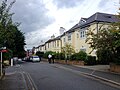
 Chandos Road, Tunbridge Wells - geograph.org.uk - 5529863.jpg 3,264 × 2,448; 1.67 MB
-
 Close-up of the inscription (OpenBenches 2484).jpg 2,048 × 1,536; 1.17 MB
-
 Close-up of the inscription (OpenBenches 2485).jpg 2,048 × 1,536; 1.27 MB
-
 Construction of a navigational cut - geograph.org.uk - 5544945.jpg 3,264 × 2,448; 3.74 MB
-
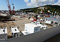 Construction of a navigational cut - geograph.org.uk - 5567076.jpg 3,264 × 2,313; 1.95 MB
-
 Currie Road, Tunbridge Wells - geograph.org.uk - 5529936.jpg 3,264 × 2,448; 1.91 MB
-
 Dover Eastern Docks - geograph.org.uk - 5523549.jpg 2,915 × 1,942; 661 KB
-
 Dukes Road, Tunbridge Wells - geograph.org.uk - 5529865.jpg 3,041 × 2,281; 1.12 MB
-
 Folkestone Harbour Station restoration (geograph 5557056).jpg 1,280 × 850; 562 KB
-
 Folkestone Harbour Station restoration (geograph 5557064).jpg 1,280 × 850; 498 KB
-
 Gaudior, Herd of Hospice - geograph.org.uk - 5526009.jpg 3,472 × 2,604; 2.53 MB
-
 Gaudior, Herd of Hospice - geograph.org.uk - 5526010.jpg 3,516 × 2,637; 2.3 MB
-
 Granville Road, Tunbridge Wells - geograph.org.uk - 5529854.jpg 3,264 × 2,448; 1.55 MB
-
 Granville Road, Tunbridge Wells - geograph.org.uk - 5529857.jpg 3,264 × 2,448; 1.62 MB
-
 Knockholt oak trees (1).jpg 2,736 × 3,648; 4.72 MB
-
 Knockholt oak trees (2).jpg 2,736 × 3,648; 4.81 MB
-
 Knockholt oak trees (3).jpg 2,736 × 3,648; 4.99 MB
-
 Long shot of the bench (OpenBenches 2484-1).jpg 3,924 × 2,943; 3.63 MB
-
 Long shot of the bench (OpenBenches 2485-1).jpg 2,048 × 1,536; 1.13 MB
-
 Mereworth Avenue, Tunbridge Wells - geograph.org.uk - 5529926.jpg 2,729 × 2,047; 1,003 KB
-
 Newcomen Road, Tunbridge Wells - geograph.org.uk - 5529930.jpg 3,215 × 2,413; 1.34 MB
-
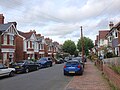
 Richardson Road, Tunbridge Wells - geograph.org.uk - 5529935.jpg 3,264 × 2,448; 1.5 MB
-
 Road layout changed sign, Chatham, Kent.jpg 3,264 × 2,448; 818 KB
-
 Rochdale Road, Tunbridge Wells - geograph.org.uk - 5529885.jpg 3,264 × 2,448; 1.55 MB
-
 Shaftesbury Road, Tunbridge Wells - geograph.org.uk - 5529934.jpg 3,264 × 2,448; 1.59 MB
-
 Southwood Avenue, Tunbridge Wells - geograph.org.uk - 5529923.jpg 3,264 × 2,448; 1.52 MB
-
 St. James Road, Tunbridge Wells - geograph.org.uk - 5529872.jpg 2,989 × 2,241; 1.18 MB
-
 St. James Road, Tunbridge Wells - geograph.org.uk - 5529894.jpg 3,264 × 2,448; 1.55 MB
-
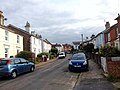
 Stephen's Road, Tunbridge Wells - geograph.org.uk - 5529910.jpg 3,264 × 2,448; 1.68 MB
-
 Stratford Street, Tunbridge Wells - geograph.org.uk - 5529889.jpg 3,264 × 2,448; 1.63 MB
-
 Terrace, Birling Rd - geograph.org.uk - 5374834.jpg 640 × 426; 45 KB
-
 The Allotment, Tunbridge Wells - geograph.org.uk - 5529876.jpg 3,264 × 2,448; 1.69 MB
-
 Town Clock Tunbridge Wells - geograph.org.uk - 5537814.jpg 4,896 × 3,672; 6.23 MB
-
 Tunbridge Wells Post Office - geograph.org.uk - 5537808.jpg 4,896 × 3,672; 5.43 MB
-
 Vernon Road, Tunbridge Wells - geograph.org.uk - 5529882.jpg 3,264 × 2,448; 1.62 MB
-
 View from the bench (OpenBenches 2484-2).jpg 2,048 × 1,536; 1,017 KB
-
 View from the bench (OpenBenches 2485-2).jpg 2,048 × 1,536; 991 KB
-
 York St - geograph.org.uk - 5672961.jpg 640 × 426; 53 KB
.jpg)

.jpg)
.jpg)


.jpg)
.jpg)


.jpg)
.jpg)
.jpg)
.jpg)
.jpg)


.jpg)
.jpg)
